Curated OER
The Oregon Trail
Students use maps and diagrams to examine the Oregon Trail. In groups, they create their own poster of the trail showing the different types of artifacts found along the way. To end the lesson, they identify the sources of water and...
Curated OER
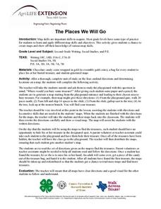
The Places We Will Go
Second graders demonstrate basic map skills. They each bury a bag of chocolate coins, create a map with directions to find their "treasure," and follow another student's directions to locate a bag of coins.
Curated OER
Understanding Geography
Students create a map of their own neighborhood to show the relationships between the geography of the neighborhood and its economy and culture. They view and discuss an introductory video on how geographers study an area then go out...
Curated OER
Understanding: Geography
Students explore their neighborhoods. In this geography lesson, students make a map of their neighborhood. They must include a key, natural terrain, buildings and streets. They also write a descriptive paragraph about their neighborhood.
Curated OER
This Land Is Your Land, This Land Is My Land
Students review and evaluate the ways land is covered and used in their local community. They consider the environmental effects of the different types of land use. Students act as community planning engineers to determine where to place...
Curated OER
Where in the Latitude Are You? A Longitude Here.
Students distinguish between latitude and longitude on the map. In this mapping lesson, students participate in mapping skills to recognize spatial relationships, and where to find natural resources on the map. Students create their own...
Curated OER
Lesson 3: Seven Day Road Trip
Students plan a seven day road trip. For this travel lesson, students plan a driving trip that includes five major cities or attractions in Florida or another state of their choice. They show the trip on a map, calculate distances that...
Curated OER
I Can Find that Where? - A Study of Landforms
First graders make landform maps of the United States. In this landform lessons, 1st graders participate in a discussion of local landforms and make a landform map of the United States. They follow the teacher's directions to add plains,...
Curated OER
Earth Structure and Processes
Students classify different rocks according to their types. In this earth science lesson, students explain how plate tectonics created Earth's landforms. They explain the continental drift theory and sea floor spreading in their own words.
Curated OER
Forms of Government Project
From the United Kingdom's constitutional monarchy to the dictatorship of North Korea, this is a very simple project that will help your class members gain a better understanding of different forms of government that exist around the...
Curated OER
Cookie Mapping
Students study the components of a bedrock geology map through a hands-on activity involving a cookie and graph paper.
Curated OER
Lesson 2: Mapping Our Home
Students recognize the importance of community participation in the census. In this U. S. Census lesson plan, students use map-reading skills to find answers and learn the difference between senators and members of Congress.
Curated OER
Housing: Types of Shelters
Students experiment with the construction of shelters and the various types of architectural designs. In this shelters lesson, students draw the building they live in. Students compare and contrast buildings made today and made 150...
Curated OER
Map It!
Fourth graders collect and explore different maps and their uses before using the program Pixie to create maps of geographic features, political features, and economic information for the state in which they live.
Curated OER
Creating a Map for Future Reference
Students use Web and other resources to create maps of either the site of their day trip, their final destination, the entire trip, or some combination of these.
Curated OER
East Asia Country Project
Get your young historians thinking about East Asian culture and history during this partner research project, in which they analyze a variety of East Asian aspects to prepare for a presentation. After an initial "what do we already know"...
Weebly
Liberty Theme Park Project
Invite your young historians to demonstrate how the American Revolution truly was one crazy ride after another as they design a theme park! This unique and engaging project prompts learners to consider major events leading up to and...
Curated OER
Create a Story May
First graders review the terms characters, setting and events in stories. They are shown how to access the Kidspiration Map, and how to add pictures in the correct spaces on the map. Students insert pictures in the map of the story...
Curated OER
Climb a Mountain, Raft a River on Your Own Land
Students are introduced to the characteristics of a map. As a class, they discuss the uses of public lands in their community and develop symbols for each feature. They use the symbols to create a map showing the recreational uses of...
Curated OER
Discovering New Mexico
Seventh graders discuss the elements of maps and using basic linear measurement. They calculate the distance between the cities and create a simulated journey around New Mexico using a road map. They write out the directions for their...
Curated OER
Arthur's Tooth
Students practice their reading comprehension by reading a story in their class. In this story map lesson, students read the Marc Brown book Arthur's Tooth and discuss the story, characters and setting. Students create a story map based...
Curated OER
All Aboard!
Pupils research the history and background of snowboarding as well as the two main types of competition; the Giant Slalom and the Halfpipe. They find the schedule of past and future events and plot the locations of as many of these events.
Curated OER
Let's Take a Trip!
Sixth graders plan trip for family of four, and choose best travel plan by studying maps, considering different routes, and visiting Web sites to get airline and travel schedules.
Curated OER
Our 50 States
Students identify the location of the 50 states using an interactive map. They practice geography skills by playing a fun game. Pupils become familiar with the state abbreviations for the US states. Students become familiar with the...
Other popular searches
- Different Types of Maps
- Reviewing Types of Maps
- Types of Maps Grids
- Types of Maps Worksheets
- 10 Types of Maps
- Three Types of Maps
- 2 Types of Maps
- Types of Maps Australia
- Types of Maps "Australia
- Types of Maps "Australia"
- Maps Types Key Symbols


