Curated OER
My Summer Vacation
Students study the United States geography using Google Earth. In this U.S. geography lesson, students create travel journals about five U.S. geographical locations. Students research the human and physical characteristics for each region.
Curated OER
Project Whistlestop:Missouri Vacation Learning Unit
Fourth graders reserach the state of Missouri. In this Missouri History instructional activity, 4th graders plan a vacation to a region of Missouri. Students work in collaborative groups to determine all aspects of the trip. Students use...
Curated OER
Let's Build a Map
Students gain an understanding of maps while studying the map of the Louisiana Purchase and the trail of Lewis and Clark and the Corps of Discovery. They demonstrate understanding of maps by creating a basic classroom map.
Curated OER
Map of Town
Third graders draw a map of the town given different sites to locate on the map by the teacher. They explain that latitude and longitude are used to locate places on maps and globes, identify the distinctive physical and cultural...
Curated OER
Colonial Maps
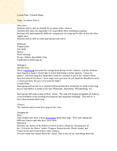
Students discover the history of America by identifying the traditional colonies. In this U.S. history lesson, students examine a world map and identify where the voyagers left from Europe to arrive at the United States. Students...
Curated OER
Take Me Out To the Ball Game
Students use a map to graph and locate major league teams of different sports. In groups, they analyze the population data of the United States and compare it with the amount and location of the major league teams. They share their...
Curated OER
Immigration to the United States
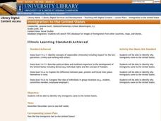
Third graders search TDC database for images of immigration from other countries, maps, and diaries. They identify why immigrants came to the United States and engage in a role-play simulating an experience the immigrants might have had.
Curated OER
Touring the Regions of the United States
Fifth graders explore the regions of the United States. They use maps, research on the Internet and use measurements and estimations. Students create a presentation using spreadsheets and publishing software.
Curated OER
The Crash Scene
Fifth graders explore geography by participating in a mapping activity. In this engineering lesson, 5th graders identify the differences between latitude and longitude and practice locating precise points on a globe or map. Students...
Curated OER
Empire State-Building
Students explore how empires around the globe have impacted the world in which they have existed. They analyze whether or not the United States is an imperialist nation and create their own empires based on their understanding of empires...
Curated OER
Learning About Maps
Pupils investigate the many uses and features of maps and globes and locate where they live on both. In this map lesson, student play a travel game and create their own maps to explore states, continents, countries, and islands.
Curated OER
Borrowing Narrative Skills from Mr. Fletcher: Using a "Prompts in Reverse" Technique to Inspire Your Writers
Help your class find their writing voices with this lesson which uses the work of Ralph Fletcher to guide a "Prompt in Reverse" activity. Using the chapter "First Pen" from Fletcher's Marshfield Dreams, learners decipher what they...
Curated OER
Where is the Trail? The Journey of Lewis and Clark
Students explore the trail followed by Lewis and Clark on their journey across the United States. For this United States History lesson, students complete several activities to establish the Lewis and Clark Expedition, including a class...
Curated OER
Mapmaker, Mapmaker, Make Me a Map!
Learners evaluate the different types of historical and geographical information that one can gather through close study of historical maps from the 16th through the 19th centuries. They create their own maps.
Curated OER
Journey to Gettysburg
Students use latitude and longitude to map the path of the Battle of Gettysburg.
Curated OER
State Names: Frequency
Data grathers determine the frequency of specified data. They identify the frequency that specified letters occur in the names of all 50 states. They create stem-and-leaf plots, box-and-whisket plots and historgrams to illustrate the data.
Civil War Trust
Civil War Soldier: Experiencing the Battle of Franklin
Fighting a war over home soil makes a living nightmare even more real. Class members describe the experience of a Civil War soldier during the Battle of Franklin, poised right at a major turning point of the war, after researching the...
Curated OER
The United State of NATO
Students examine the past fifty years of NATO, focusing specifically on NATO's involvement and actions in conflicts around the world and the results of their involvement.
Curated OER
Effects of Urban Growth
Learners explore population growth in the United States and the impact it has had on society. First, they brainstorm the reasons for population growth and the results of these increases. Then, they design surveys, record results, and...
Curated OER
Follow the Light
Students investigate the role of lighthouses in navigation and practice the use of cardinal directions through reading activities, discussion, locating geographical features, and mapping lighthouses along the east coast of the United...
Curated OER
French and Indian War: Make A Map
Fifth graders create a map of the battles that occurred during The French and Indian War. In this history lesson plan, 5th graders read about the war in their text books, then divide into groups to create a detailed map of a famous...
Curated OER
Town Development
Young scholars evaluate how the impact of building of towns affected slavery. In this United States History lesson, students work in small groups to construct a map, then they participate in a role-playing activity.
Curated OER
Discovering Prehistoric Trails
Eighth graders examine prehistoric terrain. In this geography lesson, 8th graders discover necessary resources for settlers. Students work in small groups to create a trail crossing the state of Kansas.
Curated OER
Mapping School Grounds
Students map and analyze the natural and cultural environment of the school grounds. In small groups, they sketch the natural and cultural features of each side of the school building, create a map, participate in a class discussion,...


