Curated OER
Regions of Utah - Mapping
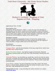
Fourth graders draw a rudimentary map of the state of Utah, dividing it into the three regions: the Great Basin, the Colorado Plateau, and the Rocky Mountain Region.
Curated OER
Spatial Connections
Students use maps, scales, and describe locations in order to learn about spatial sense. In this spatial sense lesson plan, students participate in many activities for this spatial sense unit that should last throughout the year.
Curated OER
Influence of Union and Confederate Resources in 1860 on the Civil War
Eighth graders compare/contrast population, railroad mileage, manufacturing plants, and industrial workers between the Union and Confederate States in 1860; students analyze effects of the resources of the Union and Confederate Forces on...
Curated OER
Territory and Statehood of Iowa
Fifth graders recognize the steps to create a territory, a district and a state. In this Iowa activity, 5th graders discuss the three capitals and their importance. Students recognize the key people in the development of Iowa. Students...
Curated OER
Postcards from California: A Unit on Geography, Social Studies, History and California's Resources
Fourth graders examine patterns that influence population density in the various regions of California. The unit's three lessons utilize graphic organizers for the interpretation and presentation of data.
Curated OER
Living Swamps, Bayous and Forests
Third graders explore interesting environments by exploring Louisiana. In this wetland lesson, 3rd graders utilize the web to research the State of Louisiana, the bayous in the area, and the Gulf of Mexico. Students write a journal entry...
Curated OER
MEDIEVAL SUB-SAHARAN AFRICA
Seventh graders examine the area of medieval Sub-Saharan Africa through eyes of travelers in the company of one of history's greatest travelers, Ibn Battuta. The project has been structured to include all the State standards for this unit.
Curated OER
Our City
Second graders familiarize themselves with the town they live in by practicing their imagination, library research and writing skills.
Curated OER
Who Dropped What into the Melting Pot?
Students show the movement of people to the United States from other countries on maps. They study the geographic cultural roots of foods that contribute to the melting pot of food in America. They research where an ingredient comes from...
Curated OER
America the Beautiful
Students analyze the physical geography of the United States and how we have adapted to or altered the land to create the country we know today. Students complete maps with physical features, states and cities of interest.
Curated OER
A Dollar Goes A Long Way
Investigate life along the Old Spanish Trail! They visit websites and identify the history and environment. They create journals, dramatic enactments, and maps to discover the role individuals played in society. They also explore the...
Curated OER
Major American Water Routes
Sixth graders locate and identify the major bodies of water and waterways in the United States. Through a simulation activity, they describe how early explorers would have described their surroundings. Working in groups, they create...
Curated OER
Physical Features
Students draw physical land features using ClarisWorks or Kid Pix, write their definitions, create slideshow, and create class geography book.
Curated OER
Let's Play Geography Twister
Students practice geography skills by playing a game based on Twister. Students manipulate their position on a map by placing their arms and legs on the appropriate state or country called out by the teacher.
Curated OER
Nina Bonita: Culture and Beauty
Students read Nina Bonita by Ana Maria Machado. In this reading comprehension/ geography lesson, students recall various parts of the story and create a map of where the rabbit traveled throughout the story. They participate in group...
Curated OER
Advertise With Geography...it's Free And It's Easy!!
Students establish awareness of how landforms/landmarks produce a visual image of a region and demonstrate how advertisers use the "positive geographical image" to sell their product by creating their own advertisements.
Curated OER
Food Detectives
Students investigate the regions in which particular grains are grown. Using the packaging from a variety of foods, grains are identified and the general locations where they are grown are plotted on a map.
Curated OER
Animals from Afar
Students visualize the scope of the Roman empire by illustrating the geographic origins of various imported animals. They study how exotic animals were imported into Rome from the farthest regions of the empire.
Curated OER
Wisconsin Snapshots
Fourth graders study Wisconsin's culture and heritage. They research the state's symbols and identify leaves common to the Wisconsin area. They create a leaf booklet and visit the state park. They visit local farms and create nature maps...
Curated OER
The Amazing Race -- Africa
Students conduct research and gather information regarding various cities in Africa. They discover what it would take to travel to and through Africa and plan a trip through various regions of the continent. They present their itinerary,...
Curated OER
Boundaries
Students are introduced to the term of mental mapping. Individually, they develop their own mental map of Washington state and discuss as a class what makes a boundary. They draw their mental map on paper and compare it with their...
Curated OER
Sectionalism, Popular Sovereignty, and Secession
Students examine sequence of national events that resulted in the Civil War by using primary sources, and creating timelines and maps.
Curated OER
My Brother, My Enemy
Students visit the West Virginia Museum, with the goal of creating and publishing a newsletter that demonstrates learning. Students complete vocabulary activities, and are given web site resources to this end. Students choose from 5...
Curated OER
Push/Pull Factors and Welsh Emigration
Young scholars view and discuss short sections of movies that relate to immigration. Working in groups, students create a map that shows directions of internal migration in their assigned geographical area. Young scholars review...


