Curated OER
Maps and the Pictures in Our Heads
Geographers of all ages examine different types of maps. They draw maps of their environment, utilizing both three-dimensional and picture maps. They interpret map information, noting how it can sometimes be misleading. Some good...
Curated OER
Mapping the News
Students explore cartography. In this map skills and map making lesson, Students work in groups to create wall size world maps including legends, compass roses, latitude and longitude, and physical features. Students collect...
Curated OER
Welcome to My World!
Students use maps to locate information. They read the story, "It Looked Like Spilt Milk", view images of the continents and discuss the various continents. Afterward, they make their own Atlas to record information that they can later...
Curated OER
Global Conflict: Kashmir
Learners analyze different maps of the region. They create a timeline of the area in dispute, focusing on the creation of Pakistan, Indi and Kashmir and previous conflicts between Pakistan and India over Kashmir. Students construct a...
Curated OER
World War I
Eighth graders examine the condition of the world from 1880 until the start of World War I. After watching a PowerPoint presentation, they discuss the causes and effects of the war and complete a study guide with a partner. To end the...
Curated OER
Mapping National and Geographic Identity
Young scholars analyze geographic maps. In this map analysis lesson plan, students analyze the symbols in geographic maps and the impact of cultural, historical, and political concepts. Young scholars compare and contrast maps in various...
Curated OER
Cartoon and Political Poster Analysis
Students explore the late 1800s as a time of demographic change in the US. They view the role of media during this time in the form of posters and political cartoons. They create a political poster/cartoon that deals with current...
Curated OER
Why All Maps Lie
Eighth graders discover the fundamental advantages/disadvantages of both maps and globes. They see that maps may distort size, shape, distance and direction. They discuss the advantages and applications of 5 types of map projections and...
MENSA Education & Research Foundation
Connecting Africa: A Project-Based Learning Adventure
Mission Possible: Your task is to design a new highway route from Tunis, Tunisia to Cape Town, South Africa. If you accept the challenge, you must create a small map of the route that has already been rejected, a...
Curated OER
The Sands of Arabia
Sixth graders apply geographic information to the study of World History. In this Geography lesson, 6th graders create a political/physical map of the Middle East, develop questions and answers about the culture of the Middle East,...
Curated OER
Map Skills
Students examine the nations, battlefields, troop movement of the Germans through Belgium and the location of both fronts during World War I by creating a map. They visualize the strength of the Germans early in the war.
Curated OER
Exploring Hawaiian Mountain Zones
Fourth graders watch a video that describes the climate and vegetation zones of Hawaii. They describe the different physical conditions that create vegetation zones from the sea to the mountains. In groups, they create an illustrated...
Curated OER
The Constitution: A New Federation
Students explore political parties by researching world history in class. In this Australian government lesson plan, students identify the term "federation" and discuss the elements of Australian politics. Students analyze a map of...
Curated OER
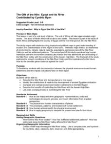
The Gift of the Nile: Egypt and its River
Middle schoolers begin with a piece of a puzzle that shows an artifact from ancient Egypt. They find others who have pieces that go with their puzzle piece. Students work in these groups to construct a relief map of the Nile River Valley.
Curated OER
Relief Maps
Students study geographical maps and their functions. In this geography lesson students work in groups to build a map to scale.
Curated OER
The failure of Diplomacy, September-December 1941
High schoolers investigate four main issues of concern between US and Japan prior to US involvement in World War II. In this role play lesson plan, students will take the role of US and Japanese negotiators trying to find a diplomatic...
Curated OER
Food Detectives
Students investigate the regions in which particular grains are grown. Using the packaging from a variety of foods, grains are identified and the general locations where they are grown are plotted on a map.
Curated OER
Put Me in My Place: Using Alphanumeric Grids to Locate Places
Learners practice locating points on a large wall grid and create and label a neighborhood map. For this geography lesson, students spell and discuss places as the teacher places them on the map. They discuss the concept of an...
Curated OER
European Agriculture
Students make inferences on how physical geography affected the development of early civilizations and come up with solutions to global issues. In this physical geography lesson plan, students compare maps of the past to maps of today to...
Curated OER
Brave New World
Young scholars view a video about the effects of World War II on the map of Europe. They discuss the video and answer questions. They work together to identify accomplishments that best represent American culture.
Curated OER
Empire State-Building
Students explore how empires around the globe have impacted the world in which they have existed. They analyze whether or not the United States is an imperialist nation and create their own empires based on their understanding of empires...
Curated OER
Geography and World History
Students build off of their current knowledge of geography and world history, while being introduced to new concepts and ideas.
Curated OER
Papyrus to PDA
What a great project. Graphic arts learners consider the social, political, and economic impact made by a chosen invention. They build an argument to substantiate their reasons for choosing said invention. They create an oral...
Other popular searches
- Political Map of World
- Blank World Political Map
- World Political Map Labeled
- Political Map of the World


