Oregon State
World Map of Plate Boundaries
Young geologists piece together the puzzle of plate tectonics in an earth science lesson. Given a physical map of the world, they search for land formations that indicate the location of different types of plate boundaries.
PHET
Earth’s Magnetic Field from Space
Feel the pull of science! The final installment of this 18-part series is an application of everything learned in the previous high school lessons. Scholars are given a magnetic field map and must propose an arrangement of magnets that...
Curated OER
Changing Planet: Sea Levels Rising
Begin by showing a six-minute video, Changing Planet: Rising Sea Level as an anticipatory set. Pupils draw a topographic map of a potato continent. Finally, they will visit NOAA's sea levels online map and NASA's carbon dioxide...
Howard Hughes Medical Institute
EarthViewer
Can you imagine Washington DC and London as close neighbors occupying the same continent? Learners will be fascinated as they step back in time and discover the evolution of the earth's continents and oceans from 4.5 billion...
Curated OER
Changing Planet: Permafrost Gas Leak
Pair earth scientists up to use an amazing online arctic portal mapping tool and Google Earth to analyze permafrost changes. They compare changes to data on atmospheric concentrations of methane to see if there is a correlation. Then...
Curated OER
Fostering Geospatial Thinking: Space to Earth: Earth to Space (SEES)
High schoolers locate and access data to help them with their science inquiry. In this geographical positioning lesson students evaluate and compare data sets.
Science 4 Inquiry
An Investigative Look at Florida's Sinkholes
In May of 1981, the Winter Park Sinkhole in Florida first appeared and is now referred to as Lake Rose. Scholars learn about the causes of sinkholes through an inquiry project. Then, they analyze recent data and draw conclusions to...
Astronomical Society of the Pacific
Getting Ready for the All American Eclipse!
Give your pupils a front row seat at the biggest light show in the sky this year! In addition to admiring the total solar eclipse, young astronomers can explain the phenomenon with a little help from an inquiry-based lesson. The focus of...
Texas State University
Earth: Deposition and Lithification
Geology geniuses analyze sediment samples with a hand lens and sort according to physical characteristics. They also learn about the processes of cementation, compaction, and lithification within the rock cycle. The lesson plan is...
Curated OER
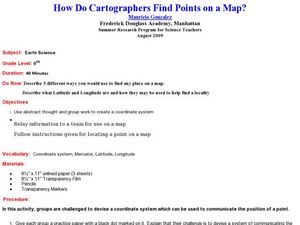
How Do Cartographers Find Points on a Map?
Ninth graders describe latitude and longitude and how they may be useful to find things on a map. In this cartography lesson students divide into groups and devise a coordinate system that can be used to communicate a position.
Curated OER
An Introduction to the Night Sky and Movement Astronomy
Basically, this is an interactive exploration of educational astronomy software and an app. Young astronomers discover how the apparent motion of the sky relates to Earth's movements and the position of the observer. It is out of this...
Columbus City Schools
Experiencing Eclipses
Don't be caught in the dark! Young scientists investigate the causes of both solar and lunar eclipses using an interactive to help them understand the development of an eclipse over time. They then research facts and characteristics...
Curated OER
A Comparison Study of Water Vapor Data to Precipitation over North America
Students use NASA satellite data to compare water vapor over the United States. In this data analysis lesson students use an Excel spreadsheet to map their data.
Curated OER
Ocean Floor
Students identify ocean floor features. For this earth science lesson, students predict the object inside a close box to make them realize the difficulties scientists faced then. They label the different zones of the ocean floor after...
Curated OER
Aerosol Lesson: Science - Graphing SAGE II Data
Learners examine and plot atmospheric data on bar graphs.
Curated OER
Is the Hudson River Too Salty to Drink?
Students explore reasons for varied salinity in bodies of water. In this geographical inquiry lesson, students use a variety of visual and written information including maps, data tables, and graphs, to form a hypothesis as to why the...
Curated OER
Structure of the Earth
Eighth graders examine the forces that are constantly acting on the Earth. They describe the theory of tectonic plates and demonstrate the two kinds of earthquake waves. They also examine the role of volcanoes in the structure of the...
Teach Engineering
Incoming Asteroid! What's the Problem?
Oh, no! An asteroid is on a collision course with Earth!. Class members must rise to the challenge of designing a shelter that will protect people from the impact and permit them to live in this shelter for one year. In this first lesson...
Curated OER
Your Expedition of Discovery
Young scholars study GPS and see how it is used to determine points on the Earths surface. In this expedition lesson students use GPS to find given coordinates.
Curated OER
Celebrating the Solstice and Equinox
Fourth graders graph the number of daylight hors throughout the year and examine why day length varies. They discover that seasonal changes and latitude on Earth affect the number of hours of daylight in each day. Students listen to...
Curated OER
Investigating the Soil
Students explore the Earth's crust by researching pH levels and acidity. In this environmental safety lesson, students identify the pros and cons of acidity within soil and how it affects plants. Students collaborate in a pH level...
Curated OER
What are Igneous Rocks and How are They Formed?
Crystals form before your very eyes! What sixth grader wouldn't enjoy this lesson on igneous rock formation? Using hot Salol, junior geologists observe the crystal formation process as the material cools. This comprehensive lesson plan...
Curated OER
Creating a Thematic Map Using S'COOL Data
Young scholars observe weather patterns, collect data, and make a weather predictions for various locations on a map.
Curated OER
You Can Die Here
Young scholars examine Death Valley including the amount of precipitation and winds that it gets. In this climate based lesson students explain the reasons for the amount of precipitation and windward patterns in Death Valley.


