National Geographic
Exploring Modern Human Migrations
Using maps, images, websites, and handouts, learners work to understand the nature of human migrations. They compare and contrast human migration from the past to the present, identify causes for migration, and trace migration routes on...
National Geographic
Genetic Markers: Connecting the Dots
Biology buffs simulate how genetic markers are passed among populations in order to understand how these markers can help anthropologists map human migration. A couple of volunteers leave the room while you walk the remaining learners...
University of California
Migration of Early Humans: Evidence and Interpretations
While much of prehistory is cloaked in mystery, ancient ancestors left evidence in DNA, languages, and materials from their time. Using photographs of items such as cave paintings and ancient tools, as well as maps of linguistic patterns...
Curated OER
California's Golden History: 1848-1880
Using a variety of online resources, learners study life and society in California during the gold rush. They use a map to identify area where gold was located, explore pre-selected websites, describe mining practices, and create an...
University of Richmond
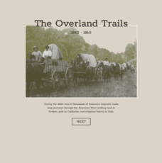
The Overland Trails 1840-1860
What led Americans to head west in the 1800s? Using an interactive map and journals from those who traveled, pupils explore the stories of those who migrated. In addition, they see how the numbers fluctuated in response to the push-pull...
Curated OER
Mapping the Human Journey
Students explore a migration of people with their surname. As a class, they define key vocabulary and identify the different types of movementbs of people in history. They examine the reasons for the migration and use the internet to...
University of Richmond
Foreign-Born Population 1850-2010
If America is a nation of immigrants, where are they from and why did they come? Demographic data and interactive maps help pupils consider answers to these questions by examining the statistics of foreign-born Americans. Features allow...
Curated OER
How Does a Migration Move Forward?
Students record and examine migration data, and calculate how fast and far a migrating animal travels and what influences its progression. They utilize the Journey North website to follow their migrating animals.
Curated OER
What in Our World Affects the Way People Live
Sixth graders study various maps that show geographical features and population. They compare the maps and make inferences about how various geographical features influence the population and human activities of an area.
Curated OER
March of the Polar Bears: Global Change, Sea Ice, and Wildlife Migration
Students study global change and how these changes impact wildlife. In this polar bears lesson students analyze maps and data to understand climate change.
Curated OER
Wetland Safari!
Students identify how humans, fish, plants, birds, insects and other wildlife benefit from wetland environments. They observe a wetland and its inhabitants, draw a migration map that represents how birds use wetlands in traveling long...
Curated OER
Understanding Growth of the Phoenix Area
Students study the growth of the Phoenix area using geographic images, maps, tables, and graphs. They study the idea of community.
Curated OER
Alberta And Saskatchwan: the View in 1905
Students analyze the differences between maps 1905 and current maps of Alberta and Saskatchewan. They use maps from the Canadian Council for Geographic Education to complete a guided inquiry. This lesson also has many extension activities.
Curated OER
Global Awareness
Students read about how scientists are arriving at current theories of human origin and migration through mitochondrial DNA analysis. They then piece together a map showing the data from mitochondrial DNA analysis to plot the migration...
Curated OER
City Bound
Fifth graders identify the reasons for people migrating to cities after the Civil War. Using population data, they discover why populations in cities rose while rural populations fell during 1860 to 1900. They discuss the impact a...
Curated OER
Stranded along the Coast
Students plot stranding sites onto a map using latitude and longitude as well as compass directions with respect to coastal features. They identify several species of marine animals that might become stranded; distinguish their...
Curated OER
Where is Everybody?
Students collect data from different grade levels at their school and develop thematic maps which show population density, and determine how this might affect the school and themselves in the future.
Curated OER
Monitor Marine Migrants
Learners, in groups, track the seasonal journey of a species, such as a shorebird, sea turtle, or marine mammal, using various sources of migration data
Curated OER
Where is Everybody?#135
Students examine the human uses of school spaces through a variety of activities. They draw the playground during recess and not during recess. They determine how many people use each room at different times before graphing the...
Curated OER
The Marsh Land as a Changing Environment
Sixth graders continue their examination of the state of Connecticut. After taking a field trip, they identify the types of birds, plants, invertebrates and vertebrates who make their home in the salt marshes. In groups, they identify...
Curated OER
Geological Development of Indiana and the Movement of Peoples Across the State
Fourth graders examine the geological development of the state of Indiana. Using the internet, they interact with the United States Geological Survey. They identify earthquake zones and energy resources in the state. They work...
Curated OER
Walking the Five Themes - Your Community to Ours
Young scholars in two classrooms share information about their communities in classrooms throughout the year. In groups, they identify the physical and human characteristics of each area and how they change through time. They also...
Curated OER
Water, Water Everywhere
Students are introduced to the complex issues of water resources around the globe. In groups, they take on the role of a country and map out the location of water sources. They barter, sell or take over other groups to have access to...
Curated OER
Who's Range is it?
Students investigate the habits of panthers by analyzing radio transmitted data. In this animal life lesson, students utilize computers to view the range of different statistics dealing with Florida panthers. Students...
