Curated OER
Land Formations
Second graders explore land formations. In this science lesson plan, 2nd graders develop an understanding of how land is naturally developed, investigate several land formations as well as earth science and chemical terminology, and ...
University of Georgia
Heating and Cooling of Land Forms
Compare heating and cooling rates of different land forms. A lab activity has groups collect data on the rate of heating and cooling of soil, grass, saltwater, fresh water, and sand. An analysis of the rates shows how the different land...
Curated OER
Lesson 2 Its a Small World (Day 2)
Students are able to explain how the water cycle recycles the earth's water supply. They are able to make use of the knowledge of land forms learned in social studies. Students are able to form a hypothesis on how/why the water cycle...
Oregon State
World Map of Plate Boundaries
Young geologists piece together the puzzle of plate tectonics in an earth science lesson. Given a physical map of the world, they search for land formations that indicate the location of different types of plate boundaries.
Curated OER
Plate Tectonics & Land Forms
Fourth graders discuss the different interactions of plates and the ways mountains are created. In this plate tectonics lesson students complete an activity in groups.
Curated OER
Google Earth Landforms
In this lesson, Google Earth Landforms, students research a landform that has been studied in class. Students explore Google Earth and record everything they find about their landform. Students have the opportunity to extend their...
Curated OER
Water Works Wonders
Students examine where water is found in the world, how we use it, and the various forms it takes. They observe the refraction of light through a prism, record the day and night sky over a week's time, and create a topographic model of...
Curated OER
Sanctuary: Quail Island Banks Peninsula
Students explore world geography by creating a 3D diorama. In this New Zealand land form lesson plan, students examine color images of New Zealand's wildlife and discuss the different elements inside them. Students utilize these...
Ocean Explorer
Easy as Pi
Seamounts are large, extinct volcanoes that rise up from the bottom of the ocean floor. They are a relatively new landform in the scientific community, and this instructional activity invites students to learn about the amazing diversity...
Curated OER
What Happens When Sea Level Rises or Falls
Students examine the impact of sea level on land formations. In this geography and map lesson, students construct a contour map model illustrating how much of the clay "coastline" is covered as water is added. Metric measurement is...
Curated OER
Build Illinois
Students examine the history of the formation of Illinois. Traveling virtually between time periods, they describe each period and compare them with how Illinois is now. They work together to complete an activity and worksheet.
Curated OER
Mud in the Water
Students build a soil erosion model to study the importance of soil conservation. They investigate how land forms from both constructive and destructive forces.
Curated OER
Understanding Topographic Maps
Underclassmen create a cone-shaped landform and then draw a contour map for it. Then they examine a quadrangle (which was easily located with an online search), and relate it to what they experienced. The accompanying worksheet is...
Curated OER
Watershed Works: Unit 1
By constructing a watershed model and identifying watershed features in it, they discover how water erosion changes the landscape. As with most watershed modeling activities, this one is costly in terms of time and materials. It is,...
Curated OER
Landforms E-mail Project
Learners identify and explain geographic terms. They write descriptions of the terms. Students discuss landforms and draw pictures to illustrate them. Learners compose and present oral reports about landforms.
Concord Consortium
Area Upgrade
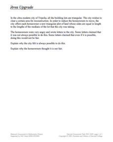
Imagine a world built of triangles. A performance task asks scholars to consider just that. They use their knowledge of special segments of a triangle to make decisions about the area of triangular plots of land.
Curated OER
War of 1812
Eighth graders locate the major land forms and bodies of water on a map of Louisiana. In groups, they discuss the role of the Mississippi River in the Battle of New Orleans and how land and water affect the outcome of battles. To end...
Curated OER
Where Should We Land?
Students discuss the difference between major landforms as a class. In groups, they rate the landforms based on the needs of the community that wish to settle there. They also discuss the push and pull factors of the colonists that made...
Curated OER
How to Make a Lake
Young scholars examine the Michigan state quarter and discuss the effects glaciers have on land formation. They perform an investigate using ice cubes and sand to show how glaciers have carved the land.
Curated OER
Slip Slidin' Away
Students investigate mechanical weathering as a form of erosion. In this erosion lesson, students, define weathering and erosion before determining how the Earth's surface is in a constant state of change. They watch a video, access...
NOAA
Into the Deep
Take young scientists into the depths of the world's ocean with the second lesson of this three-part earth science series. After first drawing pictures representing how they imagine the bottom of the ocean to appear, students...
Annenberg Foundation
Reading Maps
Can you read a map? Scholars use an interactive technology tool to analyze maps of various kinds to gather evidence and data to better understand their meanings and usefulness. Using newly obtained knowledge, they form an interpretation...
Space Awareness
Valleys Deep and Mountains High
Sometimes the best view is from the farthest distance. Satellite imaging makes it possible to create altitude maps from far above the earth. A three-part activity has your young scientists play the role of the satellite and then use...
Curated OER
Sinkholes in a Cup
Students create sinkholes and learn about the formation of sinkholes by using water, a foam cup, sugar, sand, and a sponge. For this sinkholes lesson plan, students also answer short answer questions.


