Curated OER
Creating a Thematic Map
Students create and analyze a weather-related data table and a thematic map based upon information provided.
Curated OER
Mapping the Aegean Seafloor
Earth science learners create a two-dimensional topographic map of the floor of the Aegean Sea. They use it to then create a three-dimensional model of the ocean floor features. This comprehensive resource delivers strong background...
Annenberg Foundation
Reading Maps
Can you read a map? Scholars use an interactive technology tool to analyze maps of various kinds to gather evidence and data to better understand their meanings and usefulness. Using newly obtained knowledge, they form an interpretation...
Curated OER
Documenting Texas Women’s History through Photographs
Students explore women’s history. For this women’s studies lesson, students will examine seven photographs that depict prominent female figures from Texas’s history. Students will engage in a discussion of the photographs as a mode of...
BBC
Walk Through History
First the Vikings raided Great Britain, and then they set up camp and moved in. Learners explore Viking times and discuss reasons why groups choose to settle. They construct a class timeline, engage in several online activities, and then...
Curated OER
Bears and Panthers Aplenty: Early Settlers Make a Home in Arkansas
Young historians research the Southwest Trail, which ran through Arkansas back in the 19th century. Pupils are divided into four groups. Each group researches a pioneer who blazed the Southwest Trail. Then, the group presents an oral or...
Curated OER
Where Were Your Ancestors in 1871?
Here is a nicely designed lesson plan on ancestry and family history. In it, learners read an article entitled, "Where Were Your Ancestors in 1871?" Then, they make up a series of questions to profile their family and their community 100...
Curated OER
Native Americans in Arkansas: The Quapaw
The Quapaw Indians of Arkansas are the focus of this American history lesson. Learners discover many aspects of the Quapaw culture, such as their dwellings, social organization, food, and how the tribe was eventually driven out of...
Curated OER
Great Lakes Homepage for Kids
Here are some outstanding lessons on the geology and history of the Great Lakes. These lessons are divided into Grade 4 -6, and Grade 7 - 8 activities. The activities all use the background information, maps, graphs, data, and Great...
Curated OER
"History of My Family"
Learners explore world geography by participating in a family history project. In this U.S.S.R. lesson, students read assigned text regarding the Stalinist era of Russia and the intolerance that thrived there. Learners answer a list of...
Curated OER
Mapping My Spot in History
Students create their own town's history. They place themselves on the map in a literal as well as figurative sense. Students produce portions of an updated version of an early twentieth century panoramic map. Students gather information...
University of Pennsylvania
Canaan and Ancient Israel
Planning for your next activity on ancient Israel, but not sure where to start? Check out this assortment of activities to help get the ball rolling. It includes a range of ideas on topics, such as Greek and Egyptian mythology,...
Smithsonian Institution
Who's in Camp?
Pupils complete readings, a group activity using cards, and a writing activity to better understand people's lives during the American Revolution. The resource emphasizes people such as the militiamen, women, officers, and children,...
Annenberg Foundation
America's History in the Making: Using Digital Technologies
How can digital technology of today link us to the events of the past? Scholars use technology to uncover the vast number of historical resources available in lesson 12 of a 22-part America's History in the Making series. Using databases...
Curated OER
Mapping Puerto Rico
Students use maps to discover where Puerto Rico is located. In groups, they use the internet to research the vegetation. They also compare and contrast the relationship between the United States and Puerto Rico's government.
Curated OER
Map Skills
Students examine the nations, battlefields, troop movement of the Germans through Belgium and the location of both fronts during World War I by creating a map. They visualize the strength of the Germans early in the war.
Reading Through History
The Proclamation of 1763
The French and Indian War concluded with an important proclamation—that is, The Proclamation of 1763. Scholars read about the policies in the document and how the different sides of the French and Indian War reacted. Following, they...
Curated OER
Arkansas History Lesson Plan: Identifying Arkansas on a Map
Students investigate their hometown of Arkansas. In this U.S. Geography lesson, students identify Arkansas on a map and distinguish it form the other states. Students investigate the history, state line, and personal...
Curated OER
Mapping the Prairie
Fifth graders study maps of the Chicago area looking at defining characteristics and place names. They investigate settlement patterns by looking at the maps.
Chicago Botanic Garden
Historical Climate Cycles
What better way to make predictions about future weather and climate patterns than with actual climate data from the past? Young climatologists analyze data from 400,000 to 10,000 years ago to determine if climate has changed over...
Curated OER
Whitewater Canal State Historic Site
If you happen to live in Indiana, or a neighboring state, and are planning a field trip to the Whitewater Canal State Historic Site, then this lesson plan will suit your needs quite well. In it, suggestions for activities before, during,...
Curated OER
The Importance of Site Maps in Archaeology
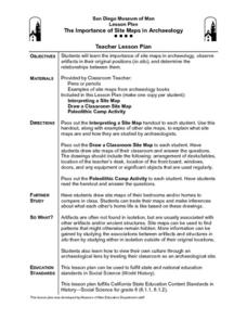
Students consider the importance of site maps in archeology. They interpret site maps, draw site maps of their classroom and home and then participate in simulated Paleolithic archeological camp activity.
Curated OER
My Secret War: Lesson 8
Fifth graders explore American history by viewing videos on the Internet. In this Japanese internment instructional activity, 5th graders discuss the politics that took place between America and Japan during WWII and why it was necessary...
BrainPOP
World History Lesson Plan: Uncovering Essential Questions
Have you ever noticed a news story revolves around an essential question? Scholars research methods of reporting historical events. Working in groups, they use an interactive module to gather information on a historical topic, uncovering...


