National Geographic
Mapping the Americas
Celebrate the geography of the Americas and develop map skills through a series of activities focused on the Western Hemisphere. Learners study everything from earthquakes and volcanoes of the Americas and the relationship between...
Curated OER
A Map as a Tool
Students study the concept of using a map as a tool with the usage of a balloon designed to mimic the features of the Earth with the major features marked and shown on the balloon.
Curated OER
The Solstices
Compare surface temperatures when the solstice occurs in the different hemispheres. Young scientists draw conclusions from their investigation of data collected using spreadsheets and a globe.
Curated OER
Finding Your Way Using Maps and Globes
Students identify the similarities and differences between different maps and globes. Individually, they create a map of their classroom along with a compass rose. They also practice reading maps as a class and finding specific locations.
Curated OER
Rivers, Maps, and Math
Students use maps to locate and label the major rivers of North and South America. Using the internet, they identify forests, grasslands, mountain ranges and other landforms on the continents as well. They compare and contrast the...
Association of American Geographers
Project GeoSTART
Investigate the fascinating, yet terrifying phenomenon of hurricanes from the safety of your classroom using this earth science unit. Focusing on developing young scientists' spacial thinking skills, these lessons engage learners in...
Curated OER
Solar Heating in the Himalayas
A fascinating instructional activity on how solar power is utilized by people who live in the Himalayas is here for you. In it, learners perform a case study which will help them understand that solar energy is a renewable resource, that...
Curated OER
Where Is Japan? What Direction Is It?
First graders locate countries on maps and globes and learn about the hemispheres and the cardinal directions. They listen to books read out loud and dicuss geography.
Curated OER
Western Hemisphere
Fourth graders use a database to compare countries in the western hemisphere. They describe a variety of regions in Texas and the Western Hemisphere such as political, population, and economic regions that result from patterns of human...
National Center for Case Study Teaching in Science
Mask of the Black God
Finally, an astronomy lesson for the high schooler! Explorers are able to read star maps for finding objects in the night sky by determining celestial coordinates. In particular, they locate the Pleiades and read about a Navajo legend...
Curated OER
Where in the World? The Basics of Latitude and Longitude
Students are introduced to the concepts of latitude and longitude. In groups, they identify the Earth's magnetic field and the disadvantages of using compasses for navigation. They identify the major lines of latitude and longitude on a...
Curated OER
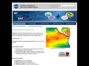
Comparing the Effects of El Nino and La Nina
Students examine the differences between an El Nino and La Nina year. For this investigative lesson students create maps and graphs of the data they obtained.
Curated OER
Rapping Regions in America
Students determine what designates a place as a region. They apply their criteria for a region to the US map. They work in groups to write a rap about their region that describes its organization, type and structure.
Curated OER
Exploring the Constellations, a WebQuest Activity
Students explore space science by participating in a class WebQuest. In this constellation identification lesson, students view star charts based on the four seasons and identify the changes our sky goes through in the course of 12...
Curated OER
A Book Is A Window To the World
Second graders listen to pieces of literature that take place in different regions of the world. Using a map, they identify and locate the continents and oceans mentioned in the story. They describe the physical and human characteristics...
Curated OER
Native American Dolls
Young scholars examine Native American dolls. They discover the connections between the dolls and the Native American culture and customs. They also use maps to locate the position of different tribes.
Curated OER
Vikings in Vinland
Students examine the role of archaeology in gaining information about past civilizations. After reading an article, they discover evidence of the Viking settlement of North America. They summarize the information in the article by...
Curated OER
Ocean Currents
Students discover the geography of Earth by analyzing water currents. In this oceanography lesson, students create visual references on a map of the globe where and why major ocean currents are moving water. Students conduct a water...
Curated OER
The Big Crush
Students examine weather maps from their state from the past few days. They examine the Highs and Lows on the maps to determine what kind of weather they produce. They use that information to better prepare for their activities and what...
Curated OER
How Does the Earth's Energy Budget Relate to Polar Ice?
Learners use satellite data to see how radiation budget relates to the ice that is present in the North. In this energy lesson students correlate data to see a relationship.
Curated OER
What I Did On My Summer Vacation
Students use the internet to research the location of their summer vacation trip. Given the demographics, they plot the location on a world map. They create a brochure using the information they collected. Using PowerPoint, they develop...
Curated OER
Migration of the Neo-Tropical Songbirds
Fifth graders plot the migration of birds using Google Earth. In this lesson on bird migration, 5th graders work in groups to plot the migration of a group of birds using Google Earth. Students present and discuss their findings and look...
Curated OER
The Time Has Come: Poetry and Drama Use in the Geography Class
Young scholars use drama and poetry in their Geography class. In groups, they role play an interviewer or the interviewee in various plays that were presented to them. In their role, they must locate and label where the countries...
Curated OER
Australia
Students participate in activities in which they discover facts about Australia. They examine its climate and history. They complete a worksheet to end the lesson.


