Curated OER
Mapping Constellations
Students become familiar with constellations. In this space science lesson, the teacher introduces constellations by showing students the star patterns and reading myths. Students, observe the stars nightly, then choose one constellation...
Curated OER
Introduction To Topographic Map Activities
Students discuss different types of maps, their similarities and differences. Using a Topographical Maps CD-rom program students create their own map.
Curated OER
Through the Forest and Home Again: Maps Help Us Find Our Ways
Students read Little Red Riding Hood, focusing on her path home to Grandma's house. In this language arts and geography lesson, students perform a reader's theater, re-creating the walk home and possible routes that could have been...
Curated OER
Yo Ho, Yo Ho, A Pirate's Map for Me: An Original Story
Students read Blackbeard and brainstorm their knowledge of maps. In this language arts and geography lesson, students use landmarks on their playground to review north, south, east and west and discuss the compass rose. Students read...
Curated OER
Bird's Eye View Map
Pupils explore seeing things from a bird's eye view. They listen to the book, "As the Crow Flies," view various objects from eye level views and standing on a chair, create a drawing of an object from both views, and read "Ben's Dream"...
Curated OER
The Case of the "Lost Gorge:
Students examine the case of a map making expedition. In groups, they read a case study on "The Lost Gorge" in the Finger Lakes region of New York state. They examine maps and determine where the error in the map-making occured to end...
Curated OER
Fossil Fuels (Part II), The Geology of Oil
More of a mini-unit than a lesson, these activities lead inquisitors through a survey of oil deposits. In the first part, they read about and view diagrams of sedimentary rock layers that trap oil. Next, they test porosity and...
Curated OER
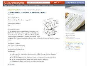
The Power of Words in Charlotte's Web
"How can a few good words save a pig's life?" Posed with this question, your ELD students explore E.B. White's Charlotte's Web in a meaningful, valuable way. By analyzing specific word choice from the book, especially the excerpts...
American Immigration Law Foundation
No Pretty Pictures
Here is a nice set of activities and discussion questions to accompany your class reading of No Pretty Pictures, a memoir of a young girl's experiences and struggle for survival during the Holocaust.
National Constitution Center
Explore Rights Around the World
How has the American Bill of Rights influenced the rest of the world? An interactive web activity helps individuals see the similarities between countries' bills of rights. A text-to-text tool compares the American Bill of Rights to...
Association of American Geographers
Project GeoSTART
Investigate the fascinating, yet terrifying phenomenon of hurricanes from the safety of your classroom using this earth science unit. Focusing on developing young scientists' spacial thinking skills, these lessons engage learners in...
Smithsonian Institution
A Ticket to Philly—In 1769: Thinking about Cities, Then and Now
While cities had only a small fraction of the population in colonial America, they played a significant role in pre-revolutionary years, and this was certainly true for the largest city in the North American colonies: Philadelphia. Your...
Curated OER
Quick-Sketch Artist Tips on Mind Mapping the Urban Landscape
Students interpret maps. They also create mental maps of regions in which they are studying. Students then explain the historical or cultural significance of map features orally or in written form. Students take a walking field trip...
Curated OER
Math with Maps and Globes
Students round out their math skills with these ‘round the world' ideas. In this math and geography activity, students try out time zone sticks, a polar race, and tic-tac-globe to engage them in learning more about globes and the...
Curated OER
PA Watersheds, Many Ways to the Sea
Students examine the water cycle and the factors that interact with watersheds. In this watersheds lesson students describe the purification process, trace the flow of infiltrate water through aquifers, and research the Internet to find...
Alabama Learning Exchange
WATER You Doing to Help?
Auntie Litter is here to educate young scholars about water pollution and environmental stewardship! Although the 15-minute video clip is cheesy, it's an engaging look at the water cycle and conservation. Learners start by illustrating...
Curated OER
Mapping Districts
Learners become literate in their use of maps. In this 2010 Census lesson plan, students visualize census data on maps, use map keys to read population maps, and explore the concept of population density.
Curated OER
Mapping Districts
Students use maps to learn about the U.S. Census. In this 2010 Census lesson plan, students visualize census data on maps, use map keys to read population maps, and explore the concept of population density.
Curated OER
The Importance of Site Maps in Archaeology
Students consider the importance of site maps in archeology. They interpret site maps, draw site maps of their classroom and home and then participate in simulated Paleolithic archeological camp activity.
Curated OER
The Water Nearby
Students explore water located near where they live. In this map skills maritime lesson, students use Google Maps to find their school and the body of water closest to them. Students research the body of water and answer questions about it.
Curated OER
Right Place, Right Time
Fourth graders complete mathematical word problems. They study the relationships among distance, speed, and time; and measure travel distances. They measure distances using a piece of string and a ruler and practice converting several...
Curated OER
The Words that Surround Us
Students investigate writing that we read daily by analyzing advertisements and articles. In this language arts lesson, students discuss the images and writing they see daily, where it comes from, and what it represents. Students...
Curated OER
Mapping It Out
Fourth graders examine various aspects of the environment of Utah. In groups, they create four maps of Utah, based on temperature, precipitation and elevation. To end the lesson, they are asked a question as a group and use their maps...
Curated OER
Mapping the Local Community
Students review the symbols and legends of a map. In groups, they follow a set of directions to create a map showing the route to a specific place. They present their map to the class and review the basic components of a community.


