Curated OER
Creating a Thematic Map
Students create and analyze a weather-related data table and a thematic map based upon information provided.
Curated OER
Introduction to Maps
Students develop their map skills. In this geography instructional activity, students participate in an activity that requires them to survey their social studies book in order to find different types of maps and purposes for their uses.
Curated OER
Mapping Perceptions of China
Young scholars discuss what types of things are included on a map. They compare and contrast maps of China with a map they create and practice using different types of maps. They write analysis of their classmates maps.
Curated OER
Using Literature to Introduce the Five Themes of Geography
Students listen to a read aloud of "If You Grew Up With Abraham Lincoln". Using the text, they identify examples of the five themes of geography and write them down. Using a map, they plot the places mentioned in the book and sort facts...
Curated OER
Teaching the Five Themes of Geography Through Picture Books
Read the story Make Way for Ducklings and introduce little ones to the five themes of geography. Reread the story, while displaying transparencies to reinforce the five themes. In groups, learners view pictures and identify the themes on...
Curated OER
Food on the Map
Students work together to examine the tastiest towns in the United States. After discovering the names of the equipment, they identify the seven continents. They take a survey and locate the cities and states of the foods mentioned.
Curated OER
Yo Ho, Yo Ho, A Pirate's Map for Me: An Original Story
Students read Blackbeard and brainstorm their knowledge of maps. In this language arts and geography lesson, students use landmarks on their playground to review north, south, east and west and discuss the compass rose. Students read...
Curated OER
Geography: examining the Glacial Features of Cape Cod
Students examine satellite images of the glacial features of Cape Cod. They analyze where human activity is located in terms of those features. Students make models of the features, including kettle holes. They also use contour maps...
Curated OER
Flat Stanley
Students read Flat Stanley, and make a poster board Flat Stanley which they sent out to family members in different states. They create an adventure for their Flat Stanley based on his "travels" and map out his trip.
Curated OER
The Geography of the Olympics
Students plot the location of the Winter and Summer Olympics since 1896. Using the maps, they analyze data on where the Olympics have been held and discuss why that location was chosen. They discuss the possiblity of Indianapolis...
Curated OER
Explore Your World--Geography Takes You Places
Students examine how the world around them is constantly changing. In groups, they travel between centers in their classroom to role play the role of explorers in Washington D.C. They share their experiences with their classmates and...
Curated OER
FRED the FISH
Pupils engage in the study of the human impact on environmental systems (specifically rivers). This lesson plan enhances Students' exploration of a variety of themes or topics.
Curated OER
SpellO': An Orienteering Lesson
Students participate in hands-on activities to practice orienting maps. Given activity cards, students accurately read maps and locate specific stations. Students collect information from the maps to spell a message when the activity...
Curated OER
Environment: Water & Air
The introduction to the lesson mentions a sailor's limited capacity to store drinking water on his ship. Pupils then set up an overnight experiment to remove freshwater from salt water by distillation. There is a math and map activity to...
Curated OER
Sybil Ludington's Ride - a poem
Fourth graders examine the role a teen from the Hudson Valley played in the American Revolution. They view the map of Sybil's ride and calculate the distance using the map's legend.
Curated OER
Country: India
Students use the Internet to study the history, geography, culture and art of India. Videos, photographs and maps are included.
Curated OER
Mapping Lab and Lead Poisoning
Students are introduced to GIS and its uses. They make predictions before viewing the actual lead poisoning cases by location of Dade County. Pupils use actual Miami-Dade County spatial data to explore basic principals. Students
Curated OER
What is the Population Distribution of Cartoon Characters Living On the Pages of Your Newspaper?
Students read various cartoons in their local newspaper and calculate the population demographics, spatial distribution and grouping of the characters. Using this information, they create a population distribution map and share them with...
Curated OER
Movement of Native American Tribes 1830-1890
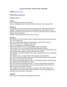
Students examine the movement of Native American tribes during the mid 1800's. In this American History lesson plan, students study two Native American tribes that live in the United States and complete a comparison/analyze project....
Curated OER
Collage/Assemblage
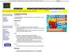
Students identify different shapes and patterns. They locate France on a world map and examine the works of artist, Henri Matisse. They discover shapes that are related to Math.
Curated OER
Brave New World
Young scholars view a video about the effects of World War II on the map of Europe. They discuss the video and answer questions. They work together to identify accomplishments that best represent American culture.
Curated OER
Oak Ridges Moraine: Southern Ontario's Sponge
Learners examine the characteristics of the Oak Ridge Moraine in Canada. Using a map, the locate the moraine and present and defend a position on how the resources found there should be used. They must use proper geography terminology...
Curated OER
Getting to Know the Streets of Honolulu
Students practice identifying the streets names of Honolulu. Using a city map, they identify a main street and two intersecting streets. They research the origin of the name and complete a worksheet. They share their findings and...
Curated OER
Water, Water Everywhere
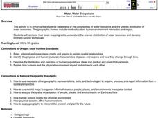
Pupils are introduced to the complex issues of water resources around the globe. In groups, they take on the role of a country and map out the location of water sources. They barter, sell or take over other groups to have access to more...


