Curated OER
Constellation Mapping
Middle schoolers plot constellations on a grid map. They discuss the various ways early explorers planned their travels. Students identify and recognize major constellations. They color their maps and take them home to try to find...
Curated OER
Geography and Culture of China
Take out a map, a paper, a ruler, and those coveted colored pencils for a lesson on Chinese culture and geography. This is a multifaceted approach to basic geography skills that incorporate story telling, class discussion, primary source...
Curated OER
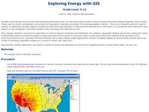
Exploring Energy with GIS
Students examine GIS technology as it is used to locate energy sources. In this GIS lesson, student access an assigned website to locate a series of lessons using the GIS software. They use the maps that are located on the primary lesson...
Curated OER
Gridding a Site
Students establish a grid system over an archaelogical site. They label each grid unit. They determine the location of artifacts within each grid unit. They construct a scientific inquiry concerning the location of artifacts on the site.
Curated OER
Location, Location, Location: Using a Grid to Determine Context
Seventh graders are introduced to making inferences about artifacts. Using a grid system, they locate the artifacts and determine where they originated from. They use this information to make conclusions about the way people lived...
Curated OER
But Where Is It On This Modern Map? A problem-solving, mind-boggling experience!
Trace Columbus' voyages by locating them on 21st Century maps. Using a navigators lesson, 4th graders will examine the Age of Exploration and trace Columbus's routes accurately on laminated world maps using different maps. Note:...
Curated OER
School Sleuths Treasure Map
Students are explained how a grid and compass work. They are also explained that archaeologists use grids as a record of the exact location of artifacts. Students define the term datum as a point of reference on grids from which all...
Curated OER
Metrics And Measurements
Students engage in a study of measuring distances between geographical locations on a map. They are able to define and use the map scale in conjunction with the metric system. For this lesson they make their own maps and measure the...
Curated OER
Mapping the Local Community
Young scholars review the symbols and legends of a map. In groups, they follow a set of directions to create a map showing the route to a specific place. They present their map to the class and review the basic components of a community.
PBS
Inspector Detector
How do spacecraft detect magnetic fields? The fourth installment of a five-part unit has learners develop a device with magnets that allows for the detection of magnetic fields. They use a map of an imaginary planet to try out their...
Curated OER
Where in the World? The Basics of Latitude and Longitude
Students are introduced to the concepts of latitude and longitude. In groups, they identify the Earth's magnetic field and the disadvantages of using compasses for navigation. They identify the major lines of latitude and longitude on a...
Curated OER
Pacific Atolls and Island Groups
Learners construct, interpret and translate maps and geographic data. Given a worksheet, students identify an island, an atoll, a scale, and a compass rose. Learners grid systems, legends, and symbols. They use the map to find answers to...
Curated OER
Where in the World? :Understanding Latitude and Longitude
Students play a grid-based game and devise clues to help classmates locate spots on the globe in order to recognize the value of using longitude and latitude for identifying locations.
Curated OER
Searching the Attic
Students conduct field research, including the use of a grid system, in order to discover important or interesting family artifacts.They map discoveries of important artifacts on a grid map in order to track and better analyze...
Curated OER
2 x 2
Learners work together to grid a 2 x 2 meter unit using the formula for the Pythagorean Theorem. After creating the grid, they identify the location of artifacts and create a map of their location. They develop a graph and table of their...
Curated OER
Where Are We?
Students use Cartesian coordinates or degrees of latitude and longitude to locate important locations within their specific countries. They Use a grid to apply the concept of latitude and longitude, or positive and negative Cartesian...
Curated OER
More Than One Grain of Rice
Students explore mathematics, geography and agriculture by studying world rice production. In this production of rice lesson plan, students read One Grain of Rice and use a worksheet grid to calculate how much rice was received. Students...
Curated OER
Tailoring Two Cultures to Adapt to Wisconsin's Biotic Zones
Middle schoolers examine the effect of the various ice ages on Wisconsin. In groups, they create a map representing the five geographic regions of Wisconsin. They must write out a description of each region to be placed on a poster...
Curated OER
Discovering the Past Using the Future: Remote Sensing and the Lost City of Ubar
Young scholars use a video, maps, worksheets and Internet research to explore the role that sensing played in locating Ubar - the lost city of Arabia.
Curated OER
Issues About Rivers
Students explore the environmental issues of rivers. In this river lesson plan, students collaborate to create a concept mat pertaining to environmental issues regarding the Tangipahoa River.
Curated OER
"Now and Then" Comparing Present Day with Medieval Times
Eighth graders compare a present-day social issue with a medieval issue. They use technology tools to conduct their research and demonstrate their new knowledge. Students present their findings to the class in the form of a PowerPoint.


