Curated OER
Backwards Goes It Does
Young scholars create a three-dimensional model of the Chicago river watershed to determine the flow of the river at its mouth. They use prepared clear gelatin and topographic maps to discover that the building of canals actually...
Curated OER
Finding the Mother Lode
Learners engage in a paper treasure hunt to find a lode deposit of gold using the placer deposit concentrations of metals found in stream sediments. They use topographic maps and metal concentrations to assist them. Students discuss the...
Curated OER
Seeing the Seafloor Using Sound - Multibeam Sidescan Sonar
Students are told that sound is not just stuff that our ears hear. They are explained that it is a tool for measuring and looking at objects in a new way. Students are introduced to sound waves and sonar imaging. They are explained...
Curated OER
The Watershed Quest
Students examine their connection to local watersheds. They describe the water cycle and list species living in their local watershed. They also draw a map of their community.
Curated OER
Geography: examining the Glacial Features of Cape Cod
Students examine satellite images of the glacial features of Cape Cod. They analyze where human activity is located in terms of those features. Students make models of the features, including kettle holes. They also use contour maps...
Curated OER
Is Purple Loosestrife a Problem Near Our School?
Students explore to investigate if the distribution of Purple loosestrife around the school district area is relevant to its distribution and control. They create a comprehensive map to support their thesis and data and then head out...
Curated OER
Park Brochures
Sixth graders investigate natural environments by researching national parks. In this brochure making instructional activity, 6th graders explore a specific national park and research it's information by utilizing the web. Students...
Curated OER
What Happens When Sea Level Rises or Falls
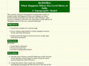
Students examine the impact of sea level on land formations. In this geography and map lesson, students construct a contour map model illustrating how much of the clay "coastline" is covered as water is added. Metric measurement is...
Curated OER
Landforms
Students begin their examination of landforms. Using a map, they locate and identify the major landforms on Earth. They discuss how landforms affect the lifestyle of the community and determine which goods and services the community...
Curated OER
Using Soil properties and Vegetation Differences to Hypothesize the Land Use History and Topographic Differences between Two Locations
Ninth graders take soil samples and perform tests on these samples.
Curated OER
Explore Your World--Geography Takes You Places
Students examine how the world around them is constantly changing. In groups, they travel between centers in their classroom to role play the role of explorers in Washington D.C. They share their experiences with their classmates and...
Curated OER
SUBMARINE MOUNTAINS
Students create a two-dimensional contour map of a submerged area from a simulated survey using sounding techniques.
Curated OER
Car Wash
Students determine the most appropriate site for a car wash, based on each site's soil characteristics (chemical, physical) and topographic features. They perform an experiment to determine the changes to three different soil types when...
Curated OER
Comparison of Snow Cover on Different Continents
Students use the Live Access Server (LAS) to form maps and a numerical text file of snow cover for each continent on a particular date. They analyze the data for each map and corresponding text file to determine an estimate of snow cover...
Curated OER
Lahar Travel Time
Ninth graders analyze published geologic hazard maps of California and comprehend how to use the map's information to identify evidence of geologic events of the past and present and predict geologic changes in the future. They select...
Curated OER
Navigation Across the Seas
Students examine nautical navigation and discover the differences between nautical charts and other types of maps or charts. Students practice setting a course, taking a bearing, and dead reckoning. This gives students an example of...
Curated OER
Exploring Our Watershed System
Students examine how watershed systems are made up, and visit the Susquehanna watershed system and map out the system. They evaluate the order of watercourses in their area.
Curated OER
Floodplains in the field (with GIS)
Students measure a topographic and geologic cross-section across a floodplain by simple surveying and auguring techniques. They consider the spatial context of the field observations, use GPS measurements, and desktop GIS analyses.
Curated OER
Floodplains in the Field
Students measure a topographic and geologic cross-section across a floodplain using simple surveying and auguring techniques in a field lab. Students also reconstruct the history of a river system.
Curated OER
Build a Model Watershed
Collaborative earth science groups create a working model of a watershed. Once it has been developed, you come along and introduce a change in land use, impacting the quality of water throughout their watershed. Model making is an...
Curated OER
Forecasting the Path of Mudflows
Students watch a demonstration to introduce them to the consistency of mudflows and how they move. In groups, they compare and contrast volcanic avalanches and mudflows. They create their own model of a volcano, simulate how it erupts...
Chicago Botanic Garden
Albedo, Reflectivity, and Absorption
What is reflectivity, and what does it have to do with the Earth's climate? As reflectivity is measured by albedo, scientists can gather information on Earth's energy balances that relate to global warming or climate change. Budding...
Curated OER
Analyzing the Relationship between Snowpack and River Flow
Learners use the Internet to research current and past snowpack levels and river gauging station readings. They determine the relationship between snowpack and river flow. They predict future river flow.
Curated OER
Barnegat Bay Watershed
Students design a model watershed. In this watershed lesson, students learn the needed parts of a watershed and how they work. Students evaluate how watersheds effect communities.
Other popular searches
- Reading Topographic Maps
- Science Topographic Maps
- Making Topographic Maps
- Geography, Topographic Maps
- Topographic Maps Labs
- Topographic Maps Computer
- Topographic Maps Isolines
- Topographic Maps Salines
- Topographic Maps + Salines
- Topographic Maps + Isolines
- Geography Topographic Maps
- Topographic Maps Profiles


