Curated OER
Compass Rose
Second graders practice identifying the four cardinal directions. After locating a compass rose on a map, 2nd graders explain each point that corresponds to a direction. Using a toy ship as a manipulative on a map, students observe its...
Curated OER
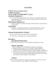
Using a Compass Rose
Second graders explore geography by completing a mapping activity in class. In this directional lesson, 2nd graders examine a map in class and utilize a compass rose to identify their location and destination. Students write directions...
Curated OER
Compass Rose
Students describe the movement of the Earth as it relates to the sun. They construct a permanent compass rose and use it to find directions.
Curated OER
In Mr. Lincoln's Shoes
Learners demonstrate basic map skills. For this US history lesson, students review cardinal directions and use a compass rose while at the same time discuss what life was like for Abraham Lincoln.
Curated OER
Finding Your Way Using Maps and Globes
Students identify the similarities and differences between different maps and globes. Individually, they create a map of their classroom along with a compass rose. They also practice reading maps as a class and finding specific locations.
Curated OER
Create a Compass Instructions for Teachers
Students, who are teachers, discover how to make box and water compass in their classrooms. They describe the scientific principles that are involved in making and using a compass.
Curated OER
Yo Ho, Yo Ho, A Pirate's Map for Me: An Original Story
Students read Blackbeard and brainstorm their knowledge of maps. In this language arts and geography lesson, students use landmarks on their playground to review north, south, east and west and discuss the compass rose. Students read...
Curated OER
Follow the Light
Here is another in the interesting series of lessons that use the special State Quarters as a learning tool. During this lesson, pupils learn about lighthouses, maps, the cardinal directions on a compass, and U.S. geography. There are...
Curated OER
Drawing A Map
Young scholars discuss any information they already know about maps. As a class, they draw a map of a park following written directions making sure to include a compass rose and key. They are graded based on a rubric and discuss the need...
Curated OER
El Nino Lesson
Students compare graphs of weather occurrences. In this environmental lesson plan, students will being using the website to gather weather related information for a certain time period. The students will then graph the data that will be...
Curated OER
Pacific Atolls and Island Groups
Students construct, interpret and translate maps and geographic data. Given a worksheet, students identify an island, an atoll, a scale, and a compass rose. Students grid systems, legends, and symbols. They use the map to find answers to...
Curated OER
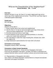
What Are The Characteristics of Your Neighborhood?
Middle schoolers make a mental map of their neighborhood. Using a software program, they make an aerial and digital map of their school and locate their school on given maps. In groups, they calculate the distances to various locations...
Curated OER
Draw A Coastline
Students identify, locate and draw at least ten different geographical features on a map. Using the map, they must make it to scale and include their own legend and compass rose. They share their map with the class and answer questions.
Curated OER
Mapping Puerto Rico
Students use maps to discover where Puerto Rico is located. In groups, they use the internet to research the vegetation. They also compare and contrast the relationship between the United States and Puerto Rico's government.
Curated OER
Navigation Across the Seas
Students examine nautical navigation and discover the differences between nautical charts and other types of maps or charts. Students practice setting a course, taking a bearing, and dead reckoning. This gives students an example of...
Curated OER
Volcanoes
Second graders review the characteristics and aspects of volcanoes. Using this information, they write a creative story and draw illustrations to accompany the words. They use geographical terms to describe a location and the physical...
Curated OER
How Healthy is the Wetland?
Students explore wetlands. In this ecology lesson plan, students visit a wetland site and collect data about the wetland functions. Students record their results and use the data recorded to rate the wetland site on its function.
Curated OER
Where's My Bot?
Students estimate geographic position based on speed and air travel. In GPS lesson students use GPS to estimate the set and drift of currents.
Curated OER
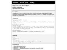
Help! I Am Lost at Fox Chapel
Sixth graders create a map to locate places on campus and share the map with another student. The other students use the map to locate certain places and validate for accuracy via a checklist. The parents use the completed map at open...
Curated OER
Geographics in Arkansas
Third graders discuss where Arkansas is located on the United States map. They use geographic tools to participate in activities.
Curated OER
Project WRITE
Second graders have been taught hwot o use a map. They also know about a compass and different types of maps. Students use a software program to locate and learn about the seven continents. At each continent they are to summarize what...
Curated OER
Flight Path
Young mathematicians investigate that things move in a directional path. They construct a paper airplane and measure an airplane's length of flight. Everyone constructs a map with a key showing their airplane's flight path
Curated OER
European Explorers: Research Project
What will your students choose to include in their explorer's treasure chest? Youngsters research an early European explorer and gather items to reflect their research, such as a detailed map of the explorer's voyages, portrait, flag,...
Curated OER
A Map Mystery
Second graders solve a map mystery. In this technology lesson plan, 2nd graders develop an awareness of maps and the symbols associated with maps as they the "Neighborhood Map Machine."


