Curated OER
Creating a Thematic Map
Students create and analyze a weather-related data table and a thematic map based upon information provided.
Curated OER
Introducing Topographic Maps: Guiding Students from Concrete Models to Graphic Representations
Students interpret topographic maps and infer human activity as it is influenced by the landscape.
Statistics Education Web
The United States of Obesity
Mississippi has both the highest obesity and poverty rate in the US. Does the rest of the data show a correlation between the poverty and obesity rate in a state? Learners tackle this question as they practice their skills of regression....
Curated OER
Natural Resources and Transportation in the United States
Students study thematic maps (included with the lesson) to determine possible relationships. They develop three hypotheses about the relationship. Students choose one of their hypotheses to explain. The explanation is to include reasons...
Curated OER
Creating a Thematic Map Using S'COOL Data
Students observe weather patterns, collect data, and make a weather predictions for various locations on a map.
Curated OER
Where is Everybody?
Students collect data from different grade levels at their school and develop thematic maps which show population density, and determine how this might affect the school and themselves in the future.
Curated OER
Thematic Unit on Cats
Students discover in which climates the cats of the world live in. They review the different climates of the world and use maps and globes to help them locate continents.
Curated OER
Mapping Lab and Lead Poisoning
Students are introduced to GIS and its uses. They make predictions before viewing the actual lead poisoning cases by location of Dade County. Pupils use actual Miami-Dade County spatial data to explore basic principals. Students
Curated OER
Lesson Plan of a Thematic Project - Water
Sixth graders investigate the properties of water. In this life science activity, 6th graders create a concept map of water. They share their work with the class.
Curated OER
Science: Draining the Land - the Mississippi River
Students use topographic maps to identify parts of rivers. In addition, they discover gradient and predict changes in the channels caused by variations in water flow. Other activities include sketching a river model with a new channel...
Curated OER
Park Brochures
Sixth graders investigate natural environments by researching national parks. In this brochure making lesson plan, 6th graders explore a specific national park and research it's information by utilizing the web. Students create travel...
Curated OER
Where Do Canadians Live?
Students investigate Canadian people by researching the geography of the country. In this world geography instructional activity, students identify locations within Canada with large populations based on their access to waterways....
Curated OER
The Role of Geography -- The United States and the Republic of Turkey
Preteens review the five themes of geography. In groups, they examine the United States and Turkey to discover how geography can impact the way people live. They create a foldable for each country, listing information for each of the...
Curated OER
If You Build It, Will They Come?
Students examine the city of Duluth, Minnesota. In groups, they use the internet to discover its current state of urban geography. After their research, they create and plan their own redeveloping of the city. They share their results...
Curated OER
Aldridge Sawmill -- The Story in Numbers
Seventh graders view a recent transparency of the average rainfall zones of the state of Texas. Using another transparency, they identify the Piney Woods subregion of the Gulf Coastal Plain and locate national forests and sawmills. ...
Curated OER
Presenting Your Community
Students research the history of a notable building and prepare a Power Point presentation to be used on the online scrapbook. They research the location of the building in the community, the architectural style and the date of...
Curated OER
SC Populations Along Major Interstates
Students examine the population among the interstates in South Carolina. Using the internet, they identify the counties and roads and compare it with their own drawing.
Curated OER
Geography and Archeology of the River People
Seventh graders work together in groups to read a handout and answer questions about the geography and archeology of a group of native peoples. As a class, they discuss their opinions and answers and the importance of using artifacts to...
Curated OER
Hoosier Artists
Students examine the paintings of various Indiana artists. Using the internet, they relate the landscapes shown to the history of the state and how it affected Native Americans. Using the information they gathered, they write story...
Curated OER
The Arctic and Taiga Ecozone of Canada
Pupils discover the differences in the Arctic and Taiga regions of Canada. They identify physical and human characteristics of both region. They also practice using an atlas.
Curated OER
The Arctic and Taiga Ecozone of Canada
Students examine the various sub-regions of the Arctic and Taiga zones in Canada. Using the online Canadian Atlas, they locate and describe the characteristics of each zone. They organize their information into a chart and share it with...
Curated OER
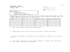
Who's Range is it?
Students investigate the habits of panthers by analyzing radio transmitted data. In this animal life lesson, students utilize computers to view the range of different statistics dealing with Florida panthers. Students complete a...
Curated OER
Making Sense of the Census
In this unit of lessons, students make sense of the census. They examine why a census is taken and partipate in activities.
Curated OER
Discovery of America
Students examine the European conquest of North America. They participate in activities which allow them to discover the indigenous peoples of the region. They also place events in chrongological order.


