Curated OER
Compare and Contrast Timelines of the World
Seventh graders create a classroom timeline of important world events. This lesson is meant to be used during the entire school year. As the school year goes along, events are added to the timeline as chosen by the class. The events are...
Curated OER
The Solstices
Compare surface temperatures when the solstice occurs in the different hemispheres. Young scientists draw conclusions from their investigation of data collected using spreadsheets and a globe.
NOAA
Graphing Temperatures
Battle of the hemispheres? In the fourth installment of a five-part series, young oceanographers use the NOAA website to collect temperature data from drifters (buoys), one in the Northern Hemisphere and one in the Southern Hemisphere....
Curated OER
A Book Is A Window To the World
Second graders listen to pieces of literature that take place in different regions of the world. Using a map, they identify and locate the continents and oceans mentioned in the story. They describe the physical and human characteristics...
Curated OER
Where Is Japan? What Direction Is It?
First graders locate countries on maps and globes and learn about the hemispheres and the cardinal directions. They listen to books read out loud and dicuss geography.
Curated OER
Reason for the Seasons
Students study the seasons of the Earth. In this seasons lesson, students study the science of the seasons on Earth by studying the tilt and axis of the Earth's orbit. Students read background information and four experimental activities...
Curated OER
Biomes: Extreme Climate
Students create a web connecting global warming, the Arctic, and wold climate. They write a paragraph explaining the role of the Arctic in world climate.
Curated OER
Where in the World? The Basics of Latitude and Longitude
Students are introduced to the concepts of latitude and longitude. In groups, they identify the Earth's magnetic field and the disadvantages of using compasses for navigation. They identify the major lines of latitude and longitude on a...
Curated OER
What I Did On My Summer Vacation
Students use the internet to research the location of their summer vacation trip. Given the demographics, they plot the location on a world map. They create a brochure using the information they collected. Using PowerPoint, they develop...
Curated OER
Rapping Regions in America
Students determine what designates a place as a region. They apply their criteria for a region to the US map. They work in groups to write a rap about their region that describes its organization, type and structure.
Curated OER
iChat AV and iSight Camera
Students interact with science and math classes around the world by doing the same experiment and communicating their results. They use iChat AV and an iSight camera to share relevant information about their area, decide on the...
Curated OER
Winds Go Spinning Around
Students simulate the Coriolis Effect to comprehend why winds in the Westerlies are prone to cyclonic and anti-cyclonic motion. They arrive at an explanation of processes that drive world wind patterns
Curated OER
Tides and Currents
Students research and describe how currents are formed. In groups, they relate specific terms to the formation of currents and locate different currents on a world map. They also examine tides, how they are formed and how they are...
Curated OER
Learning Lesson: How it is Currently Done
Students create their own ocean currents by using everyday items. They examine the constant pushing of molecules that makes us feel wind. They discuss how the water moves in the Southern Hemisphere.
Curated OER
Weather Chart
Students select at least 6 cities from around the world to keep track of their high and low temperatures over a period of time.
Curated OER
Identifying Ozone Variations over Different Locations
Students analyze ozone data. In this atmosphere lesson, students will use a NASA resource to gather data for different regions of the Earth. Students will then create a graph for their data and answer related questions.
Curated OER
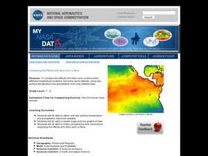
Comparing the Effects of El Nino and La Nina
Students examine the differences between an El Nino and La Nina year. For this investigative lesson students create maps and graphs of the data they obtained.
Curated OER
A Map as a Tool
Students study the concept of using a map as a tool with the usage of a balloon designed to mimic the features of the Earth with the major features marked and shown on the balloon.
Curated OER
How Does the Earth's Energy Budget Relate to Polar Ice?
Learners use satellite data to see how radiation budget relates to the ice that is present in the North. In this energy lesson students correlate data to see a relationship.
Curated OER
Seasonal cycles
Students understand that the rotation of the Earth is responsible for the seasons. In this seasonal cycles lesson, students learn how the rotation of the Earth affects the seasons. Students answer questions about the rotation, the...
Curated OER
Australia
Students participate in activities in which they discover facts about Australia. They examine its climate and history. They complete a worksheet to end the lesson.
Curated OER
Ocean Currents
Students examine ocean currents. In this investigative lesson, students examine ocean currents and the relationship between the ocean, our atmosphere, and the weather. They will create a model of an ocean current.
Curated OER
Modern Culture and Society
Sixth graders investigate different cultures by comparing the United States to Europe. In this social structure lesson, 6th graders discuss the economies, religions, languages and cultures in the Americas and Europe and define their...
Curated OER
Rivers, Maps, and Math
Students use maps to locate and label the major rivers of North and South America. Using the internet, they identify forests, grasslands, mountain ranges and other landforms on the continents as well. They compare and contrast the...


