Howard Hughes Medical Institute
EarthViewer
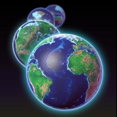
Can you imagine Washington DC and London as close neighbors occupying the same continent? Learners will be fascinated as they step back in time and discover the evolution of the earth's continents and oceans from 4.5 billion years ago to...
Institute for Geophysics
Understanding Maps of Earth
Here is your go-to student resource on primary geography concepts, including facts about the surface of the earth and its hemispheres, latitude and longitude, globes, types of maps, and identifying continents and oceans.
Curated OER
The Dynamic Earth
Students participate in assessments related to the layers of the Earth. They read chapters of text, answer questions, watch videos, and identify and label continents and oceans on a map. They design posters, create vocabulary cards,...
Curated OER
Earth System Science
Learners explore the Earth and its ability to support life. They discuss the geosphere and the water cycle and complete the Water Wonders activity. After completing the activity, they respond in their journals and reflect upon the...
Curated OER
Leapin' Landmarks: Locating 10 Man-made Landmarks Around the World
Third graders label continents, oceans, and major mountain ranges on maps and use the maps to write an informational report about landmarks. In this landmarks lesson plan, 3rd graders write about 1 major landmark.
Curated OER
Plate Tectonic Cycle
Students explore the Earth's movements by completing worksheets. In this plate tectonics lesson, students define such natural disasters as volcanoes, earthquakes, tsunamis and mudslides and discuss their connections to plate tectonics....
Curated OER
The Volcano Factory
Collaborative groups work together to report on the volcanic activity leading to island formation and construct models to demonstrate the process. Consider having each group present their project to the rest of the class. There are many...
Curated OER
My Friend, the Volcano
Working in cooperative groups, young scientists research and report on how undersea volcanic activity may benefit marine ecosystems. There are many links to websites that you can use to stimulate curiosity or for pupils to use for...
National Wildlife Federation
Is It Getting Hot in Here, or Is It Just Me?
Currently, only 2.1% of global warming is felt on continents, while over 93% is felt in the oceans. The fourth lesson in the series of 21 on global warming is composed of three activities that build off one another. In the first...
Curated OER
Earth: The Water Planet
Students elicit data on the water cycle, ocean topography, and island formation in this six lesson unit. The ocean floor and the properties of water are examined through a variety of discussions and hands-on experiments.
Curated OER
Earth and Space Science: Exploring Earthquakes
Students explore earthquakes. In this earthquake activity, students research earthquakes and identify where they take place. Students use map skills to track down earthquake locations. There are internet sites suggested in this activity.
Curated OER
PLATE MOVEMENTS AND CLIMATE CHANGE
Students label three geological maps with continents provided to analyze the relationships between the movement of tectonic plates and the changes in the climate. In small groups, they discuss their findings and form hypotheses about the...
Curated OER
Corals and Coral Reefs
Students label the continents, oceans, and seas on a provided world map and use it to determine where they would expect most of the world's coral reefs to be found based on provided information the teacher has read to them.
Curated OER
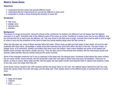
Ocean Zones
Students create a mural showing ocean zones and the diversity of ocean life. They use reference books to create a list of plants and animals that would live in each zone.
Curated OER
Ocean Color
Pupils examine NASA's SeaWiFS Project Web site to explore how the SeaWiFS Project monitors environmental and climatic changes in the oceans and atmosphere. They answer questions and write a summary in support of continued funding for...
Curated OER
Climate and Topography, What Is the Connection?
Fourth graders study Neumann's world continent map and explore topography and climate.
Curated OER
Where Am I, and How Do I Get Where I am Going?
Students describe geographical places through art, music, writing, and math. They compile information in booklets which may be published.
NOAA
I Can't Breathe!
The Gulf of Mexico dead zone, an area of low oxygen that kills marine life, costs the United States $82 million every year. Young scientists research anoxic ocean environments then come up with a hypothesis for the cause of the Gulf of...
Curated OER
Pets Around the World
Learners communicate via e-mail with other students to learn about pets, animals of interest , and geography from different parts of the world. Vocabulary focuses on rural, urban, and suburban areas.
Curated OER
A Line Graph of the Ocean Floor
Students develop a spreadsheet and import the information into a line graph. In this spreadsheet and line graph lesson plan, students develop a spreadsheet of ocean depths. They import the information into a word processed document. They...
Curated OER
What's the Difference?
Students investigate volcanic processes at convergent and divergent
tectonic plate boundaries. They read and analyze diagrams, complete a worksheet, and write an essay.
Curated OER
I Robot, Can Do That
Students examine how underwater robots can be used to assist scientific explorations. They read and discuss an article, conduct Internet research, complete a worksheet, and present an oral report.
Curated OER
Do You Have a Sinking Feeling
High schoolers determine how marine archaeologists use historical and archaeological data to draw inferences about shipwrecks. Students plot the position of a shipwrecked vessel, and draw inferences about the shipwreck from artifacts...
Alabama Learning Exchange
Forces that Change the Land
Students conduct Internet research find information about the following landforms: mountains, canyons, and valleys. They create travel brochures of their findings.


