Curated OER
A World of Information
Students analyze data and statistics about countries around the world. They read graphs and charts, color a world map to illustrate the top ten statistics about the world, and write a paragraph to summarize their information.
Curated OER
Tejana Military Members in World War II
Seventh graders discover who the Tejanas were and how they contributed to World War II. In this World War II lesson, 7th graders listen to their instructor discuss who the Tejanas were prior to researching the contributions of three of...
Curated OER
Where Did Foods Originate? (Foods of the New World and Old World)
What do papayas, peanuts, pineapples, and potatoes have in common? Why, they are foods explorers brought back to the Old World. Young researchers use the Internet to investigate how New World explorers helped change the Old World's diet....
Shaker Junior High School Library Media Center
WWII Project Outline
Work together as a class and get to know the ins and outs of World War II with this engaging collaborative project. Class members are broken into groups to research particular war topics, from life on the home front to the Holocaust and...
Curated OER
Maps
Maps, globes, and computer software aid young explorers as they locate state capitols, major cities, geographic features, and attractions for states they are researching. They then use desktop publishing software to create a map to share...
Curated OER
Giving Students a Little Latitude
Students use a world outline map to locate places using coordinates of latitude and longitude. They answer questions about places based on their knowledge of the map and on their research and make up more questions of this sort for each...
Curated OER
Organization of a Territory, Map Elements
Third graders compare printed and online maps and use proper geographic terminology to answer questions.
Curated OER
European Integration: Who and Why?
This French IV-V lesson addresses European integration into the European Union. French language learners research, discuss, and present in the target language. Online research, discussion, and presentations will take approximately 5-7...
Curated OER
Through the Looking Glass: Recognizing Developing and Industrialized Countries
Students examine the regions of the world, and identify the basic characteristics of industrialized and developing countries. They conduct Internet research on the economic and population characteristics of industrialized and developing...
Curated OER
The Adventure of Negative clue and Alice World
Students read the story "The Adventure of the Negative Clue" and design an Alice World for the story's setting. In this reading analysis lesson, students read the story and complete a story map. Students use the Alice program to design...
Curated OER
Where Is Rome?
Third graders discover Ancient Rome through maps and worksheets. In this world history lesson, 3rd graders locate Rome on a world map and identify the scope of the Roman Empire. Students label an entire map of Italy after printing one...
Curated OER
Summer Trip
Fourth graders search for information and directions to specific cities from their homes, figure cost of trip when given miles per gallon, distance, and cost per gallon of gas, develop outline budget for summer trip, and draw and label...
Curated OER
Where in the World?
Learners locate famous landmarks around the world. They identify the location of natural and manmade landmarks using a worksheet that provides ten clues.
Curated OER
What a Relief Map
Learners create a map using cookie dough. In this geography lesson, students research the physical features of a country, draw a diagram and design and create a map out of cookie dough.
Curated OER
World Religions
Seventh graders identify major tenets and the distributions of world religions. In this world religions lesson, 7th graders work with a group to research a religion using the given website. Students complete a graphic organizer for the...
Curated OER
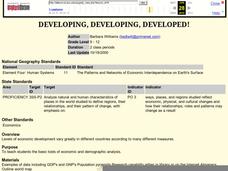
Developing, Developing, Developed!
Learners differentiate among and explain various levels of economic development around the world. They see that levels of economic development vary greatly in different countries according to many different measures.
Curated OER
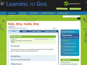
Where's the Sand?
Students identify the characteristics of deserts. In this geography lesson plan, students discuss the characteristics of a desert and label a map with the names of deserts.
Latin America Network Information Center
Urbanization
Brazil's population has been changing dramatically in the last century. Study the causes of Brazilian urbanization, including industrialization and and migration, and the implications for the country of the populations'...
Curated OER
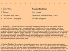
Number the Stars
Learners read Number the Stars. In this social studies lesson, students read the story and use a map of western Europe and identify the countries involved in the war. Learners locate the cities of Denmark that are discussed in the story.
Curated OER
Continents
Young scholars investigate World Geography by researching the different continents. In this Asian Geography lesson, students discuss the continent of Pangaea and color a worksheet of the continents. Young scholars locate China on the map...
National First Ladies' Library
World Starvation
Learners investigate the concept of world starvation and some of the organizations that are founded in order to help solve the problem. They conduct research using a variety of resources. The information is used in order to conduct class...
Curated OER
Mapping Your Community
Students define the boundaries of their community by comparing the community's official boundaries with other historical, political, physical, and perceived boundaries of the area and create a community map.
Curated OER
The Student Newspaper on World War I
Students explore WW I through the publication of a completely student-compiled newspaper.
Curated OER
What They Left Behind: Early Multi-National Influences in the United States
Students examine how the European voyages of discovery influence American culture even today. They map eighteenth century Europe's impact on the United States.


