Oregon State
World Map of Plate Boundaries
Young geologists piece together the puzzle of plate tectonics in an earth science lesson. Given a physical map of the world, they search for land formations that indicate the location of different types of plate boundaries.
NOAA
A Watery World
With about 70% of the earth's surface covered in oceans, it's fair to say that we live in a very wet world. Young scientists gain a better appreciation of this fact as they use maps to identify the world's ocean basins in the first...
Association of American Geographers
Project GeoSTART
Investigate the fascinating, yet terrifying phenomenon of hurricanes from the safety of your classroom using this earth science unit. Focusing on developing young scientists' spacial thinking skills, these lessons engage learners in...
NOAA
Into the Deep
Take young scientists into the depths of the world's ocean with the second lesson of this three-part earth science series. After first drawing pictures representing how they imagine the bottom of the ocean to appear, students investigate...
Curated OER
GEOGRAPHY: SPACE CENTERS
Students examine the descriptive science dealing with the surface of Earth, its division into continents and countries, climate, natural resources, inhabitants and industries of the various divisions and analyze the political geography...
Alabama Learning Exchange
The Sun and the Earth
Third graders study and diagram the positions of the Earth and sun during the four seasons. They predict weather for cities in the northern and southern hemispheres.
Environment Agency - Abu Dhabi
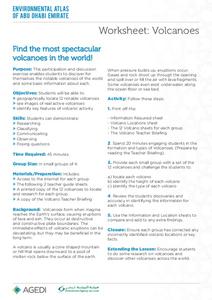
Find the Most Spectacular Volcanoes in the World!
Heat things up in your earth science class with this collaborative lesson plan on volcanoes. After first being introduced to the different types of volcanoes and how they are formed, young geologists work in small groups to research the...
Curated OER
Google Earth on the Range
Eighth graders use Google Earth to study the landscape of Utah. In this Utah landscape lesson, 8th graders view landscape photos and work in partners to analyze the pictures. Students write a paragraph that describes the landscape and...
Curated OER
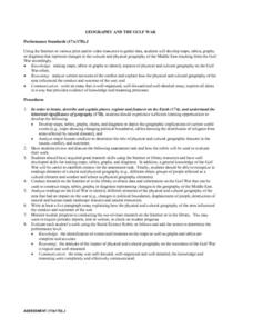
Geography And The Gulf War
Young scholars develop maps, tables, graphs, charts, and diagrams to depict the geographic implications of current world events, and analyze major human conflicts to determine the role of physical and cultural geographic features in the...
National Park Service
Glaciers and Water
Explore the amazing power of glaciers with a hands-on earth science experiment! After first learning basic background information, learners go on to create their very own chunks of frozen water and gravel in order to observe first-hand...
Curated OER
Mapwork: A Place In the News
Students determine how to find geographic information about places they read about in the news. For this geography lesson, students look at political and physical maps to determine the difference. They access maps online to find the...
Curated OER
Location of Cities 201
Students work in pairs to locate the ancient cities on a world atlas using the longitude and latitude measurements. They examine the physical and human futures that explain their locations.
Curated OER
Geography, Map Skills & the Internet:
Students research various websites focusing on Italy while enhancing student utilization of computer, keyboards and the Internet. They discuss their findings on the geography, history, topography, and culture.
Curated OER
World Geography: Climate Change Round Table
Students are able to explain the suspected causes of relatively recent climate changes, specifically the observed global warming. They discuss how unusual or extreme global warming disrupts the balance of the earth's geo-spheres.
Curated OER
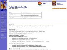
World Geography: Postcard from the Rim
Students are able to identify the areas of the world that are affected by arsenic contamination of the water supply. They are able to describe the ways in which various societies deal with the problem of arsenic contamination. ...
Curated OER
Interpreting Aerial Photographs
Students interpret aerial photographs. They view aerial photographs or satellite-produced images to locate and identify physical and human features. They study satellite images and label their images for bodies of water, clouds,...
Curated OER
2.0 "Water Is Life" Global Water Awareness Mini-Unit (Grades3-5)
Students study the amount of potable water on the Earth. In this water activity, students examine the amount of potable water as compared to all the water on the Earth. They discuss why many parts of the world do not have access to good...
MENSA Education & Research Foundation
Connecting Africa: A Project-Based Learning Adventure
Mission Possible: Your task is to design a new highway route from Tunis, Tunisia to Cape Town, South Africa. If you accept the challenge, you must create a small map of the route that has already been rejected, a rationale for rejection...
Wild BC
Carbon Sinks and Sources
Earth or environmental science pupils are assigned to be carbon sources or sinks. They ask yes-or-no questions to try to figure out which one they are. Then they discuss ways people can have positive effects on the changing climate by...
Population Connection
The Human-Made Landscape
Agriculture, deforestation, and urbanization. How have human's changed the planet and how might we mitigate the effects of human activity on the planet? To answer these questions class members research the changes in human land use from...
Curated OER
Affects of Geography on Colonial Cultures
Sixth graders examine the effects of geography on the development of culture. They discuss how geography can affect the lifestyles and development of a society's culture. Students examine the geography and climate of New England and the...
Curated OER
The Hunter Using Children's Literature to Teach the Geography of Africa
Learners are able to answer basic questions about the region and the use of natural resources, sketch a mental map of the story's setting, and find their way through the thematic maze/map.
Curated OER
Geography of the Silk Road And the Tokaido Road
Students examine the geographical features of the Silk Road and the Tokaido Road in this introductory lesson on Chinese geography. Small group learning is emphasized and encouraged.
Curated OER
Let's Make a Map
Second graders draw maps of their playground, noting objects such as trees and play equipment. Working in groups, they make maps of different parts of the school and assemble them into a schoolwide map. They make maps on a field trip to...


