Education World
Edible Resource Maps!
Young scholars discuss resource maps and examine examples from library resources. Working in groups, they create edible resource maps by drawing examples, such as popcorn on the border of Iowa and Nebraska. Then they use cookies in the...
Curated OER
Geography of Canada
All about Canada! Learners explore the geography and providences of Canada by watching videos, studying maps and conducting internet research. By the end of this lesson, your class should be able to locate major areas and compare and...
US Mint
Symbols in My Eyes
Explore the hidden meanings behind the images on US currency with this elementary school lesson on symbolism. Starting with a class discussion about symbols, children go on to brainstorm different objects that represent the Unites States...
Oregon State
World Map of Plate Boundaries
Young geologists piece together the puzzle of plate tectonics in an earth science lesson. Given a physical map of the world, they search for land formations that indicate the location of different types of plate boundaries.
Royal Geographical Society
An Introduction to Maps
First graders are introduced to a variety of maps such as globes, street maps, atlases, and different types of floor plans. The focus of the lesson requires individuals to create their own plan of the classroom using the PowerPoint...
Curated OER
World Map and Globe- Introduction to Symbols
Students investigate picture symbols. For this symbols lesson, students define symbols and discuss symbols that they see in everyday life. Students identify symbols on maps by using post-it notes.
Curated OER
Those Who Have Come Before Me
Class members are transformed into explorers as they work in groups to locate hidden items and map their journey along the way. They then leave clues for other groups of students to follow, and ultimately discover how past explorations...
Curated OER
Read a Map ... It's a Snap!
Students are introduced to map and globe skills. They use grids and are able to construct their own simple maps of familiar places. Students are able to define a map, globe, and symbol and use the direction words north, south, east,...
Curated OER
Through the Forest and Home Again: Maps Help Us Find Our Ways
Students read Little Red Riding Hood, focusing on her path home to Grandma's house. In this language arts and geography lesson, students perform a reader's theater, re-creating the walk home and possible routes that could have been...
Curated OER
Of Maps and Worldviews
Young scholars explore Ptolemy's world map as an expression of the Renaissance view of the world.
Curated OER
Mapping Electricity
Students complete Internet research and use their map reading skills to learn about how the United States creates and uses electricity in different states. In this energy sources activity, students study the mini map of energy usage in...
Curated OER
Celebrate Hanukkah in Israel
Explore Hanukkah and its origins with a social studies lesson. Learners discover the history of Hanukkah and its traditions. They locate Israel on a map, hear the story of the menorah and create their own dreidel. Afterwards, they sing...
Curated OER
Yo Ho, Yo Ho, A Pirate's Map for Me: An Original Story
Students read Blackbeard and brainstorm their knowledge of maps. In this language arts and geography lesson, students use landmarks on their playground to review north, south, east and west and discuss the compass rose. Students read...
Curated OER
Mapping Roxaboxen
Fourth graders read Roxaboxen and draw a map of the Roxaboxen community. In this language arts and geography lesson, 4th graders use specifications given, adding features to the map as described in the book and creating a legend.
Curated OER
Learning to Use Map Legends
Fifth graders comprehend the purpose of and use map legends. They identify and use symbols and lines from legends on a general-purpose map and four topical maps to completely and accurately answer eight questions on a geography worksheet.
Curated OER
Finding Their New World
First graders place stickers on maps indicating their understanding of the cardinal directions. They locate Jamestown, England, the Atlantic, and Virginia.
Curated OER
Put Me in My Place: Using Alphanumeric Grids to Locate Places
Students practice locating points on a large wall grid and create and label a neighborhood map. In this geography lesson, students spell and discuss places as the teacher places them on the map. They discuss the concept of an...
Curated OER
What Do We Learn From the Repartiation of Alaska Native Artifacts?
Students observe and evaluate evidence of Alaska Native cultural symbols and artifacts. They research historical data from a variety of primary resources, including the Harriman expedition journals, related web sites, oral accounts,...
Curated OER
Finding Meaning in the Badge
Children who are three to five years old study two rank badges from the Qing dynasty to develop an understanding of social rank, language skills, and symbolism. The lesson is discussion-based and requires learners to compare and contrast...
Curated OER
Nina Bonita: Culture and Beauty
Students read Nina Bonita by Ana Maria Machado. In this reading comprehension/ geography lesson, students recall various parts of the story and create a map of where the rabbit traveled throughout the story. They participate in group...
Curated OER
Mapping With MapPoint
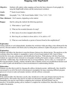
The class is engaged through a discussion of mapping. They determine what they believe makes a good map and what the essential elements of a map are. Students work independently to complete a worksheet on mapping. They follow clear...
Curated OER
Washington, Jefferson, Roosevelt, Lincoln
Students study four of the most influential and important presidents in United States history. In this United States presidents lesson, students learn the facts and histories to four of the most influential presidents in history - George...
Curated OER
Puerto Rico: The 51st State?
Students research the history of Puerto Rico, its culture, and geography. In this Puerto Rico lesson, students find Puerto Rico on a map and find specific regions or cities. Students discuss Puerto Rico's statehood and listen to salsa...
University of Pennsylvania
Canaan and Ancient Israel
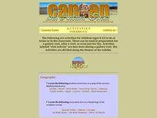
Planning for your next activity on ancient Israel, but not sure where to start? Check out this assortment of activities to help get the ball rolling. It includes a range of ideas on topics, such as Greek and Egyptian mythology,...


