Curated OER
Scaling it Down: Caves Have Maps, Too
Measurement and map skills are the focus of this lesson, where students crawl through a "cave" made out of boxes, desks and chairs, observing the dimensions. Your young geographers measure various aspects of the cave and practice...
Richmond Community Schools
Map Skills
Young geographers will need to use a variety of map skills to complete the tasks required on this learning exercise. Examples of activities include using references to label a map of Mexico, identify Canadian territories and...
Curated OER
Mapping Your Schoolyard Habitat
Students explore the terrain, structures, plants and signs of habitats around their schoolyard. They draw a sketch map showing the different areas around the schoolyard. Students identify the location of weeds and native plants on their...
Curated OER
Water and Land 207
Students examine maps of different projections, mathematically calculate distortions, and note the advantages and disadvantages of each map. They study the different maps and transfer the map to graph paper.
Curated OER
Using Concept Maps to Design 3D Spheres
Students create three dimensional shapes using concept maps. In this geometry lesson, students investigate the impact of mental schemas on humans. They collect data on this topic and plot their data on a coordinate plane.
Curated OER
Reading distance on maps
Eighth graders complete worksheets on reading the distance on maps in miles or kilometers. In this maps lesson plan, 8th graders use a calculator and ruler.
Curated OER
Welcome to My World!
Students use maps to locate information. They read the story, "It Looked Like Spilt Milk", view images of the continents and discuss the various continents. Afterward, they make their own Atlas to record information that they can later...
Curated OER
Wales: An Interdisciplinary Unit
Young scholars practice basic map and geographic skills as they compare Oregon to Wales. Students color map of Wales and Oregon using color codes to distinguish between land, water, and bordering nations or states, listen to stories and...
Curated OER
Places on the Planet: Latitude and Longitude
Middle schoolers locate different places on globes and maps by learning about latitude and longitude lines. In this latitude and longitude lesson plan, students identify specific locations based on the degrees of latitude and longitude.
Curriculum Corner
Australian Christmas
Where is Australia? How is an Australian Christmas from other Christmases around the world? Learners participate in a mini-research project where they discover what an Australian Christmas is like.
University of Pennsylvania
Decoding Propaganda: J’Accuse…! vs. J’Accuse…!
Reading snail mail is a great way to go back into history and to understand others' points of view. The resource, the second in a five-part unit, covers the Dreyfus Affair. Scholars, working in two different groups, read one letter and...
Mojang
Minecraft – Pocket Edition
You don't have to be a Minecraft wiz to know that this app has great playability for your learners! As afterschool programs and classroom projects around the world demonstrate, this game goes well beyond placing blocks and traditional...
Curated OER
Welina's World
Students living in Hawaii draw a picture of themselves in their neighborhood. They draw their neighborhood in relation to their district and then in relation to the island they are from. They compare their pictures to their classmates'...
Mathematics Assessment Project
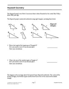
Hopewell Geometry
Right triangles from 2,000 years ago? Learners investigate different right triangles found in the earthworks of the Hopewell people, a Native American culture that populated the United States from 200BC to AD 500. Learners apply concepts...
Environmental Education in Wisconsin
Biome Travel Guide
In a perfect marriage of social studies and science, groups work together to research and create a travel guide presentation to share with the class. Not only do kids learn about the climate and geography of a biome, but also the...
Curated OER
FINDING A RESOLUTION
Students examine detailed Moon and Earth views provided by the NASA-sponsored "World Wind" computer program. They work in groups to create maps of different scales using landmarks of their choice, and challenge their classmates to...
Curated OER
Drawing a Bird's Eye View Map
Students make birds-eye view maps and place the compass rose on the map.
Curated OER
Canada Data Map
Students collect data and analyze it. In this algebra lesson, students collect data on the population characteristic in different regions. They use population, culture, settlement and others to help in their criteria.
Curated OER
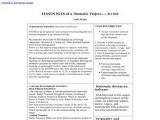
Lesson Plan of a Thematic Project - Water
Sixth graders investigate the properties of water. In this life science lesson, 6th graders create a concept map of water. They share their work with the class.
Curated OER
My First Biography: Christopher Columbus Storia Teaching Guide | Scholastic.com
Sail with Christopher Columbus on a biographical reading adventure. Young explorers learn about the life of Sir Columbus as they hone their comprehension skills through guiding questions, shared reading, and fluency practice. Included in...
Curated OER
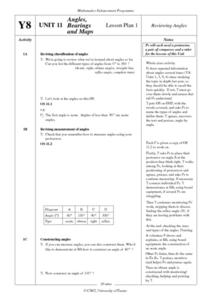
Angles, Bearings and Maps
Students review what they comprehend about angles. They name the differnt types of angles and define them. Students use their protractors to answer questions, the teacher walks around to look at the positioning of the protractors. ...
Scholastic
STEM Challenges and Activity Sheets for Grades 6–8
From 3-D cities to building bridges, young engineers engage in innovative STEM challenges that promote brainstorming and collaboration. Learners take on the roles of different types of engineers as well as become familiar...
Curated OER
Equivalent Mixed Numbers
Fifth graders use various internet sites to complete math programs where they identify different representations of mixed numbers. In this mixed numbers lesson plan, 5th graders practice math before hand and then go on the computers in...
Curated OER
Rainfall Mapping
Students explore rainfall and habitats. In this rainfall instructional activity, students explore the relationships among rainfall, vegetation, and animal habitats. Resources are provided.


