Curated OER
Maps and Globes: Where in the World are We?
Students explore maps and globes. In this introduction to map and globe concepts lesson, students identify features of physical maps, political maps, and globes. Students locate land and water, and recite a poem about the names of the...
Curated OER
Africa: Political Map
Young scholars create a political map for Africa. In this country identification lesson, students locate Africa on a globe and discuss some of its major countries and bodies of water. Young scholars complete a political map of Africa...
Curated OER
U.S. Political Map
Learners explore the symbols found in a map legend. In this map skills lesson, students locate the legend on a political map and explain what each of the symbols mean. Learners locate and identify several symbols on the map.
Smithsonian Institution
Borders with the World: Mexican-American War and U.S. Southern Borderlands
The Mexican-American War created social borders—not just physical ones. Scholars learn about the effects of the Mexican-American War on the people living in the borderlands using text excerpts, maps, and partnered activities. Academics...
National History Day
“Saving the Bear”: The Russian Expeditionary Force of World War One
How have Russian politics affected countries on a global stage? The discussion of the Russian Revolution and World War I begins with an analysis of primary resource letters. Learners finish with a project where they create a timeline of...
World Maps Online
Introduction to the World Map
Students identify the differences between maps and globes. In this map skills instructional activity, students are shown a globe and a map and recognize the differences. Students use post-it notes to locate several locations on the world...
Curated OER
Cities of the World
Young scholars identify the symbol for cities on a political map. In this world map lesson, students identify specific cities on the World Political Map. Young scholars should identify the country in which the city is located. Students...
Curated OER
Mapping the News
Students explore cartography. In this map skills and map making lesson, Students work in groups to create wall size world maps including legends, compass roses, latitude and longitude, and physical features. Students collect current...
Curated OER
Welcome to My World!
Learners use maps to locate information. They read the story, "It Looked Like Spilt Milk", view images of the continents and discuss the various continents. Afterward, they make their own Atlas to record information that they can later...
Curated OER
Political Legends and Map Symbols
Students identify the legend and map symbols. For this map skills lesson, students use a world map to find various locations using a map key.
Curated OER
World Map and Globe-Equator, North Pole, and South Pole
Young scholars identify the Equator, North Pole, and South Pole on a map. For this geography lesson, students use a world map and circle the North and South Pole. Young scholars locate the Equator on a globe and use a map marker to...
New York State Education Department
Global History and Geography Examination: August 2012
Let's test global history knowledge. The standardized test, designed for high schooler scholars, assesses world history and geography. The assessment is divided into five different sections, including essay items and multiple choice. It...
Geography 360°
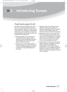
Introducing Europe
Provide your learners with a comprehensive introduction to Europe with this great set of worksheets. Map activities include matching European countries to their capitals and places on a political map, as well as exploring different...
Curated OER
"History of My Family"
Students explore world geography by participating in a family history project. For this U.S.S.R. lesson, students read assigned text regarding the Stalinist era of Russia and the intolerance that thrived there. Students answer a list of...
Curated OER
NATO Geography & Language
The class receives background information on NATO, an atlas, and a blank world map. They color the original 1949 countries in red, the 1952 additions in green, and the 1990 additions in blue. This exercise would be a good starting point...
Curated OER
Waldseemuller's Map: World 1507
Seventh graders analyze various maps. In this Geography activity, 7th graders create a large map as a whole class. Students write a letter to Mr. Waldseemuller.
Curated OER
Country Capitals
Learners locate country capitals on a world map. In this map skills lesson, students review the definition of the word country and discuss what a capital is. Learners locate and label capital cities on a world map using a map marker.
GCSE Modern World History
Mao's China
Here is a great textbook chapter on China's establishment as a communist state in 1949 and the effects of World War II on the nation. The first page prompts learners to complete a timeline activity as they read the material, which...
New York State Education Department
Global History and Geography Examination: January 2017
Global history and geography class members demonstrate their knowledge of and ability to analyze primary sources such as graphics, maps, political cartoons, and texts from important documents with an assessment that includes multiple...
Curated OER
My Secret War: Lesson 8
Fifth graders explore American history by viewing videos on the Internet. In this Japanese internment lesson, 5th graders discuss the politics that took place between America and Japan during WWII and why it was necessary to incarcerate...
Curated OER
Identifying Island Countries
Learners discover the definition of an island and identify island countries around the world. In this geography lesson, students determine the characteristics of an island. Finally the learners will identify specific island countries,...
Curated OER
Location, Location, Location: Civilization's Ultimate Advantage
Students discover how geographical advantages, locational and regional, ultimately led to western Eurasian societies' disproportionate accounting of world power and innovation. They utilize a workbook which can be downloaded within this...
Curated OER
Hemispheres & Continents
Students learn in cooperative learning groups to determine how the equator and the Prime Meridian divide the earth into hemispheres and use Venn diagrams. Students will locate and label the hemispheres, continents, and oceans.
Curated OER
Foods and Languages of the World
Students review Mexico's location and language and learn to pronouns 10 new Spanish food words. Students listen as the book, Corn is Maize is read, touching and passing around an ear of Indian corn. Students discuss the contribution of...
Other popular searches
- Political Map of World
- Blank World Political Map
- World Political Map Labeled
- Political Map of the World


