Curated OER
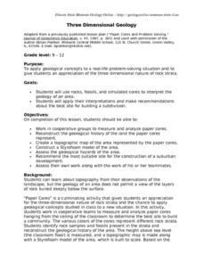
Three Dimensional Geology
Here is a fine lesson plan on geology designed for high schoolers. Learners use rocks, fossils, and other geological clues to determine the geology of an area. Then, they make recommendations to a fictitious city council about the...
Curated OER
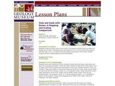
Hide and Seek with Bones: A Mapping and Scaling Comparison
Students examine and simulate how paleontologists map objects. They hide and find objects using a grid to map the objects' placements.
NOAA
Into the Deep
Take young scientists into the depths of the world's ocean with the second lesson of this three-part earth science series. After first drawing pictures representing how they imagine the bottom of the ocean to appear, young scholars...
Curated OER
Volcanoes: Second Grade Lesson Plans and Activities
Young geologists explore volcanoes with a series of engaging geology activities. First, they learn the difference between magma and lava before coloring and labeling the parts of a volcano. During the lab, individuals watch a...
US Environmental Protection Agency
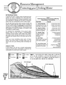
Protecting Your Drinking Water
Having a clean, reliable source of drinking water is essential for any community, but in many cases this is easier said than done. Engage young environmentalists in exploring the five factors affecting vulnerability of a groundwater...
Curated OER
Ping!
Using "mystery bathymetry" shoeboxes, young explorers simulate sonar action to map out the topography of an un-viewable landscape. This classic activity helps physical oceanography learners understand how sonar works. It would be...
Midnight Martian
Mars Globe HD
Explore the surface of Mars without leaving the comforts of your home or classroom! Learn about volcanoes, missions to the red planet, view the topography, and more.
Curated OER
LAND USE DEBATE / TOWN MEETING
Ninth graders research, analyze, and orally defend an issue related to the use of geologic resources. They defend their position in written form by composing a letter to an appropriate source.
Curated OER
Good Vibrations Remote Sensing data Collection: Thermal Emission Spectrometer
The Mars Global Surveyor spent two years creating a mineral map of the planet Mars using thermal emission spectrometry. To help young astronomers understand this remote sensing instrument, have them simulate how data is collected and...
Columbus City Schools
Diversity of Living Things
Here's a topic classes can really dig—the fossil record. Use the well-organized and thoughtful road map to take eighth graders back in time to unearth the answer. Learn how our climate has changed, and how organisms have...
Montana State University
Who’s on Top?
What's it like to climb Mount Everest? An educational resource encourages an in-depth knowledge of Mount Everest's scientific missions through a variety of activities, including an analysis of maps, a KWL chart, videos, a simulation, and...
Curated OER
Using Waves on the Job!
A colorful and comprehensive PowerPoint highlights this lesson on waves. Junior geophysicists pretend that they are hired to analyze seismic waves. A worksheet is provided to go along with an online article about how compact discs work...
Curated OER
The Living Edens: Virtual Yellowstone Tour
Students take an online virtual tour of Yellowstone National Park. They act as park rangers to research geological features of Yellowstone, locate these features on maps, and describe and define associated geologic terms.
Curated OER
Distribution of Active Volcanoes Exercise
Students collect and plot data, then interpret the results and answer questions about the geologic causes and the human effects of volcanic eruption. They participate in a role-play activity and a virtual field trip, as well.
Curated OER
Can You Dig It?
Young scholars investigate a fossil site and diagram a site map. They role play as paleontologists.
Curated OER
Plate Tectonics
Students simulate the three types of plate boundaries using robots. In this earth science lesson, students explain how earthquakes and volcanoes are formed. They collect real-world earthquake data and plot them on the map.
Curated OER
Cookie Topography
Students construct a cross section diagram showing elevation changes on a "cookie island." Using a chocolate chip cookie for an island, they locate the highest point in centimeters on the cookie and create a scale in feet. After tracing...
Curated OER
How is Gold Found in the Ground?
Fourth graders participate in a series of activities designed to simulate mining for gold. They pan for "gold" and create a safe tunnel.
Curated OER
Japanese Religion (Shinto)
Fifth graders explore the relationship between the early Japanese religion of Shinto and the natural phenomena of Japan. They engage in Day 3 of the Warlords of Japan simulation.
Curated OER
Carving Mountains
Students explore geography by participating in an illustration activity. In this land-form lesson, students define vocabulary terms associated with glaciers and forests. Students utilize pens, cardboard and pottery clay to draw and...
Curated OER
Natural Hazards
Learners evaluate the hazards of naturally occurring events. After watching a video concerning safety hazards, students work in groups to discuss the safety issues involved in taking a trip to a mountainous region. Recommendations are...
Curated OER
Fenwick Island, Maryland And Beyond: Who Owns the Sand?
Students examine beach processes and complex beach systems. They study the human efforts to stabilize an unstable environment can lead to complex problems.
Curated OER
Science: Trouble in the Troposphere
Students research a NASA Website and record information about an assigned city's tropospheric ozone residual monthly climate. In groups, they graph the information for the past year. They form new groups and compare their city's...
Curated OER
Science: Down Home Dinosaurs
students participate in hands-on activities to discover the different types of fossils. Using teacher-provided materials, they make models of cast and trace fossils. After writing essays describing how traces are formed, students plan a...
Other popular searches
- Geologic Mapping Loveland
- Geologic Mapping of Loveland
- Geologic Mapping Love Land
- Creating a Geologic Map
- Geologic Mapping of Love Land
