Curated OER
Mapping the Aegean Seafloor
Earth science learners create a two-dimensional topographic map of the floor of the Aegean Sea. They use it to then create a three-dimensional model of the ocean floor features. This comprehensive resource delivers strong background...
Polar Trec
Mini-Ocean Bathymetric Mapping Research Cruise
Middle or high schoolers transform into oceanographers in a week-long simulation. To begin, each group follows directions to create a model of the ocean floor with specified features. Next, the groups prepare to set sail on a research...
Curated OER
Map-A-Buddy
Middle schoolers investigate the concept of tracking and spatial movements of animals in relation to the environment in which they live. They participate in an interactive activity by tracking one another over a pre-defined region,...
Curated OER
Crude Conversation
Students analyze text and maps in determining the effect the world's energy resources have on human society, and make charts illustrating at least three ways each resource makes life easier for human society.
Curated OER
Hazards: Second Grade Lesson Plans and Activities
Equip learners with safety knowledge in the case of an earthquake. After coloring the places to go to get help after a quake, and label places that wouldn't be safe to go after a quake, young geologists simulate three levels of...
Curated OER
Volcanoes: Second Grade Lesson Plans and Activities
Young geologists explore volcanoes with a series of engaging geology activities. First, they learn the difference between magma and lava before coloring and labeling the parts of a volcano. During the lab, individuals watch a...
Curated OER
On the air! Interviews
In this mock interview lesson, students view pictures of famous personalities and determine which of these personalities they would like to interview. Students follow the three step interview process and conduct a mock interview...
Curated OER
A Colony is Born : Lesson 6 -To Leave or Not to Leave
Fifth graders connect reasons for coming to the New World with identity. The create identities and place them in one of three settled regions. They refer to prior study notes in their Colonial Notebooks to establish their identities.
Curated OER
Plate Tectonics
Pupils simulate the three types of plate boundaries using robots. In this earth science instructional activity, students explain how earthquakes and volcanoes are formed. They collect real-world earthquake data and plot them on the map.
Curated OER
Four Color Map
Students explore geometry by completing a color puzzle. In this shape identification lesson, students utilize deductive reasoning to complete a Google SketchUp puzzle with trapezoid, triangles and rectangular shapes. Students...
Curated OER
Introduction to Representing and Analyzing Data
Represent data graphically. Allow your class to explore different methods of representing data. They create foldables, sing songs, and play a dice game to reinforce the measures of central tendency.
Curated OER
The Rock Family
Learners research the characteristics of igneous, sedimentary and metamorphic rocks using the Internet. They evaluate websites for use before they organize the research information into a table. They use software to complete a concept map.
Curated OER
Arsenic and Lead Scavenger Hunt
Health wizards read and discuss an article about lead contamination then come up with a plan to help solve the problem. They get into groups to develop a community solution within the parameters of a budget, feasibility, and the source...
Curated OER
Do We Still Need the Electoral College?
One of the most confusing aspects of any presidential election year is the role of the Electoral College. Learners read a bit about how the Electoral College works and then they hold a mock election in their classroom. They'll redraw a...
Curated OER
Four Corners Mystery: Where In The World Are We?
Students research and describe various locations around the world using five fundamental themes of geography.
Curated OER
Filling Up Florida
Students study factors controlling Florida's population growth and related environmental impacts. They research natural community types and construct maps (including a large-sized map of Florida) to be used for a simulation activity.
Curated OER
Exploring the Variety of World Markets
Learners examine the various types of world markets and analyze the differences between developed and developing countries. They watch a PowerPoint presentation and take notes, participate in a role-play that demonstrates supply and...
Curated OER
Tzedakah Begins at Home (Private-Religious)
Middle schoolers learn about the eight levels of tzedakah or charitable giving. In this philanthropy lesson, students examine the eight levels of charitable giving that were developed by Rabbi Moses Maimonides. They participate in...
Curated OER
Science: Down Home Dinosaurs
students participate in hands-on activities to discover the different types of fossils. Using teacher-provided materials, they make models of cast and trace fossils. After writing essays describing how traces are formed, students plan a...
Curated OER
Second Star To the Left and Straight On 'Till Morning" - Spreadsheet Driven Exploration of Pacific Asian Geography
Students explore the geography of Pacific Asia. The class is divided into two groups to participate in a role-play activity where they act as European explorers. Students utilize mathematics, spreadsheet and internet technology to make...
Curated OER
Primary and Secondary Documents for Colonial Times
Students investigate the Colonial Era by completing a template on their computers. For this U.S. History lesson, students discuss the differences between primary and secondary sources and identify several different sources as one...
Curated OER
Magazine Sales Talks
Students role-play to determine the best types of magazines that should be purchased for their media center. They create a sales presentation for a particular magazine in small groups. As they listen to each presentation they evaluate...
Curated OER
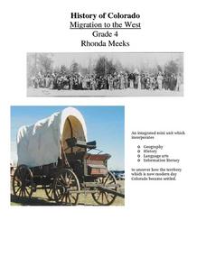
History of Colorado-Migration to the West
Fourth graders identify reasons for people moving to the Colorado Territory and examine how moving in the 1800's is different than moving today. They also practice reading maps and gathering information from maps, as well as, describe...
Curated OER
Tools of Modern Astronomy
Students differentiate refracting and reflecting telescopes. In this earth science activity, students explain how they are closely connected to satellites. They complete the concept map at the end of the activity.

