Space Awareness
Let's Map the Earth
Before maps went mobile, people actually had to learn how to read maps. Pupils look at map elements in order to understand how to read them and locate specific locations. Finally, young cartographers discover how to make aerial maps.
Luminations Media Group
Geography: Map Reading Basic Skills
Enhance scholars' map skills using this worksheet displaying the land of Kahitsa’an from the series, The Realm, by K.L. Glanville. The activity helps readers visualize the make believe-land, examine its attributes, and answer...
AGSSS
World Regions
Help your learners to visualize where historical events have taken place around the globe with a map that details the major regions of the seven continents.
Ed Helper Clip Art
USA States
Looking for a map of the Unites States of America? Look no further than this printable map designed to accompany your geography instruction and to give map skills a boost.
NY Learns
Geography of the Fertile Crescent by ECSDM
Using Google Earth, a vocabulary assignment, and map handout, your class members will outline the Fertile Crescent in Mesopotamia and identify the source of the Tigris and Euphrates rivers. They will then complete graphic organizers...
K-State Research and Extensions
Water
How are maps like fish? They both have scales. The chapter includes six different activities at three different levels. Scholars complete activities using natural resources, learn how to read a map, see how to make a compass rosette,...
NOAA
Into the Deep
Take young scientists into the depths of the world's ocean with the second lesson of this three-part earth science series. After first drawing pictures representing how they imagine the bottom of the ocean to appear, students...
Science Matters
Ring of Fire
Over a period of 35 years, earthquakes and volcanoes combined only accounted for 1.5 percent of the deaths from natural disasters in the United States. The 15th lesson in a 20-part series connects the locations of earthquakes and...
Alpha Omega
History and Geography—Two World Wars
Here's a combination textbook/workbook that examines the conditions in Europe that lead to World War I. Ideal for homeschoolers as well as classroom use.
Curated OER
Call to Arms: A Service Project
Sick of selling candy and washing cars? How about hosting a Digital Day or a Learning Lunch? The suggestions here make fund raising fun and rewarding. Raise money to preserve important maps and other primary source documents.
Global Oneness Project
Citizen Photojournalism
Matt Black's photo essay, "The Geography of Poverty" provides a shocking reminder of the poverty that exists in the United States. The resource not only focuses attention on poverty but also conditions that have given rise to situation...
Core Knowledge Foundation
The United Kingdom
Scotland, Northern Ireland, Wales, and England are four countries united by more than a monarchy. Academics explore the geography of the nations that make up the United Kingdom. The resource is broken into six lessons focusing on...
Orange County Water Atlas
Location, Location, Location…
Young geographers discover not only how to read and recognize coordinates on a map, but also gain a deeper understanding of latitude and longitude and how climate changes can vary significantly across latitudes.
Core Knowledge Foundation
Year 2: Northern Europe
How is life in Northern Europe different from other areas of the world? Historians journey through the various regions of Northern Europe discovering what type of climate, animals, and lifestyles exist in that section of the world. They...
National Geographic
Ocean Exploration
Dora, Dora, Dora, Dora, Dora! This may be your little ones' best guess as to what it's like to be an explorer! Give them a deeper understanding with this compact examination. A four-minute video introduces them to Robert Ballard,...
NASA
Analyzing Surface Air Temperatures by Latitude: Student Activity
Explore global temperatures from the comfort of your learning place! Meteorologists analyze surface temperatures and anomalies across different latitudes. Investigators evaluate graphs to find temperature differences and answer questions...
The New York Times
Kiev in Chaos: Teaching About the Crisis in Ukraine
Provide a historical context for the political unrest between Russia and Ukraine that began in late 2013. Learners review their prior knowledge and chronicle new understandings with a KWL chart, watch a video explaining the Ukrainian...
Scholastic
Study Jams! The Ocean Floor
Under the sea, the geography is as varied as it is on land! Young oceanographers find out about continental shelves, abyssal plains, seamounts, trenches, and mid-ocean ridges by viewing and reading the eight high-quality slides. Then...
Global Oneness Project
The Value of Ancient Traditions
Imagine having to give up cell phones, computers, and TV? What would be lost? What gained? An examination of the Drokpa, a nomadic people who live in the grasslands of Tibet, provides class members an opportunity to consider how access...
Edgate
Discovering New Resources
What is a natural resource, and what resources did the Lewis and Clark expedition seek? After reading an article on the mapping of the west, learners get into small groups to discuss the important natural resources of the period. They...
National Museum of the American Indian
The A:Shiwi (Zuni) People: A Study in Environment, Adaptation, and Agricultural Practices
Discover the connection of native peoples to their natural world, including cultural and agricultural practices, by studying the Zuni people of the American Southwest. This lesson includes examining a poster's photographs, reading...
National Arts Centre
Stage-Space Awareness
Introduce scenic designers to stage-space awareness with three fun activities that demonstrate how placement on the nine stage areas convey emphasis and clarify relationships.
PBS
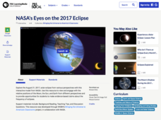
NASA's Eyes on the 2017 Eclipse
How did the 2017 eclipse look in Los Angeles—or Chicago? Experience both views, plus many more, using a lesson from PBS's Space series for middle schoolers. Scholars follow the movements of the sun, moon, and Earth during the most recent...
California Academy of Science
Discovering Rainforest Locations
How many rainforests are there, where are they, and do global factors effect their locations? These are great questions that have great answers. Children in grades four through eight use several different maps to determine why...


