Oregon State
World Map of Plate Boundaries
Young geologists piece together the puzzle of plate tectonics in an earth science lesson. Given a physical map of the world, they search for land formations that indicate the location of different types of plate boundaries.
PHET
Mapping the Field of Multiple Dipole Magnets
So you built a magnetometer, now what? High school scientists use their magnetometer made in a previous lesson to map the union of magnetic fields of dipole magnets. They experiment with different alignments and draw conclusions about...
Howard Hughes Medical Institute
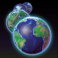
EarthViewer
Can you imagine Washington DC and London as close neighbors occupying the same continent? Learners will be fascinated as they step back in time and discover the evolution of the earth's continents and oceans from 4.5 billion...
PHET
Mapping the Field of a Dipole Magnet
High school scientists build their own magnetometer and use it to map the field surrounding a bar magnet. Excellent background resources is included, as well as a diagram of how to build the magnetometer.
Science 4 Inquiry
An Investigative Look at Florida's Sinkholes
In May of 1981, the Winter Park Sinkhole in Florida first appeared and is now referred to as Lake Rose. Scholars learn about the causes of sinkholes through an inquiry project. Then, they analyze recent data and draw conclusions to...
University of Colorado
Strange New Planet
The first remote sensors were people in hot air balloons taking photographs of Earth to make maps. Expose middle school learners to space exploration with the use of remote sensing. Groups explore and make observations of a new...
Astronomical Society of the Pacific
Getting Ready for the All American Eclipse!
Give your pupils a front row seat at the biggest light show in the sky this year! In addition to admiring the total solar eclipse, young astronomers can explain the phenomenon with a little help from an inquiry-based instructional...
Texas State University
Earth: Deposition and Lithification
Geology geniuses analyze sediment samples with a hand lens and sort according to physical characteristics. They also learn about the processes of cementation, compaction, and lithification within the rock cycle. The lesson plan is...
Science 4 Inquiry
Edible Plate Tectonics
Many people think they can't observe plate tectonics, but thanks to GPS, we know that Australia moves at a rate of 2.7 inches per year, North America at 1 inches per year, and the Pacific plate at more than 3 inches per year! Scholars...
Orange County Water Atlas
Location, Location, Location…
Young geographers discover not only how to read and recognize coordinates on a map, but also gain a deeper understanding of latitude and longitude and how climate changes can vary significantly across latitudes.
University of Colorado
Are All Asteroids' Surfaces the Same Age?
Did you know scientists can tell the age of an asteroid by looking closely at its craters? This final lesson of a six-part series focuses on two asteroids, Gaspra and Ida, in order to demonstrate the concept of dating asteroids. Scholars...
Space Awareness
How Light Pollution Affects the Stars: Magnitude Readers
Did you know light can decrease visibility? Light pollution absolutely makes it more difficult to see stars. Scholars build a simple magnitude reader to determine the magnitude of stars. They use these data to estimate the impact of...


