Curated OER
Tree Inventory and Map Project
In this tree inventory and map project worksheet, students follow the directions on how to take inventories of trees and create a map from it. Students follow 4 sets of directions.
Curated OER
Nutrition: How important is rice to the world?
Fourth graders point out places on a map that grow rice around the world. In this rice growing lesson plan, 4th graders read about the importance of rice and use a map to see where it comes from.
Curated OER
Gilligan's Island
Students investigate topographical maps and match actual landforms to them. In this topographical maps lesson students create "Gilligan's Island" to scale then answer questions about it such as what the highest elevations is and what...
Curated OER
Map Maker Map Maker
Students create their own maps. In this map making lesson, students go to Microsoft Word and create a chart. They label directions, buildings, streets, and distance.
Curated OER
Creating a Map of France
In this crating a map of France worksheet, students find and label important parts of France, bodies of water, mountains and surrounding countries.
Curated OER
Where in the world is...
Young scholars identify locations around the world. In this mapping lesson, students place tag board pieces with names of locations on a wall map of the world. Initially, young scholars identify states, then cities, then continents,...
Curated OER
Landscape Picture Map- The Earth's Surface
Students discuss different landscapes. In this map lesson plan, students describe what they see when they travel between home and school. Students use a landscape picture map to locate the places or objects they see.
Curated OER
United States Map- Rivers
Students learn about rivers. In this maps lesson, students describe rivers and what human activities take place in a river. Students use a map to locate the rivers in the United States.
Curated OER
Matching the Globe with the Map
Students examine how to use a globe. In this globe and map comparison lesson plan, students discuss how the globe and map are alike when looking at Africa and Antarctica. Students investigate shapes and sizes of globes versus maps.
Curated OER
Landscape Picture Map
Students identify a neighborhood on a Landscape Picture Map. In this geography lesson, students discuss the characteristics of their neighborhood and identify their neighborhood on a Landscape Picture Map. Students use post-it notes to...
Curated OER
The Globe and World Map
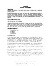
Students explore how to use maps for travel. In this map skills lesson, students read the text, With Love from Gran and discuss the places the character traveled. Students list the names of each city and country on chart paper.
Curated OER
Seven Wonders of the World
Students recognize "The Seven Wonders of the Ancient World." For this world history lesson, students research various architectures on the Internet and construct a PowerPoint presentation.
Curated OER
First Word: Map
In this word recognition worksheet, students trace the word map, write it independently, and identify it in a group of other words.
Curated OER
Mapping Counties
Learners practice reading a map. In this mapping lesson, students illustrate a map and compare and contrast the counties based on their population. Learners also explore what a census is and read census data on a map. A student...
Curated OER
Dandelion Seed Lesson Plan
Students create a map using the story The Dandelion Seed by Joseph Anthony. In this early childhood lesson plan, students develop map skills as they illustrate the path of the seed in The Dandelion Seed.
Curated OER
Scale Problem
For this scale problem worksheet, 6th graders solve 9 different problems that include reading a map scale of a neighborhood. First, they determine the distance between each person's home as illustrated. Then, students determine the...
Curated OER
Scale Drawing
In this scale drawing worksheet, 10th graders solve 10 different word problems that include various types of scale drawings in each. First, they determine the length of a highway on a map. Then, students determine the dimensions of a...
Curated OER
The Birmingham River System
After a lesson on geography and the features of a river, students view a map of the Birmingham river system, which is in England. They are then asked to label 4 features on the map.
Curated OER
Let's Travel!
Students review the rules and expectations, they earn points each day by making the correct behavioral choices. They read maps and do Internet reserach, students become aware of United States and or world geography. Students check...
Curated OER
Following Directions
Learners identify and descibe how to follow directions in detail. Then, they create and construct something requiring them to read directions. Students explain what they would do if they were driving to a particular place, but did not...
Curated OER
Orienteering 2
Students are shown the basics of map and compass work. They name the parts of a compass and comprehend the function of each part. Students define paces and tallies and use them in a real world situation. They use a map and compass to...
Curated OER
Map Reading
After examining a map from 1803 and 2003, they explore how to become map readers. They describe what they see on the map from 1803 and compare the information to the map from 2003. Learners create their own map of the neighborhood that...
Curated OER
Mapping Central Park
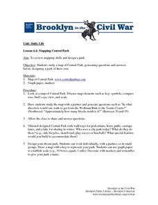
Students use the mapping skills to explore New York's Central Park. They examine a map of Central Park to discover its features. After discussing the characteristics of the park, students design their own dream park and draw it to scale.
Curated OER
Hurricane Tracking
Students access the Internet to find information on current hurricanes. They get locations, speeds, and air pressures and then plot the location of the hurricane on a hurricane-tracking map. They also access the FEMA website to solve...


