PBS
Arthur Compass Rose
Keep your class headed in the right direction with this printable compass rose. Large and easy to read with a smiling picture of Arthur in the middle, this resource would make a fun addition to the desk of any primary grade...
Curated OER
Basic Mapping Skills
Establish and study the parts of a map with your class and, then they will work in small groups to create their own detailed map, including a legend. There are specific instructions to follow on what needs to be included.
Space Awareness
The Sun Compass of the Vikings
Evidence shows the Vikings likely navigated by using a simple sundial to find their course. Videos, a short story, and discussion help bring this time period to life as they study European history with a hands-on experiment. Scholars...
Parkwood Hill Intermediate
Map Skills Project
Young pupils develop their mapping skills and knowledge by designing their own islands, using geographic terms and physical features they have learned as features of their work.
Curated OER
Compass Rose
Keep it simple and visual when practicing directions using this compass rose labeling worksheet. Learners fill in the compass themselves, using cardinal and intermediate direction abbreviations. Consider using their compass on a map to...
Curated OER
Understanding the Compass
Young geographers view an excellent description of how compasses work, then work in partners to make a compass of their own. There is a heavy religious component in this lesson plan; for example, as closure, the teacher reads a verse...
Curated OER
Telling Direction - Compass Rose
Keep it simple when practicing directions using this compass rose labeling activity. Learners read a brief text describing the cardinal and intermediate directions, then fill in the compass themselves. They can get immediate feedback...
Curated OER
Jordan's Neighborhood: Using a Compass Rose
A neighborhood map is a great way to practice compass rose and key skills! Use these 2 worksheets to introduce these concepts through reading and comprehension activities. First, students look at 3 compasses, circling their favorite and...
Curated OER
Introduction to Field Mapping with a Compass and Pace
Students practice using compass and calibrate their own pace, take field measurements of pre-set course with compass and pace, convert measurements into map, using angles and vectors, and make composite class map by adjusting different...
Curated OER
Compass Rose Activity
Which direction is which? Use this compass rose labeling worksheet to practice with basic directions as learners fill in the compass themselves. They use cardinal and intermediate direction abbreviations. Consider using their compass on...
Curated OER
Compass Rose
Keep it simple and visual when practicing directions using this compass rose labeling activity. Learners fill in the compass themselves, using cardinal and intermediate direction abbreviations. North is done for them. Consider using...
Curated OER
Mapping Worksheet #1
Get out the compass and a pencil its time to use a coordinate grid to practice mapping skills. Young cartographers use the prompts and provided grid to plot locations, draw parallel lines, and determine distances between points.
Curated OER
Mapping It Out: Social Studies Online
A great way to introduce 2nd graders to map skills would be to use this presentation. The visuals are inviting and the layout is easy to understand. This would be a terrific way to cover the basics on how to read a map. There is also a...
Curated OER
Christopher Columbus: The Man, the Myth, the Legend
Learn more about maps by examining Christopher Columbus's voyage to the New World. Kindergartners will learn about basic map skills and how to identify the compass rose, oceans, and land masses. They will also discover the purpose of...
Curated OER
Orienteering: Map Skills
Students use a map to locate six specific landmarks on a course using a map. They identify how maps can help us and write a paragraph describing how to get from one landmark to another on the map.
Curated OER
Direction Skills
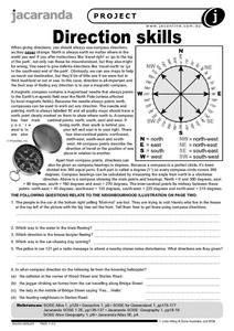
In this geography worksheet, students read an excerpt on what directions tell someone. They respond to 6 short answer questions related to the neighborhood illustration found on the second page of the worksheet.
Curated OER
Combining Map and Compass
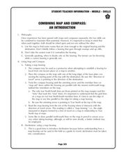
Learners practice using the map and compass to find a location. In this geography instructional activity series, students identify basic requirements needed when traveling in the wilderness. They plan a healthy menu for a backpacking trip.
Curated OER
I Can Compass, Can You?
Students discover how to use geographic tools. In this compass lesson, students identify cardinal directions by appropriately using compasses along with a number of various maps.
Curated OER
Compass Crusaders
Learners discover how to use a compass and how to use that knowledge in the field while applying orienteering and mathematical skills.
Curated OER
Barnaby Bear Compass Directions
In this compass worksheet students study the compass rose provided and answer 8 questions. Locations and spellings would be most familiar to students in the U.K.
Curated OER
Finding Captain Hook's Treasure
Young scholars use their map-reading skills to find Captain Hook's treasure. They see how the directions on a map correspond with "real-life" directions, and that symbols on a map represent real things.
Curated OER
Mapping America
While learning about the Louisiana Purchase, pupils practice map skills. This motivating lesson has them answer questions about the Louisiana Territory and the United States. It provides a quick and easy way review of skills and the...
Curated OER
How Do I Get There? Planning a Safe Route to School
One much-needed skill for young learners is direction giving. Have your class plan and draw a safe route for them to travel from home to school. They will also draw places and items that are in between home and school in order to build a...
Owl Teacher
Imaginary Nation: Constructing a Map
Your young geographers will combine what they have learned about the five themes of geography and their inner creativity to design a physical map for an imaginary nation.
Other popular searches
- Compass Skills Worksheets
- Compass Skills 3rd Grade
- Compass Skills First Grade
- Compass Skills Elementary
- Map and Compass Skills
- Compass Skills Lesson Plans
- Map Compass Skills
- Math Compass Skills
- Tecahing Compass Skills
- Decaying Compass Skills
- Compass Skills Yr 10
- Math Compass Skills Triangle


