Curated OER
Mastering the Keyboard
Sixth graders view an animated program showing how the continents fit together millions of years ago. In groups, they compare and contrast the distribution of rocks and fossils based on how the continents fit together. After reading a...
Curated OER
Hudson Canyon Expedition Let's Bet on Sediments!
Students investigate and analyze the patterns of sedimentation in the Hudson Canyon students observe how heavier particles sink faster than finer particles. They study that submarine landslides (trench slope failure) are
Curated OER
This Life Stinks!
Pupils explore the process of chemosynthesis and contrast this process with photosynthesis. They consider the relevance of chemosynthesis to biological communities in the vicinity of cold seeps.
Curated OER
This Old Tubeworm
High schoolers explain the process and significance of chemosynthesis. They develop their own graphic based on data of a biological community. They estimate the age of a given species as well.
Curated OER
Are You Related?
High schoolers study microsatellite markers and explain how they might be used to identify populations. They use data to make inferences about the populations of deep-sea corals.
Curated OER
Modeling Plate Tectonics
Students investigate the four different ways tectonic plates interact at their boundaries. Using simple available materials, they create models to simulate these interactions present at plate boundaries.
US Geological Survey
Usgs: u.s. Atlantic Continental Margin Gloria Mapping Program
This site from the U.S. Geological Survey allows you to access detailed images of the continental margin around the United States. There is additional information about the sonar methods used, and a wealth of additional sources listed.
CK-12 Foundation
Ck 12: Earth Science: Continental Margins
[Free Registration/Login may be required to access all resource tools.] Discusses the differences between active and passive continental margins.
University of Washington
University of Washington: Coastal Processes and the Continental Margin
Events affecting the continental margin off Washington State are presented. This article comes from the "Thompson Times," an onboard newspaper from the UW's primary research vessel, the Thomas Thompson.
Other
Aligarh Muslim University (India): Active and Passive Continental Margins
Explains what active and passive continental margins are and where they can be found. Includes a world map showing their locations.
Other
Geo Man: What's the Difference Between an Active and Passive Continental Margin?
Explains what active and passive continental margins are and where they can be found.
US Geological Survey
Usgs: Monterey Submarine Canyon, California Moored Array Data Report [Pdf]
This advanced site discusses some of the research done and research techniques used in studies of the Monterey Canyon. Great graphics showing the position of the canyon relative to other features of the continental margin. Also...
CK-12 Foundation
Ck 12: Earth Science: Bathymetric Evidence for Seafloor Spreading
[Free Registration/Login may be required to access all resource tools.] Describes features of the seafloor and how they are mapped by echo sounding. It touches upon the continental margin as well.
American Museum of Natural History
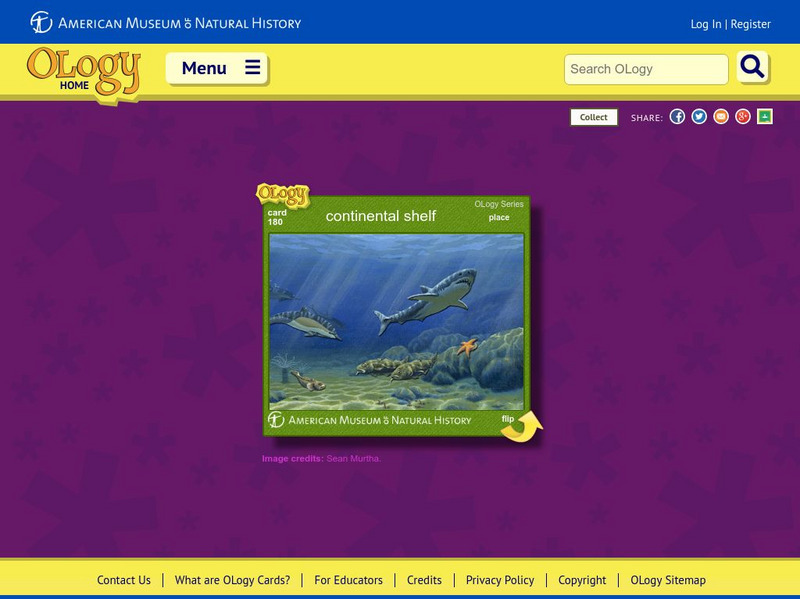
American Museum of Natural History: Continental Shelf O Logy Card
Turn over this interactive card to find fast facts, questions and answers, and similar bite-size pieces of information to help you understand the continental shelf.
US Navy
Office of Naval Reasearch: Ocean Floor
A comprehensive site that provides information on the characteristics of the ocean floor, continental margin and rise, deep ocean basin, and the mid-ocean ridge. A quick quiz follows at the end of this site.
NOAA
Noaa: Expedition to the Deep Slope
This resource provides articles and information about an expedition to the Deep Slope in the Gulf of Mexico.
Science Education Resource Center at Carleton College
Serc: Fire and Ice: Volcanic and Glacial Features on Land and Seafloor
Students learn about glacial and volcanic features by examining and comparing bathymetric and topographic images of the Sand Point area of Alaska.
Indiana University
Indiana University: Evolution of Continents and Oceans
A course lecture on how the Earth's geological features have evolved through the movements of tectonic plates. Explains the different types of plate boundaries and how they manifest in geological formations. Also describes the structure...
CK-12 Foundation
Ck 12: Earth Science: Deposition by Waves
[Free Registration/Login may be required to access all resource tools.] Describes terrain features formed by ocean waves.
University of California
Ucmp: Glossary of Natural History
A glossary of useful terms, including "abyssal plain" and related terms.
Curated OER
Etc: Maps Etc: Elevations of the Asian Continent, 1912
An orographic map of Asia from 1912 showing average elevations and land features of the region. The map uses color-contouring to show land elevations from depressions below sea level to above 12,000 feet. Offshore fathom contour lines...


![Usgs: Monterey Submarine Canyon, California Moored Array Data Report [Pdf] Handout Usgs: Monterey Submarine Canyon, California Moored Array Data Report [Pdf] Handout](https://d15y2dacu3jp90.cloudfront.net/images/attachment_defaults/resource/large/FPO-knovation.png)


