Curated OER
Exploring Arizona's Biotic Communities Lesson 2: Biotic Communities Vocabulary
Part of a unit on Arizona's biotic communities, this activity focuses on the vocabulary to be used. Terms include biodiversity, topography, desert, hybridization, niche, and more! Youngsters will define these words from contextual...
Curated OER
The New England Fishing Industry:Sea Changes in a Community
Explore New England's economic and cultural past and possible issues New Englanders will face in the future. Middle and high schoolers research the fishing industry and the need for regulation. They analyze the topography of New England...
Curated OER
Contour Map
In this contour map worksheet, students create 3 different contour maps by highlighting all the data points with the same value and connecting the dots.
Curated OER
Exploring Arizona's Biotic Communities Lesson 1: Mapping Biotic Communities
As part of a unit on Arizona's biotic communities, young ecology learners create a map. They describe how humans and animals adapt in their habitat. They take notes and create graphic organizers from articles they read. Beautiful maps,...
Curated OER
Trail Construction
Learners explore environmental care by participating in a trail building exercise. In this topography lesson, students collaborate in small groups and utilize building materials to create a trail in a nearby park or nature area. Learners...
Curated OER
Cause and Effect: Light Clusters and Geography
After viewing a map of lights at night over a variety of geographic formations, young topographers connect the location of light clusters to geographic features that encourage human settlement. They list causes and effects of large...
Curated OER
Wetland in a Pan
Seventh graders build a watershed from various materials. In this life science lesson plan, the students will be able to change the design of their watershed to see the changes in the way the water will drain. Each group will be able to...
Curated OER
Geography and Culture in South Carolina
Young scholars explore South Carolina. In this cultural heritage instructional activity, students investigate the topography of South Carolina using maps. Young scholars are engaged in identifying the different regions of the state and...
Curated OER
What is a Karst
Students investigate landforms by holding a class experiment. In this topography lesson, students define the word "karst" and discover why sinkholes are created on the surface of the Earth by completing worksheets. Students create a...
Curated OER
Sequence of Events: The Watershed
Class members simulate a watershed with a painters drop cloth, placing objects underneath to create landscape variation, making "rain" with a watering can, and using red drink mix powder to track the path of precipitation. They observe...
Curated OER
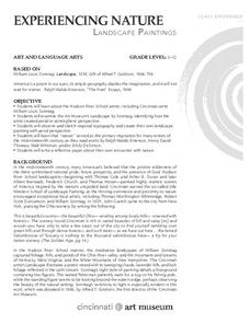
Experiencing Nature
Students create their own landscapes based on the topography of their region after studying the artwork of Cincinnati-based artist William Sonntag and other "Hudson River School" artists.
Curated OER
Landslides!
Students discover soil and Earth movement by experimenting in class. In this Earth Science lesson, students utilize a stream table, soil, graduated cylinder and water to create a re-enactment of a landslide. Students simulate...
Curated OER
Build the Great Wall Lesson Plan
Students study the history and significance of the Great Wall of China. They examine the topography of the Chinese landscape before building a model of the Wall. Over the course of the school year, they use art supplies to build a wall...
Curated OER
Contour and Cross-Section Skills
In this geography worksheet, learners identify the Wolf Creek Crater and how it was formed. They examine a contour map given of how the crater would look from above. Then, pupils use a ruler to draw lines as on the graph to the side....
Curated OER
Oceanography
Fifth graders study the topography of the ocean floor. They determine its ever changing nature as they examine currents and trade winds. They write paragraph describing how the winds might affect land formations after the discussion of...
Curated OER
Sonar Simulation
Students compare and contrast side-scan sonar to other methods used to find objects underwater. In this underwater search instructional activity, students describe side-scan sonar and make inferences about the topography of an unknown...
Curated OER
Laura Ingalls Wilder and Pioneer Life
Fourth graders complete a three-week unit about Laura Ingalls Wilder and pioneer life. They research the topography of Michigan in the 1870's, conduct Internet research, write journal entries, participate in polka and waltz dancing, and...
Curated OER
Physical Geography of Africa
Fifth graders investigate the topography of Africa. For this physical geography lesson, 5th graders research the six regions of Africa and complete a physical map. Students locate various landforms in Africa. Students...
Alabama Learning Exchange
WATER You Doing to Help?
Auntie Litter is here to educate young scholars about water pollution and environmental stewardship! Although the 15-minute video clip is cheesy, it's an engaging look at the water cycle and conservation. Learners start by illustrating...
Curated OER
Camp and Travel on Durable Ground
Pupils explore environmental awareness by conducting a class discussion. In this camping lesson, students discuss different methods to minimize their human imprint on the land they are camping or hiking on. Pupils participate in a hike...
Curated OER
The Sugar Cane Curtain/ Defining Political and Social Struggles Between Haiti and the Dominican Republic
Twelfth graders explore historical events that created conflict between Dominican Republic and Haiti, examine how need for cheap source of labor has led to exploitation of Haitian workers, and discuss how topography of island of...
Curated OER
The Mormon Trail Through Iowa
Middle schoolers read selections from travel diaries and create their own travel diary. In this Mormon Trail through Iowa lesson, students discover background of the Mormon Trek of 1846 and discuss how a group may be persecuted for...
Curated OER
Our Neighborhood
Students inspect visual arts by analyzing their hometown. In this neighborhood lesson, students identify the different buildings, topography, landmarks and scenery near their home. Students utilize art products such as paints and...
Curated OER
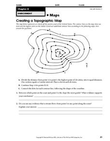
Creating a Topographic Map
In this topographic map instructional activity, students add contour lines to a topographic map using instructions provided. Once topographic map is finished, students complete 2 follow-up short answer questions.
Other popular searches
- Contour Maps
- Contour Maps and Elevation
- Contour Maps Topography
- Contour Lines Maps
- Contour Lines on Maps
- Contour Lines Map Reading
- Reading Contour Maps
- Contour Interval Map Scale
- Worksheets Contour Maps
- Geography Contour Maps
- Isolines and Contour Maps
- Music Contour Maps


