Curated OER
Can You See What I See?
Young scholars gain an understanding of the methods used to explore the earth's surface. Students create a time line leading to the first satellite image of the Earth that includes the various methods utilized to observe the earth's...
Curated OER
The Earth's Surface
Students identify the characteristics of places. In this communities lesson, students discuss what they observe when they travel and construct a list of places in their neighborhood. Students use a Landscape Picture Map to circle...
Curated OER
Fault Features
Students discuss the different kinds of faults in the earth's crust and examine photos of the San Adreas Fault. Working in groups, they experiment with fault making by placing fabric in a pan and filling the inside with wet dirt. When...
Curated OER
Settlement Exploration: Then and Now
NASA has crafted an imaginative and memorable series of lessons, "NASA and Jamestown Education Module." This lesson is one of the five components. In it, middle schoolers connect history and science by comparing the settlement of...
Curated OER
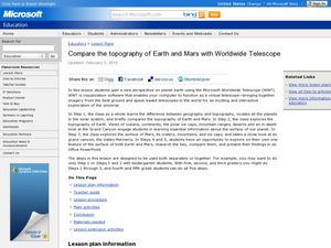
Compare Topography of Earth and Mars with a Worldwide Telescope
Students compare geography to topography. In this topography lesson plan, students examine the topography of the surfaces of the Earth. Students compare one feature of Earth to one feature of Mars and present in a PowerPoint.
Curated OER
The Ocean Floor
Practice reading comprehension by approaching oceanography through 2 pages of informational text. The text compares the ocean floor to the Grand Canyon to gives students perspective, and gives a brief coverage of the earth's crust and...
Curated OER
Water Features - Lesson 2 - U.S. Political Map Grade 4-5
Students locate water features on maps. In this geography lesson, students complete worksheets that require them to identify water features on a U. S. political map.
Curated OER
Landscape Picture Map- The Earth's Surface
Students discuss different landscapes. In this map instructional activity, students describe what they see when they travel between home and school. Students use a landscape picture map to locate the places or objects they see.
Curated OER
GEOGRAPHY: SPACE CENTERS
Young scholars examine the descriptive science dealing with the surface of Earth, its division into continents and countries, climate, natural resources, inhabitants and industries of the various divisions and analyze the political...
Curated OER
Earthquake Formation
Students explore earthquakes. In this natural disaster and engineer career education lesson, students identify features of the earth's surface that increase the likelihood of an earthquake. Students use visual aids to locate the earth's...
Curated OER
Landscape Picture Map
Students discuss differences between man made and natural features on the Earth's surface. In this natural and man made features lesson plan, learners brainstorm a list of features and categorize them on the board. Students study a...
Curated OER
Your Own Backyard
Students study Earth's features and their local environments. In this Earth's features lesson, students take a field trip to observe a natural environment and students sketch their observations of the nature. Students watch videos about...
Curated OER
Landscape Picture Map: Natural and People Made Features
Students explore the places and objects that make up the Earth's surface. In this natural and people made features lesson, students identify things they've seen that are people made and those that are natural to the environment. ...
K5 Learning
Landforms
Valleys, mountains, and plateaus are just a few geographic landforms on our Earth. Read about these types and more in a brief landform passage. After reading, learners respond to six short answer comprehension questions.
Curated OER
Geography: examining the Glacial Features of Cape Cod
Students examine satellite images of the glacial features of Cape Cod. They analyze where human activity is located in terms of those features. Students make models of the features, including kettle holes. They also use contour maps...
Curated OER
Map Grids
Students examine how grids are created and used to locate positions of objects or features on a map.
Curated OER
May We Present Planet Earth?
Learners draw a map to scale. They illustrate knowledge of how to use DOGS TAILS on a map. Students identify the main parts of a map. They identify and illustrate the major features necessary for sustaining a quality of life for a society.
Curated OER
Map Lesson Plan
Fourth graders locate and label major sites related to the Revolutionary War in the Hudson River Valley. They examine topographical features of each site and list a few of these features and list two advantages of each military site.
Curated OER
Social Studies: Looking at Regions
Quiz your 3rd graders on why we have regions. This regions quiz includes 16 questions on why and how we group areas into regions based on physical features, culture, politics or religion. A class discussion on technology completes this...
Curated OER
When It Rains it Drains
Students examine the major paths of water on the Earth's surface, and to investigate the many factors that contribute to those paths. Students demonstrate their understanding of a watershed by identifying the defining features of a...
Curated OER
World Geography: Global Interdependence
Students are able to discuss the theory of climate change. They identify examples of how climate change impacts the earth's geo-spheres. Students are able to use the example of climate change to describe the interdependence of the...
Curated OER
"Water is Life" Global Water Awareness
Students examine and calculate the percentage of potable water remaining on the earth. In this ecology and geography instructional activity, students brainstorm the main factors affecting water distribution. Students use mathematical...
Curated OER
Sea to Sky
Students investigate the Earth's major landforms and how they occur, and how engineers apply this knowledge for the design of transportation systems, mining, and measuring natural hazards. They listen to a teacher-led lecture, match...
Curated OER
Geology and the Battle of Gettysburg
Students create geologic maps of the Gettysburg battlefield. In this geologic skills lesson, students consider the variations of Earth's surfaces and explore strategies employed by the North and South in the Battle of Gettysburg to...
