NOAA
Mid-Ocean Ridges Interactive
Your class will be on top of their game when it comes to mid-ocean ridges! The second installment in a 13-part series focuses on the 65,000-km underwater ridge system that spans our globe. Junior oceanographers practice placing the...
Curated OER
Welcome to the Americas
Students research and map the North and South American continents. In this geography lesson on the Americas, students can locate North, Central and South American countries and states. Students choose a location to research and prepare a...
Curated OER
Getting to Know the Seven Continents
Learners are introduced to basic map and globe skills. Using the internet, they identify and locate the seven continents and complete a blank map to reinforce the names of the continents. They also distinguish between land masses and...
Curated OER
Global Lesson: Social Studies On-Line Global Lesson: Social Studies On-Line Continents
In this geography PowerPoint a simple world map on which each continent is represented by a solid green landform is the background for each of the nine slides. The continent names appear in a list on the first slide, followed by one...
Curated OER
Earth Science Jeopardy
This jeopardy game has 5 categories and 5 point levels, and is designed with a section of hodge podge, geography, and earth science review questions. The questions are clear and the point selections are designed to darken once used.
Curated OER
Asia Crossword
In this geography instructional activity, learners complete a crossword puzzle on the continent of Asia. They answer 21 questions related to the type of government systems found, capital cities, deepest lake, and lowest population density.
Curated OER
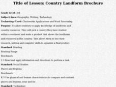
Country Landform Brochure
Third graders create brochures that include landforms, natural resources and pictures of a country that has been researched or studied in class.
Curated OER
Landforms By Hand: Geography, Map Skills
Learners experiment with landform vocabulary by using their own hands and a bar of soap as media.
Curated OER
Earthquakes and Volcanoes
In this geology worksheet, 10th graders locate thirty-six terms about earthquakes and volcanoes in a word search. Answers to the word search are available in various formats.
Curated OER
World Landforms
In this blank outline map worksheet, students note the major landforms of the 7 continents of the world on a Robinson projection map.
Curated OER
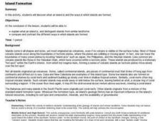
Island formation
Students explain what an island is, and distinguish islands from similar landforms. They compare and contrast the different ways in which islands are formed.
Compton Unified School District
How Can We Locate Places?
How can we locate places? Maps, of course! Expose second graders to the tools available in maps and discuss how these tools can help people find locations. Students also look at communities, including what makes a community and the...
Curated OER
The 50 States and its Holidays
Though the format of this ELL lesson is confusing (the standards listed are for plate tectonics, yet the objectives are for American geography and holidays), a teacher could glean some ideas from the main idea. Here, pupils complete a...
Curated OER
Learning About Maps
Students investigate the many uses and features of maps and globes and locate where they live on both. In this map lesson, student play a travel game and create their own maps to explore states, continents, countries, and islands.
Curated OER
Happy Lesson: The Earth's Crust
This PowerPoint provides a multiple choice and fill-in-the-blank format for reviewing vocabulary and related content following an "earth's crust" science unit. The information is concise and age-appropriate and the font and colors are...
Alabama Learning Exchange
Forces that Change the Land
Students conduct Internet research find information about the following landforms: mountains, canyons, and valleys. They create travel brochures of their findings.
Polar Trec
The Amazing Antarctic Trek
This resource provides two ways to engage learners in using latitude, longitude, and research skills. In pairs, or on their own, learners will locate several Antarctic regions on a map. They will write the name of the place and a few key...
Curated OER
Exploring our National Parks
Young scholars utilize maps/Atlases to find key spatial information, locate U.S. National Parks, characterize the geography of a specific region, and create a National Park brochure.
Curated OER
Cartographer on Assignment: Creating a Physical Map of Africa
Students use geographic information to make an outline map of Africa, then demonstrate their understanding of the physical landscape of Africa by using a variety of materials to create a physical map of Africa
Curated OER
"Planet" Vacation
Students research a location of their choice using the internet. They list the characteristics of the location and why they chose it as their ideal vacation spot. Using maps, they pinpoint their destination and trace their route. They...
Curated OER
What I Did On My Summer Vacation
Learners use the internet to research the location of their summer vacation trip. Given the demographics, they plot the location on a world map. They create a brochure using the information they collected. Using PowerPoint, they develop...
Curated OER
Investigating Our Place in the World
Students study the concept of geography in a year long unit. In this geography unit, students participate in different activities that explain the spatial sense of the world, the physical landmasses and bodies of water, geographic...
Curated OER
Early Explorers
Fifth graders investigate the routes taken by the early explorers. In this explorers lesson, 5th graders use interactive notebooks, discussion and maps to discover the routes taken. Students get into pairs and label maps, and create...
Curated OER
Middle East Related
Eighth graders find a current event related to the Middle East. In this current event lesson students write a brief summary of a new story related to the Middle East. They give their opinion and tell how it affects their life or who it...


