Curated OER
Carbon Monoxide and Population Density
Tenth graders investigate the carbon monoxide level at a fixed latitude to determine if there is a relationship to population density. They download data sets and generate a graph, and find locations using the Earth's coordinate system....
Curated OER
Dinosaur Traces
Students identify and interpret the type of evidence found at a typical dinosaur dig and mimic a paleontologist by taking crayon rubbings of simulated bone impressions. After the rubbings are taken, the students reconstruct the complete...
Curated OER
Exploring for Petroleum - Modeling an Oil Reserve
Learners experiment with locating oil reserves. In this conservation activity, students use a cardboard box to create sand, rocks, and an oil reserve (water balloon). They use a probe to dig around in the box to find the oil reserve and...
Curated OER
Modeling an Oil Reserve
Students conduct an experiment. In this oil and natural gas lesson, students learn how geoscientists identify and explore reserves of petroleum. Students make a model of an oil reserve, record how much it would cost to drill...
Curated OER
The Great MPA Debate
Students study the 'Marine Protected Areas' process. In this ocean lesson students work in groups, conduct research and present it to the class.
Curated OER
Date a Rock!
High schoolers figure the number of half-lives since the sample solidified, and therefore the "age" of the sample rocks.
Curated OER
Where Next?
Young scholars read an article explaining NASA's possible Mars landing sites. They use the Internet to research Mars and the Module. They are able to submit their own proposals for a landing site after researching the planet.
Curated OER
Sea to Sky
Students investigate the Earth's major landforms and how they occur, and how engineers apply this knowledge for the design of transportation systems, mining, and measuring natural hazards. They listen to a teacher-led lecture, match...
Curated OER
Earthquakes
Sixth graders explore reasons for earthquakes. They discuss and describe the types of faults. Using the internet, 6th graders research a specific location of a former earthquake. They describe the damage, magnitude, the epicenter,...
Curated OER
Crater Lakes and the Volcanoes of the Cascade Mountains
Learners study volcanoes. In this Earth science lesson plan, students read, discuss and take notes on the volcanoes of the Cascade Mountains. This lesson also includes an art project.
Curated OER
Evaluating an Illinois Earthquake
Students examine the frequency of earthquakes in Illinois. They discover the distribution of earthquakes in the Midwest. They also practice reading measurements from the Richter scale and Mercalli Intensity scale.
Curated OER
Classification
Students gather and classify samples of a given item (rocks, fossils, seeds, etc.) They discuss various ways of classifying and that there are many different ways that are acceptable.
Curated OER
Finding an Earthquake's Epicenter
Students examine the process used to identify the epicenter of an earthquake. They identify the Richter scale and interpret a seismograph reading. They also view photographs of the aftermath of earthquakes.
Curated OER
Gold Mine
Students investigate gold. In this gold panning lesson, students demonstrate the process of mining through an experiment using two boxes of sand. Students design a safe way to mine gold.
Curated OER
Bedrock Learning
Students test and identify soil and rock samples. In this rock and soil lesson, students video themselves gathering samples. Students test the samples and create graphs showing the results.
Curated OER
Make a Community Almanac
Students gather geographic information about their community. They work together to create a community almanac.
Curated OER
Currently Warm
Seventh graders investigate how ocean currents affect climate. In this earth science instructional activity, 7th graders draw and label the current in their assigned ocean. They discuss how currents from the poles differ from the equator.
Curated OER
Carving Mountains
Students explore geography by participating in an illustration activity. In this land-form lesson, students define vocabulary terms associated with glaciers and forests. Students utilize pens, cardboard and pottery clay to draw and...
Curated OER
English Settlement
Students study the development of the New England colonies, their rationale for settlement, and the importance of Puritan theology in this development. They research towns in England and their copies in Massachusetts.
Curated OER
Where's My Dot?
Students explore the five basic elements of Monart, dot, curved line, straightline, and angle line to create a book about their home address. The concept of "big" is explored in this lesson.
Curated OER
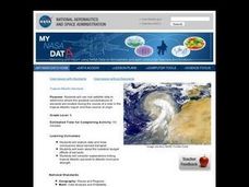
Troical Atlantic Aerosols
Learners explore the effect aerosols have upon he weather and climate. They observe NASA satellite images to explore and draw conclusions about aerosol transport. From studying the images, students track the path of aerosols. They...
Curated OER
A Different Kind of Rock Star: Part 2
Students examine our society's fascination with Mars. In this journalism lesson plan students read an article that outlines the various ways Mars has captured our imagination and are given topics for discussion and a...
Curated OER
Surfing for Earthquakes and Volcanoes
Young scholars search the Internet for data pertaining to the world's volcanic and seismic activity.
Curated OER
Shake, Rattle And Roll: Studying the Effects of an Earthquake
Learners gauge earthquake intensity by reviewing firsthand accounts. They use the Modified Mercalli Intensity Scale and newspaper articles to estimate the strength and effects of a past earthquake.
Other popular searches
- Geologic Mapping Loveland
- Geologic Mapping of Loveland
- Geologic Mapping Love Land
- Creating a Geologic Map
- Geologic Mapping of Love Land

