Curated OER
Archaeology at Woods Canyon Pueblo
Eighth graders research information about the archaeology at Woods Canyon Pueblo, identifying different terminology. Students make a hypothesis about why the ancient Pueblo people chose to live. Students conducts research to support...
Curated OER
Hottest, Coldest, Highest, Deepest: Science, 4th Grade
Fourth graders investigate weather patterns in their home state of Utah. After creating KWL charts, they research weather and geographical data to locate the state's extremes. As an extension, 4th graders write and illustrate books about...
Curated OER
Wetlands/Watershed Model
Students make a model that will demonstrate the flow of surface water across the land in Texas and how materials that originate many miles away can end up in the wetland along the coast.
Curated OER
Geography: Mapping Neighborhoods
Students examine their neighborhoods and draw maps reflecting land use. In addition, they make predictions about their community's future. Students also consider the impact of business and industry on their communities and predict ...
Curated OER
Historical and Physical Georgia: Change
Students explore the geographical features of Georgia. In this geology lesson, students explore the physical regions of Georgia and make observations regarding their changes through the years.
Curated OER
Getting to Know the Seven Continents
Learners are introduced to basic map and globe skills. Using the internet, they identify and locate the seven continents and complete a blank map to reinforce the names of the continents. They also distinguish between land masses and...
Curated OER
Geology of Connecticut
Students examine the geology of Connecticut, including plate tectonics, glaciation, and fossil formation.
After reviewing past lessons, they write essays about what life may have been like in the Mesozoic Period. Following a field...
Curated OER
Mapmaker, Make Me a Map!
Here is a well-designed, very thorough lesson plan on mapping for very young children. Within the six-page plan, you will find everything you need to implement the lesson plan. They will identify various landforms found in Colorado on a...
Curated OER
How Volcanoes Grow
Students create models of the three major types of volcanoes and determine how a volcano's shape is related to the type of material erupted. They then observe a demonstration that simulates the nature of two volcanic materials: lava and...
Curated OER
Nature and Place Names in Arkansas
Middle schoolers examine the way that many place names in Arkansas came to be. By looking at Arkansas highway maps, they find names that come from the characteristics of each of the state's six geographical divisions. This interesting...
Curated OER
Exploring our National Parks
Young scholars utilize maps/Atlases to find key spatial information, locate U.S. National Parks, characterize the geography of a specific region, and create a National Park brochure.
Curated OER
Google Earth Geology Field Trip
Learners take a virtual field trip around California using Google Earth. In this geology field trip lesson, students explore landforms and a variety of rocks located in California. Learners compare environments where rocks are formed....
Curated OER
Cartographer on Assignment: Creating a Physical Map of Africa
Students use geographic information to make an outline map of Africa, then demonstrate their understanding of the physical landscape of Africa by using a variety of materials to create a physical map of Africa
Curated OER
The Geography - Writing Connection
Students examine and describe the four physical systems of the Earth. Using two of the systems, they practice their writing skills and use vocabulary associated with the different types of landforms. They predict the types of shelters...
Curated OER
Tissue Paper Geography
Students explore geographic features of the desert and apply their understanding of the topography of the desert by creating a tissue paper painting.
Curated OER
Travelogs
Pupils make travelog journals to send to acquaintances in other states in order to receive mail in return. They make scrapbooks with the return mail they receive.
Curated OER
Contour and Cross-Section Skills
For this geography worksheet, learners identify the Wolf Creek Crater and how it was formed. They examine a contour map given of how the crater would look from above. Then, pupils use a ruler to draw lines as on the graph to the side....
Curated OER
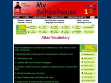
Atlas Vocabulary
In this atlas terms and definitions online interactive instructional activity, students read the definitions and match them with Atlas vocabulary words. Students match 49 answers.
Curated OER
Map Your State: Regions of Arizona
Fourth graders define vocabulary and locate physical features on maps. In this mapping lesson, 4th graders explore regions of Arizona through landforms found on topographic maps. Students research the history and culture of the...
Curated OER
Mining Riches
Students research and map how various mining ventures have changed local geographies and populations. First they read the article provided--Examining the Environmental and Social Impact of the Mining Industry.
Curated OER
Desertification
Learners investigate the process of desertification in the Sahel region of Africa. They discuss photos from a National Geographic magazine, analyze the physical/political map of the Sahara, identify the causes and effects of...
Curated OER
Go Maryland! Our State's Geography & Economy
Fifth graders design and create a brochure that may be used by the Maryland Department of Business and Economic Development to attract visitors in the 3 different regions of the state. In this Maryland state activity, 5th graders...
Curated OER
The River Ran Through It
Students identify the processes that shape our rivers and form our lakes. They participate in hands-on and multimedia activities as they discover and apply the river-cutting processes of water.
Curated OER
Mapping the Canyon
High schoolers compare and contrast topographic maps and bathymetric maps. They investigate how bathymetric maps are made and how to interpret one.
Other popular searches
- Landform Maps
- France Geography Landform
- Landform Map of Virginia
- Landform Vocabulary
- Geography Land Forms
- East Asia Land Forms
- Geographic Land Forms
- Landform Change
- 3d Models Land Forms
- Landform Regions of Canada
- Land Forms in Egypt
- Ocean Land Formations


