Curated OER
Customized Topographic Maps and Models
Students explore the information depicted on topographic maps. They construct a 3-D topographic map of a local area. They go on a field trip to the depicted area and compare the 'real world' with their models.
Kate Stickley
Reading the World: Latitude and Longitude Lesson latitude and longitude, maps, coordinates on a map, prime meridian, reading maps, equator, globes
Find five activities all about longitude and latitude! Use oranges to show the equator and prime meridian, plot birthdays on a map using coordinates, and plan a dream vacation.
Curated OER
European Explorers: Research Project
What will your students choose to include in their explorer's treasure chest? Youngsters research an early European explorer and gather items to reflect their research, such as a detailed map of the explorer's voyages, portrait, flag,...
Curated OER
Create Your Own Country Project
Young scholars demonstrate their knowledge of geography with this fun, collaborative social studies project. Working in small groups, students develop their very own countries, writing descriptions of their physical location, social...
Sharp School
Geography Project
This very simple geography project can lead to a lot of useful referential information that can be displayed in your classroom! Learners construct a poster-size map of a country, identifying major demographic points and including pie/bar...
American Institute of Physics
Women and the Manhattan Project
The Manhattan Project was a massive undertaking involving multiple sites and thousands of scientists and technicians. To gain an understanding of the women who participated in the project, groups select an oral history of a woman...
National Geographic
Rivers and the Gabcikovo-Nagymaros Project
Damming rivers has been a case of necessity versus negative environmental impact since the process began. Kids take on the role of a stakeholder in the proposed damming of the Danube River. They begin by reading arguments for and against...
Population Education
Population Map
Here is a very interesting graphic of a world map where each country's size is adjusted accordingly to its population. The bottom row of the document also includes several maps depicting the major shifts and growth of the world...
C-SPAN
2016 Electoral College Map
The electoral college can be confusing for citizens of any age. Clear up misconceptions with a handy printable map that details how many electoral votes are allotted to each state, as well as a history of modern elections, complete with...
Curated OER
East Asia Country Project
Get your young historians thinking about East Asian culture and history during this partner research project, in which they analyze a variety of East Asian aspects to prepare for a presentation. After an initial "what do we already know"...
Curated OER
Identifying, Mapping, and Personifying Countries Involved in WWII
Get artsy with this WWII group activity, starting with a whole-class assignment. Create a map of Europe, Northern Africa, and the Pacific using geometric shapes cut from construction paper and placed on the floor. Consider splitting the...
Curated OER
Blank Europe Map
Simple blank map, limitless possibilities! Here is a single-page resource of a blank map of Europe, without any country boundaries or text.
Curated OER
Basic Mapping Skills
Establish and study the parts of a map with your class and, then they will work in small groups to create their own detailed map, including a legend. There are specific instructions to follow on what needs to be included.
Curated OER
Designing a Hiking Trail
Put your students' map skills to the test with this engaging cross-curricular project. Given the task of developing new hiking trails for their local community, young cartographers must map out beginner and intermediate paths that meet a...
American Library Association
Explorers Project
Delve into the Age of Exploration with a multiple-intelligences research project. Learners generate a rubric and worksheet to guide their studies and research one explorer. There is emphasis on research skills, citing sources,...
Curated OER
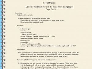
Production of the Lunar Relief Map Project
Young scholars replicate the lunar surface. For this mapping skills lesson, students study the topography of the moon. Young scholars then use craft materials to create topographic maps of the lunar surface where the Eagle landed.
Curated OER
We're on the Map!
Students identify a variety of topographic map symbols. They make generalizations about an unidentified community by reading and interpreting map symbols.
Curated OER
Way to Go! Create a Road Map Game
Learners create a travel game of one of the United States. They research a state of their choice and create a travel game using a common road map. They interpret map symbols as they calculate map mileage for their games. They create...
Mesa Public Schools
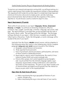
Country Project
Give your young learners the chance to discover more about countries in their world community with a research project. Class members write reports on an assigned country and include such major features as geography, important historical...
Curated OER
Geography/Current Events Project
Using the Balkan region as an example, fourth graders review the five themes of geography as a class. They identify the physical and human characteristics of a region before labeling the countries and landforms on a map. They then...
Curated OER
Texas Commemorative Maps: Honoring Our Past
To celebrate Texas, groups plan and create a commemorative map for a topic or theme in Texas history. The richly detailed plan and the approach could easily be adapted to any state. Samples are included.
Curated OER
The Great Military: Map of Texas
The battle at the Alamo may be one of the most famous military campaigns in Texas history, but it is by no means the only one. As part of their study of the military history of Texas, class members research less-well-known sites, locate...
Curated OER
Call to Arms: A Service Project
Sick of selling candy and washing cars? How about hosting a Digital Day or a Learning Lunch? The suggestions here make fund raising fun and rewarding. Raise money to preserve important maps and other primary source documents.
Association of American Geographers
Project GeoSTART
Investigate the fascinating, yet terrifying phenomenon of hurricanes from the safety of your classroom using this earth science unit. Focusing on developing young scientists' spacial thinking skills, these lessons engage learners in...
Other popular searches
- 3 Different Map Projections
- Map Projections Worksheets
- Different Map Projections
- Map Projections Cylinders
- Globe and Map Projections
- Types of Map Projections
- Map Projections Explanation
- Map Projections Cyclinders
- Map Projections Mercator
- Pacific Projection Map
- Map Projection Lesson Lans
- Robinson Projection Map


