Curated OER
Distances on Coordinate Grids
In this grid worksheet, 5th graders use a grid map with coordinate points to answer six questions regarding distance between locations.
Curated OER
An Erosion Survey
In this erosion worksheet, students draw a map of their school ground or neighborhood, mark examples of weathering and erosion, and list the examples on spaces provided. A chart with examples of different types of weathering and erosion...
Curated OER
Landforms and Resource Regions
In this geographical regions worksheet, students read a short passage, examine 2 maps which show landforms and regions in South America, then answer 4 comprehension questions based on the information from the maps and the reading passage.
Curated OER
Mixed Review-Chemistry
In this chemistry review worksheet, students answer a variety of questions about matter, elements, the kinetic theory, chemical and physical properties and the distillation process. They complete a concept map about matter.
Curated OER
Isolines
In this isolines worksheet, students are given a series of numbers representing altitudes and they draw the isolines for 50 foot intervals. Students determine gradients between given points on the map.
Curated OER
Red River Contours
In this contour map worksheet, students use a given contour map to answer 16 questions about the area shown on the map. Topics include the gradient from one spot to another, the elevation, the direction of the flow of the Red River, the...
Curated OER
Lesson 3-5: Proportions and Similar Figures
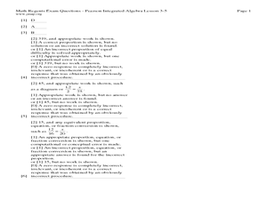
For this similar figures worksheet, students use proportions to solve 6 short answer and multiple choice questions. Students use proportions to answer questions about map scales and height of trees given shadow lengths.
Curated OER
Canadian Provinces Quiz
In this online interactive geography quiz worksheet, learners examine the map that includes 13 Canadian provinces. Students identify the names of the provinces in 3 minutes.
Curated OER
Great Lakes Cities Quiz
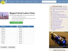
In this online interactive geography worksheet, students examine a map of the Great Lakes region and identify the 20 noted cities on the map using a pull down menu within 4 minutes.
Curated OER
Forester
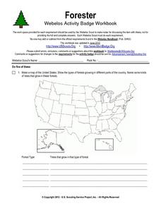
In this forester worksheet, students illustrate a map that shows the types of forests growing in various parts of the country. They also identify six forest trees common to the area where they live and explain how both wildlife and...
Curated OER
Gallery Scavenger Hunt for U.S. History
In this U. S. historical facts worksheet, students participate in identifying the various leaders being described, identify places described in detail and fill out a map by following the directions given.
Curated OER
Word Search -ap
In this word search worksheet, students find 13 words ending in "ap." Words include clap, map, chap, scrap, flap, lap, gap, and wrap.
Curated OER
Melody II
In this music worksheet, students determine which string of notes are a harmony and which ones are a melody. Students also form a map of the musical contour of the songs "Twinkle, Twinkle Little Star" and "Sweet Georgia Brown."
Curated OER
Settlements in Belfast
In this Belfast geography worksheet, students arrange the names of places in order by size, color a map, match important dates and events, and write a plan for redeveloping Laganside.
Curated OER
Geometry Standardized Test Practice
In this figures and graphs review activity, 10th graders solve and complete 23 various types of problems that include identifying various figures and graphs. First, they name the transformation that maps the unshaded figure or preimage...
Curated OER
Worksheet 9: There Is/Are
This nifty activity has learners identify locations on a map. Once students have identified the location, they use a word bank to fill in the blanks on the worksheet. This activity could be used with elementary children or ESL students.
Curated OER
Boosting Your Memory
In this memory worksheet, students learn about three different ways to memorize given information. They make up phrases to help remember lists and they create mental maps to remember terms. They put what they learned to the test and...
Curated OER
Name the States Worksheet 4
In this name the states instructional activity, students examine 6 state map outlines and identify each of them by writing the state names and postal abbreviations.
Curated OER
Name the States Worksheet 2
In this name the states worksheet, students examine 6 state map outlines and identify each of them by writing the state names and postal abbreviations.
Curated OER
Name the States Worksheet 1
In this name the states worksheet, learners examine 6 state map outlines and identify each of them by writing the state names and postal abbreviations.
Curated OER
Name the States Worksheet 5
In this name the states worksheet, students examine 6 state map outlines and identify each of them by writing the state names and postal abbreviations.
Curated OER
Lewis & Clark: The Louisiana Purchase
In this facts about the Louisiana Purchase and the Lewis and Clark expedition online interactive worksheet, students read information and observe a map of the Louisiana Purchase to answer questions showing their comprehension skills....
Curated OER
Radon Gas in the Basement: A Radiation Hazard
In this radon gas instructional activity, students read about the harmful effects of radon exposure over time. They use a map that shows radon gas zones to answer 3 questions about exposure to the gas and the amount of radiation that...
Curated OER
Biggest Mediterranean Islands
In this online interactive geography quiz worksheet, learners examine the the a map and chart as they try to name all of the Mediterranean Islands represented in 4 minutes.
Other popular searches
- United States Maps
- Weather Maps
- Topographic Maps
- Story Maps
- Maps and Charts
- Types of Maps
- Maps and Globes
- Middle East Maps
- Maps and Flags
- Historical Maps
- Maps of Europe
- Create Character Maps


