C-SPAN
Political Polarization
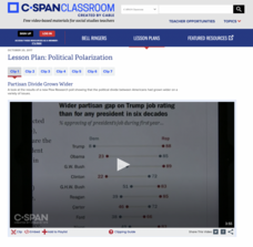
Dive into the political breach with pupils and explore the reasons for political polarization. Using clips from C-SPAN that include discussions from reporters and scholars, class members consider what is causing the political fault lines...
Annenberg Foundation
Teaching Geography: Workshop 4—North Africa/Southwest Asia
Can Jerusalem be equitably organized? Can Israel and Palestine be successfully partitioned? Part one of a two-part workshop looks at the geo-political history of Jerusalem while Part two investigates Egypt's dependence of the Nile River...
Curated OER
Travel Diary
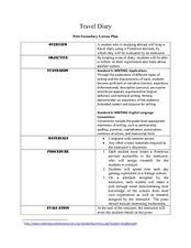
Darwin kept a travel diary as he voyaged to South America, noting the politics, geography, cultures, animals, and interesting facts he encountered. Your class will do the same. Each student chooses a country to research and keep a five...
Curated OER
Basic U.S. Geography
Provide your 11th graders with a basic understanding of U.S. Geography. They label the state, regions, and boundaries found in the contiguous U.S. as well as Hawaii and Alaska. Then, they complete two Internet related activities.
World Maps Online
Introduction to the World Map
Learners identify the differences between maps and globes. For this map skills instructional activity, students are shown a globe and a map and recognize the differences. Learners use post-it notes to locate several locations on the...
Curated OER
Cartoon and Political Poster Analysis
Students explore the late 1800s as a time of demographic change in the US. They view the role of media during this time in the form of posters and political cartoons. They create a political poster/cartoon that deals with current...
Curated OER
Geography of Canada
All about Canada! Learners explore the geography and providences of Canada by watching videos, studying maps and conducting internet research. By the end of this lesson, your class should be able to locate major areas and compare and...
Curated OER
The Holy Land
Explore the culture, geography, and religion of Ethiopia. Learners complete a viewing guide while watching a film on Ethiopia as the first Christian country in Africa. Additionally, they create group presentations and write paragraphs...
Curated OER
GEOGRAPHY: SPACE CENTERS
Students examine the descriptive science dealing with the surface of Earth, its division into continents and countries, climate, natural resources, inhabitants and industries of the various divisions and analyze the political geography...
Curated OER
Political Geography of Europe
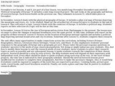
Fifth graders listen to a lecture that traces the political geography of Europe from 814 through 1997. They incorporate these themes into a research project on Western Europe.
Curated OER
Political Legends and Map Symbols
Students identify the legend and map symbols. In this map skills lesson, students use a world map to find various locations using a map key.
Curated OER
Geography And The Gulf War
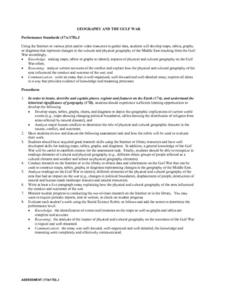
Young scholars develop maps, tables, graphs, charts, and diagrams to depict the geographic implications of current world events, and analyze major human conflicts to determine the role of physical and cultural geographic features in the...
Curated OER
An Introduction to Immigration and the Canadian Political System
Twelfth graders take a citizenship test before learning how their own ideology fits in with current political parties. They create questions for a debate and learn the process of registering to vote.
Curated OER
Political Cartoons About Community Problems
Students research problems faced by their community and create political cartoons for the issues. In this community problems lesson plan, students brainstorm problems their community faces and draw a political cartoon for the problems....
Curated OER
Water Features - Lesson 2 - U.S. Political Map Grade 4-5
Students locate water features on maps. In this geography lesson, students complete worksheets that require them to identify water features on a U. S. political map.
Curated OER
Energy Crisis: Then and Now
Using political cartoons, scholars analyze the energy crisis of the 1970s and '80s, comparing and contrasting it to current tensions with oil. Display the 6 cartoons (linked) to the class, and demonstrate analysis using the worksheet...
Curated OER
An Upbeat West Side Story: Puerto Ricans and Postwar Racial Politics in Chicago
Tenth graders read an article about the migration of Puerto Ricans to Chicago. As a class, they identify the barriers the immigrants faced regarding employment and separation from family members. To end the lesson, they work with a...
Curated OER
Political crisis in Indonesia
Students research Indonesian government and politics, then compare and contrast Indonesian demonstrations to recent upheavals in the Philippines and Ivory Coast. They formulate opinions about the relationship of a nation's stability...
Curated OER
Regents High School Examination: Global History and Geography, 2009
Get your geographers thinking with this global history and geography standardized practice test. Class members respond to 50 multiple choice questions, 2 essay prompts, and 15 short answer questions that require them to review their...
Curated OER
Geography And The Revolutionary War
Students gain a deeper understanding of both geography and the Revolutionary War. They practice using on line research in examining historical events and using political, physical, and topographic maps.
Curated OER
Be the Kiwi
Compare the North and South of New Zealand. Exploritive minds identify which island is better to live on, taking into consideration such things as social, political, and economic aspects. They research an argument to present and debate...
Curated OER
Teacher Notes
Gathering information, distinguishing between arguments, preparing an oral presentation; these skills are fostered as 10th graders explore aspects of global trade and politics. They use the Internet to gather information about NATO, The...
Pulitzer Center
Revolution in Tunisia
How much do your pupils really know about the revolution in Tunisia? In order to inform your class and spark discussion, first create a country profile, comparing and contrasting Tunisia with the United States. Learners then analyze the...
Curated OER
California's Golden History: 1848-1880
Using a variety of online resources, learners study life and society in California during the gold rush. They use a map to identify area where gold was located, explore pre-selected websites, describe mining practices, and create an...


