Annenberg Foundation
Teaching Geography: Workshop 4—North Africa/Southwest Asia
Can Jerusalem be equitably organized? Can Israel and Palestine be successfully partitioned? Part one of a two-part workshop looks at the geo-political history of Jerusalem while Part two investigates Egypt's dependence of the Nile River...
Curated OER
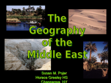
The Geography of the Middle East
Topographic, political, and satellite maps establish the world of the Middle East for your class- a land about which they have heard quite a lot, but might not really understand. This presentation would be a good introduction into a unit...
New York State Education Department
Global History and Geography Examination: January 2013
How much do high schoolers know about human history? The assessment covers global history and geography with multiple choice, document based items, and essay questions. It covers topics such as human migration patterns and religions of...
New York State Education Department
Global History and Geography Examination: August 2012
Let's test global history knowledge. The standardized test, designed for high schooler scholars, assesses world history and geography. The assessment is divided into five different sections, including essay items and multiple choice. It...
Curated OER
Basic U.S. Geography
Provide your 11th graders with a basic understanding of U.S. Geography. They label the state, regions, and boundaries found in the contiguous U.S. as well as Hawaii and Alaska. Then, they complete two Internet related activities.
College Board
2017 AP® Human Geography Free-Response Questions
How have urban planners tried to attract people to cities? What can be done about booming birth rates in some parts of the world? How does a country's political structure affect the well being of its people? Scholars investigate these...
New York State Education Department
Global History and Geography Examination: January 2017
Global history and geography class members demonstrate their knowledge of and ability to analyze primary sources such as graphics, maps, political cartoons, and texts from important documents with an assessment that includes multiple...
World Maps Online
Introduction to the World Map
Students identify the differences between maps and globes. In this map skills instructional activity, students are shown a globe and a map and recognize the differences. Students use post-it notes to locate several locations on the world...
College Board
2015 AP® Human Geography Free-Response Questions
How are population and political power related? What is the significance of the globalization of English? Why do refugees leave their home countries? Using structured short-answer questions, scholars unravel complicated dynamics with...
College Board
2005 AP® Human Geography Free-Response Questions
Why do people leave their home countries and come to the United States? How has nationalism affected European nations politically and socially? The answers are complicated. Pupils explore the intricate dynamics using structured questions...
Curated OER
Geography of Canada
All about Canada! Learners explore the geography and providences of Canada by watching videos, studying maps and conducting internet research. By the end of this lesson, your class should be able to locate major areas and compare and...
Curated OER
GEOGRAPHY: SPACE CENTERS
Students examine the descriptive science dealing with the surface of Earth, its division into continents and countries, climate, natural resources, inhabitants and industries of the various divisions and analyze the political geography...
Curated OER
4th Grade Geography Multiple Choice
In this grade 4 geography worksheet, 4th graders complete a total of 25 multiple choice questions relating to 4th grade geography concepts. An answer key is provided.
Curated OER
Political Geography of Europe
Fifth graders listen to a lecture that traces the political geography of Europe from 814 through 1997. They incorporate these themes into a research project on Western Europe.
Curated OER
Political Legends and Map Symbols
Students identify the legend and map symbols. For this map skills lesson, students use a world map to find various locations using a map key.
Curated OER
World Geography Final Exam Review Quiz #3
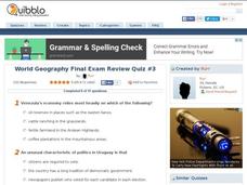
In this world geography instructional activity, students respond to 14 multiple choice questions based on their knowledge of the world's places and features. Students may submit their answers to be scored.
AGSSS
World Regions
Help your learners to visualize where historical events have taken place around the globe with a map that details the major regions of the seven continents.
College Board
2002 AP® Human Geography Free-Response Questions
Nations and states may sound like similar ideas, but these concepts have led to endless wars and conflicts. Learners explore the terms using authentic College Board materials. An additional test item delves into the influence of...
Curated OER
Physical and Human Geography Review Worksheet and Study Guide
In this geography skills worksheet, students respond to 30 short answer questions pertaining to physical and human geography.
Curated OER
Water Features - Lesson 2 - U.S. Political Map Grade 4-5
Students locate water features on maps. In this geography lesson plan, students complete worksheets that require them to identify water features on a U. S. political map.
Curated OER
Maps
If your students are just starting a unit on Geography this could be the introduction you're looking for. This PowerPoint presents a clear and organized overview of the different types of maps people use and why each is important. Tip:...
Curated OER
Eastern Europe in 1989
Major political shifts occurred in Eastern Europe during the late 1980s. Locate, identify, and label 90 different areas on the provided map. A list of cities, countries, and water ways is provided.
Curated OER
World: Political Map
In this world political outline map worksheet, students examine boundaries of each of the countries in the world. This map not is labeled.
Curated OER
U.S. Political Map
In this political map worksheet, students use the map of the United States and the 7 cities to measure the straight-line distance between the cities. Students add the total number of miles traveled and write their answers in the spaces.


