Curated OER
Map Your State: Regions of Arizona
Fourth graders define vocabulary and locate physical features on maps. In this mapping lesson, 4th graders explore regions of Arizona through landforms found on topographic maps. Students research the history and culture of the...
Curated OER
Mining Riches
Learners research and map how various mining ventures have changed local geographies and populations. First they read the article provided--Examining the Environmental and Social Impact of the Mining Industry.
Curated OER
Physical Geography of Africa
Fifth graders investigate the topography of Africa. In this physical geography lesson, 5th graders research the six regions of Africa and complete a physical map. Students locate various landforms in Africa. Students use their...
Curated OER
Improvisational Setting - "Where are You?"
Second graders explore setting through improvisations. For this theatre lesson, 2nd graders perform a variety of improvisations in different settings and chart how they established the setting in the different environments.
Curated OER
Regional Landforms and Native People
Third graders study the Native American tribes of Maidu and Miwok by studying Internet artifacts, culture, language, music, storytelling, architecture, food, clothing, crafts and geology.
Curated OER
Salad Tray 3D Topographic Model
Pupils explore the characteristics of topographical maps. They examine the relationship of contour lines and vertical elevation. Students create a three-dimensional model of a landscape represented by a topographic contour map.
Curated OER
Winter Wonderland - Winter Olympics and the Water Cycle
After a concise introduction to the water cycle, junior meteorologists access NOAA's average snowfall data. They choose a city to examine in terms of precipitation. Then they look at historical snowfall data and use it to predict snow...
NET Foundation for Television
1850-1874 The Kansas-Nebraska Act
How the Kansas-Nebraska Act created Bleeding Kansas is complicated—until scholars research and examine documents from the time. After completing activities that include mapping, photo, document analysis, and discussion, learners...
Kenan Fellows
Sustainability: Learning for a Lifetime – The Importance of Water
Water is essential for life—and understanding the importance of clean drinking water is essential in understanding sustainability! Show your environmental science class the basics of water testing and treatment through a week-long...
Curated OER
Mapmaker, Make Me a Map!
Students are introduced to the state quarter program and examine the Colorado state quarter. They locate Colorado on a map and create a map with a key. They discuss the state motto and examine pictures of the state's geographical features.
Curated OER
Oregon Trail Maps
Fourth graders explore the Oregon Trail. In this Oregon Trail lesson, 4th graders collaborate to conduct Internet research regarding states along the Oregon trail route. Students present their findings to their peers.
Curated OER
The Mountain Community: Why Flagstaff?
Students identify geographical features that hindered or promoted settlement in the city of Flagstaff, Arizona. In this settlement lesson plan, students write a summary of what they learned and identify geographical features on a map.
Curated OER
Sailin' Through Time...Rhode Island, The Ocean State
Fourth graders explore the history of Rhode Island. They research famous people who brought change to the state. They explore the state song, natural resources, and colonies of the state. In groups, 4th graders create a travel brochure...
Curated OER
Identifying Pennsylvania Watersheds
Ninth graders study and identify the six major drainage systems in Pennsylvania. For this watershed lesson students read an article, complete an activity and take a quiz on what they learned.
Curated OER
Living Swamps, Bayous and Forests
Third graders explore interesting environments by exploring Louisiana. In this wetland lesson, 3rd graders utilize the web to research the State of Louisiana, the bayous in the area, and the Gulf of Mexico. Students write a journal entry...
Curated OER
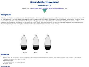
Groundwater Movement
Students study groundwater movement beneath the surface of the Earth. In this agriculture activity, students experiment with how water moves through rock materials such as sand, gravel, and clay.
Curated OER
Modeling Estuaries
Students create a model estuary. In this modeling estuaries lesson, students identify characteristics and mix water of varying densities. Students form a hypothesis, conduct an experiment, and analyze the results.
Curated OER
Biomes: Coastlines and Seas
Students study the different types of coastlines and their territories. For this marine coasts lesson students identify life forms that are in the coastal regions.
Curated OER
Creating the Future
Students work together to develop and write scenerios for the future of hazardous waste cleanup. They share their scenerios with the class. They complete activities as well.
Curated OER
A New Federation
Students describe the relationships between state and federal parliaments in Australia. They identify responsibilities shared between federal and state and territory governments. Students explore an alternative federal structure by...
Curated OER
Draw A Coastline
Students identify, locate and draw at least ten different geographical features on a map. Using the map, they must make it to scale and include their own legend and compass rose. They share their map with the class and answer questions.
Curated OER
Wetlands/Watershed Model
Pupils work together to create a watershed model. They discover the flow of surface water on different topography. They examine how materials originate from miles away and end up in a different wetland.
Curated OER
Big Blue Sky- Based on the Montana Quarter Reverse
Students use a Montana quarter to help describe geographical features such as landforms and bodies of water. Students read an article about Montana as a group and discuss examples of landforms and bodies of water. After reading,...


