Curated OER
Wales Quiz 2
In this country of Wales worksheet, students answer short answer questions about famous people, famous places, and more about the country. Students complete 17 short answer questions.
Curated OER
Wales: An Interdisciplinary Unit
Students practice basic map and geographic skills as they compare Oregon to Wales. Students color map of Wales and Oregon using color codes to distinguish between land, water, and bordering nations or states, listen to stories and...
Curated OER
Destination--Wales
For this Welsh history worksheet, students identify the names of four famous Welsh people based on the descriptions given. Students also take an eight question multiple choice quiz based on their knowledge of Wales. Students participate...
Curated OER
Wales
Students read passages and look online to discover the history and important people, culture, and icons of Wales. In this Wales lesson plan, students participate in a jigsaw reading and learn a few phrases in Welsh.
Curated OER
Wales
Learners investigate Wales. In this Wales lesson, students do Internet research for facts about Wales. Learners are given a list sentences about Wales and decide if they are true or false. Students listen to an audio file and take notes.
Curated OER
Test Your Research Skills- More Interesting Place Names in England, Scotland, and Wales
In this research skills worksheet, students examine a list of names of 20 towns and villages in England, Scotland, and Wales. They use an atlas of Great Britain to find any fake names and place a mark in the box next to it.
Curated OER
Wales
In this map of Wales activity, students view and label on a map of Wales its regions, major cities, landmarks, compass rose and a legend.
Core Knowledge Foundation
The United Kingdom
Scotland, Northern Ireland, Wales, and England are four countries united by more than a monarchy. Academics explore the geography of the nations that make up the United Kingdom. The resource is broken into six lessons focusing on the...
Curated OER
Welcome To Wales
Fourth graders explore the the culture and geographical region of Wales. After reading a picture book on Wales, 4th graders compare and contrast life in Wales to that in the United States. Given a camera, students develop their own...
Curated OER
A Comparative Study of Bangor, Wales and Your Community
Twelfth graders research how a university in their local community changes the cultural landscape of the area. As a class, they discover how the town of Bangor, Wales was affected and compare that to a community in their local area. They...
Curated OER
Demographic Changes in 19th Century England and Wales
Learners examine population in England and Wales during the period of 1801-1911. They calculate the percentage of population and how it changed from one census to the next in various towns. They record data on a spreadsheet and create...
Curated OER
Destination UK: Wales
Students study Wales as a part of the United Kingdom. They examine what they already know about Wales, play guessing game about famous Welshmen, and complete jigsaw reading activity.
Curated OER
The Plight of Women's Work in the Early Industrial Revolution in England and Wales
Learners read about, discuss, and answer questions regarding the various jobs women performed in the early Industrial Revolution in England and Wales.
Curated OER
Towns And Villages in England, Scotland And Wales
In this geography learning exercise, students analyze 15 names of towns and villages in England, Scotland and Wales. Among real place names are up to 10 fake names. Using an atlas of Great Britain, students find any fake names and mark...
Curated OER
Push/Pull Factors and Welsh Emigration
Students view and discuss short sections of movies that relate to immigration. Working in groups, students create a map that shows directions of internal migration in their assigned geographical area. Students review ads/booklets created...
Denver Art Museum
Lesson: Facebook for a Prince
In 1538 a portrait and a praise poem were created in honor of Edward, Prince of Wales. Your class will analyze the poem and painting, research the life of young Edward, then use the information to create a Facebook page. They will...
Curated OER
Geography- KS4-
Students categorise the changes in the iron and steel industry in S Wales. They use literacy or paragraph techniques to strucuture and apply the information. Students given paragraph template to brainstorm and order key points in pairs...
Curated OER
Interesting Place Names 1
In this geography learning exercise, students analyze 24 names of villages and towns in England, Scotland and Wales. Students use an atlas for reference and mark the ten fake names.
Curated OER
Interesting Place Names 2
For this social studies worksheet, students read a list of 17 towns and villages in England, Scotland and Wales. Students use an atlas and identify which 10 names are fake and mark the box in front of them.
Curated OER
WRITING BUSINESS & PERSONAL LETTERS
Students write both a business letter and a personal letter to Jamie Bastedo at the Prince of Wales Northern Heritage Center to request his presence at a drama presentation for a unit on Northern Studies: Europeans and Fur Traders, which...
Curated OER
Country: United Kingdom
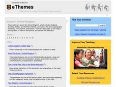
Students use the Internet to examine the food, sports and history of England, Scotland, Wales and Northern Ireland. They view photographs and maps.
Curated OER
Labeling a Map of the British Isles and Elapsed Time
In this map work and elapsed time activity, students label England, Scotland, Wales, and Ireland on a map. They calculate the elapsed time of a delivery that is described in a word problem that is broken down into four parts.
Curated OER
Britian of the Future
Students explore the issues touched on in the programme extracts and generate ideas about what Britian might look like in the future. They develop a picture of this imagined England and explore how the relationship between Scotland,...
Curated OER
Finding Out-- Forest Researchers
In this social studies and science worksheet, students study facts about the forest, creatures who inhabit the forest and those who work in forestry. Students complete 20 questions including word meanings, surveying classmates, matching...
Other popular searches
- Ralph Wales Emerson
- Wales Outline Map
- Cities in Wales
- New South Wales
- Llandudno Wales
- Recycling in Wales
- Landon Wales
- National Assembly for Wales
- Outline Maps Wales
- Geography Llandudno Wales
- Wales and the Carpenter
- History Gerald of Wales


