Curated OER
Hurricane Tracking
Students access the Internet to find information on current hurricanes. They get locations, speeds, and air pressures and then plot the location of the hurricane on a hurricane-tracking map. They also access the FEMA website to solve...
Curated OER
Using a Graphic Organizer to Critically Observe Televised News Broadcasts
Students compare two television news broadcasts. They discuss how to organize information when comparing two objects and read and discuss two books to create a Venn diagram to compare both books. After creating the diagram, they view...
Curated OER
Presenting the Geologic Timescale
Students model the geologic timescale using distance as a metaphor for time. They write a summary of a major event or fossil organism. and station themselves and their summaries along a path within a gymnasium, and present their...
Curated OER
Presenting Research with PowerPoint
Students organize information and prepare a visual interpretation that enhances an oral presentation using pictures, graphics and sound.
Curated OER
Ways to Prevent the Spread of Pathogens
Fifth graders discuss the ways to prevent the spread of pathogens. In groups, they use the internet to research the ways to prevent disease from spreading. They use this information to create a poster and share the information with the...
Curated OER
Learning About Our World
Young scholars explore their world using the book "This is the Way We Go to School." They predict information about the story based on the title and pictures. Students label a world map with the names of continents and oceans. They write...
Curated OER
Rounding Numbers
Fifth graders demonstrate rounding numbers to a sensible level of accuracy and in context. They discuss rounding numbers for newspaper headlines, complete a table of grocery items that need to be rounded, and observe and demonstrate...
Curated OER
Environment and the Earth
Students were involved in environmental service learning and they gathered information from academic buildings for a database. The data allowed them to use an establish baseline data on light use, recycling, and water fixtures in five...
Curated OER
Coming to America
Students present tableaus showing scenes from The Memory Coat, a book about immigration. For this tableau lesson, students examine the cover of the book and make predictions about what is happening and who the people are. They...
Curated OER
The Middle East
Pupils investigate the countries of the Middle East. In small groups, they conduct Internet research, conduct a debate, draw and label a map, and present their information to the class in the form of a presentation.
Curated OER
Marshmellow Geometry
Learners explore a variety of geometric shapes, name them, and list their characteristics. The shapes are transposed into structures and checked for accuracy.
Curated OER
High and Low Tides
Students collect real world data from the Web regarding high and low tides at various locations in the United States. They find a function which models this data and make predictions on tide levels based on the information found.
Curated OER
Using Prepositions #3
Students use the information they gathered in previous lessons to practice using prepositions in regards to movement, time, location and place. They write a dialogue using all of the elements listed. They complete a preposition quiz to...
Curated OER
Reading Weather Maps
Fourth graders the symbols that are used on weather maps. They develop five day forecasts based on information they gather from weather maps in the newspaper and on the Internet.
Curated OER
Climbing the Mountain of Fluency!
Students work to improve their reading fluency. They read and reread sentence strips to improve their speed and accuracy. They complete timed readings with a partner--one student reads and the other times him using a stopwatch. They...
Curated OER
Ancient Cities
Students discuss ways homes, buildings and cities are designed for a particular climate and geography. Students use a chart and conduct library and online research to explore ways the Mayans and Incas developed their land based on their...
Curated OER
Topographic Map Unit Plan
Students examine topographic maps and discover how to decipher contour intervals, use contour lines and apply information to complete a topographic map lab. Working in groups, they identify the scale of the map, latitude and longitude,...
Curated OER
Cabeza de Vaca
Fourth graders observe the 1529 map of the Gulf of Mexico and describe the accuracy of the map, including the unknown landscape that Cabeza de Vaca would traverse. They read the discuss the excerpt of his journey including his treatment...
Curated OER
Sorting
Young scholars explore how to sort and manage information. In this organization lesson students complete an activity on sorting.
Curated OER
Digraphs
Sixth graders participate in a word study activity to increase vocabulary and spelling accuracy. In this digraphs lesson plan, 6th graders understand how the letter "h" changes and initial sound. Students complete a crossword using...
Curated OER
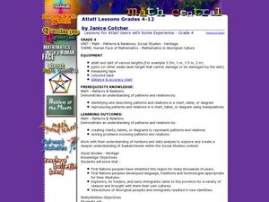
Atlatl Lessons for Grade 4
Fourth graders explore the weapons of the Aboriginal people. In this fourth grade math lesson, 4th graders create charts, tables, or diagrams to represent patterns and relations. Students investigate which dart length has the...
Curated OER
Help Maggie Rebuild Her Airplane!
In this airplane worksheet, students build airplanes out of paper and test their accuracy while flying them. Students build 6 planes and fill out test logs to go with them.
Curated OER
Bible: Aztec Gods
Students create a visual representation of an aspect of Aztec religion. In this Aztec religion lesson plan, students work in groups to read a passage and create a visual way to remember the important information in it. ...
Curated OER
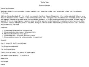
"Go-Car" Lab
Students construct a car based on directions given. In this physics lesson, students calculate average speed using distance and time information. They collect data and create a graph of distance vs. time.


