Curated OER
How Has Transportation Changed Since the 1899 Harriman Alaska Expedition?
Students recognize modes of transportation. They research historical data from a variety of primary and secondary sources including the Harriman expedition journals, related web sites, and photographs from the expedition. Students...
Curated OER
Coral Reef Geography
In this coral reef geography worksheet, learners find locations of reefs on a globe or map. There are 10 instructions to follow. There is no map provided--an atlas, globe or map is needed.
Curated OER
U.S. Geography for Children
In this U.S. map activity worksheet, students observe maps of the continental United States, Hawaii, and Alaska, locate and label landforms and bodies of water, and create symbols for natural resources and places of interest. Students...
Curated OER
The United States and Canada: Climate and Vegetation
Display U.S. and Canadian climate and vegetation through this text-companion worksheet. Learners read about the geography of these regions, take notes, and answer 3 comprehension questions as they read the selection. A graphic organizer...
Curated OER
There's a Place That Has a Race
Students define the term "place," collect data about Alaska and the Iditarod from several web sites, take online quiz using information gathered, and draw conclusions based upon their data collection and analysis.
Curated OER
Growth of a River
Students evaluate geography by drawing an image in class. In this river lesson, students identify a list of vocabulary terms associated with bodies of water. Students identify how a river is formed and draw a picture of one including the...
Curated OER
Let's Play Geography Twister
Students practice geography skills by playing a game based on Twister. Students manipulate their position on a map by placing their arms and legs on the appropriate state or country called out by the teacher.
Curated OER
Assessing and Making Maps
Students evaluate maps using the TODALSIGs basic map analysis system, explained on the worksheet. They create a map of Alaska using TODALSIGs. Students brainstorm the elements of maps.
Curated OER
A Long Way from Home: A Hands-on Geography Lesson about World War II
Students build World War II directional signs. In this World War II lesson, students explore the geographic locations of the war as they analyze primary sources and conduct research regarding places of significance in the war. Students...
Curated OER
U.S. Archaeological Sites: Geography Practice
In this archaeological sites worksheet, students read about sites in the Unites States and use a map to complete a set of 7 short answer questions.
Curated OER
Recreate the Race
Students research and find the route of the Alaskan dog sled race.In this Iditarod race lesson students find the checkpoints for the Iditarod on a map. Students research information in pairs about each one of the checkpoints. Students...
Curated OER
Topographic Maps Worksheet
For this geography skills worksheet, students respond to 37 multi-part questions that require them to read and interpret topographic maps.
Curated OER
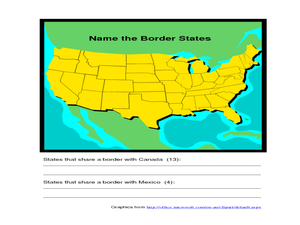
Identifying Border States of the U.S.
In this identifying border states of the U.S. worksheet, 3rd graders visually identify then write the names of the states that border Canada and Mexico; page 1 is a lesson, page 2 is the worksheet.
Curated OER
States in the USA Quiz
In this online interactive geography quiz learning exercise, students respond to 50 identification questions about the states in the United States of America. Students have 4 minutes to complete the quiz.
Curated OER
Fish Now or Later
Students describe the effects of over-harvest on a salmon population. They explain the importance of salmon to many communities in Alaska. They manage harvest levels to maintain a sustainable population.
Curated OER
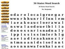
50 States Word Search
In this fifty states worksheet, students identify and locate all fifty states of the United States of America. There are 50 states located in the word search.
Curated OER
Learning About Location: Charting the Path of the George W. Elder
Students acquire a working knowledge of the geographical concepts: absolute location, relative location, longitude and latitude. They analyze primary sources that shows the physical and human characteristics of the places along the 1899...
Curated OER
General Knowledge Questions- All School Subjects Lower Intermediate
For this interactive general knowledge worksheet, students complete 24 multiple choice questions based on their knowledge in several subject areas. These subjects include science, geography, sports and music.
Curated OER
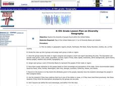
Diversity
Students work in groups to research and prepare an oral report about a region. In this regions lesson, students find out about the geography, population, state capitals, and landmarks. Students assign attributes to the people based on...
Agriculture in the Classroom
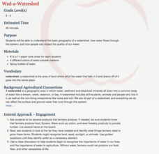
Wad-a-Watershed
What kind of impact do humans have on watersheds? Find out in a lesson that defines, explores, and promotes ways to protect our watersheds. The ultimate goal of the lesson is for learners to discover how a watershed is impacted by...
Curated OER
Biggest Cities in Each State Quiz
In this online interactive geography quiz worksheet, high schoolers examine the chart that includes the names of 50 U.S. states. Students identify the names of the two largest cities in each state in 8 minutes.
Curated OER
USA National Parks Quiz
In this online interactive geography quiz worksheet, students examine the chart that includes 58 state names. Students identify the names of the national parks in the listed states in 5 minutes.
Curated OER
United States Map- Continent, Country, State
Students identify their continent, country, and state on a globe. In this geography lesson, students use a globe to identify the seven continents, the United States, and the state which they live in. Students define key terms.
Curated OER
5 Themes Awareness of Current Event Issues
Students analyze newspaper articles for the 5 themes of geography. They create a colorful portfolio explaining how each theme: location, place, etc. is relevant in a chosen current event.


