Space Awareness
Continental Climate and Oceanic Climate
There's nothing better than a cool breeze blowing in from the ocean. Scholars explore how water affects change in temperature using a hands-on experiment on climate. They use measurement tools to compare the continental and oceanic...
Curated OER
The Mysteries of El Nino: How Much do We Really Know?
Seventh graders investigate the causes and effects of El Nino and explore its global impact on weather related occurrences through this series of activities.
Curated OER
Mars Geologic Mapping
Students identify and interpret photographic details of a Martian surface image, design, and create a simple features map. They identify and interpret the geologic history of a part of Mars' surface and then, analyze and discuss the...
National Wildlife Federation
Get Your Techno On
Desert regions are hotter for multiple reasons; the lack of vegetation causes the sun's heat to go straight into the surface and the lack of moisture means none of the heat is being transferred into evaporation. This concept, and other...
National Wildlife Federation
I Speak for the Polar Bears!
Climate change and weather extremes impact every species, but this instructional activity focuses on how these changes effect polar bears. After learning about the animal, scholars create maps of snow-ice coverage and examine the yearly...
Curated OER
Become the Meteorologist
Seventh graders analyze the data from Hurricane Tracking maps. In this earth science lesson, 7th graders plot data points on their maps and predict where the storm will most likely hit. They compare their prediction with the actual storm...
Texas State University
Earth: Deposition and Lithification
Geology geniuses analyze sediment samples with a hand lens and sort according to physical characteristics. They also learn about the processes of cementation, compaction, and lithification within the rock cycle. The lesson plan is...
Polar Trec
What Can We Learn from Sediments?
Varve: a deposit of cyclical sediments that help scientists determine historical climates. Individuals analyze the topography of a region and then study varve datasets from the same area. Using this information, they determine the...
Curated OER
Cold, Clouds, and Snowflakes
Students explore satellite data and graphing. For this weather data analysis math and science lesson, students analyze NASA satellite data to draw conclusions about geographical areas where precipitation might have happened. Students...
Montana State University
Who’s on Top?
What's it like to climb Mount Everest? An educational resource encourages an in-depth knowledge of Mount Everest's scientific missions through a variety of activities, including an analysis of maps, a KWL chart, videos, a simulation, and...
Curated OER
Reading Satellite Images
Students analyze satellite images. In this astronomy lesson, students examine 3 satellite images in order to understand how satellite images are taken and what they can teach scientists.
Curated OER
PLATE MOVEMENTS AND CLIMATE CHANGE
Students label three geological maps with continents provided to analyze the relationships between the movement of tectonic plates and the changes in the climate. In small groups, they discuss their findings and form hypotheses about the...
Curated OER
Trouble in the Troposphere
Learners create graphs using NASA data, compare ozone levels of several U.S. cities, analyze and evaluate the data and predict trends based on the data, and discuss and describe how human activities have modified Earth's air quality.
Curated OER
The Rifting of Pangaea and the Gettysburg Battlefield
Eleventh graders analyze and interpret an animated model of Earth’s rifting processes. In this Earth Science lesson, 11th graders connect Earth’s rifting processes with the Earth’s surface in the Gettysburg battlefield. Students apply...
Curated OER
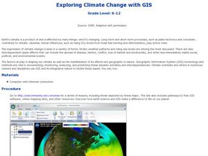
Exploring Climate Change with GIS
Learners investigate climatological changes that are occurring to the Earth. In this climate change activity, students access an assigned web site to view maps and lessons that show how climate change makes a difference to life on Earth.
NASA
Erosion and Landslides
A professional-quality PowerPoint, which includes links to footage of actual landslides in action, opens this moving lesson. Viewers learn what conditions lead to erosion and land giving way. They simulate landslides with a variety of...
Curated OER
What is the Rock Cycle and Its Processes?
Geology beginners examine three different rock samples and determine their origin by their characteristics. By making and recording observations, they become familiar with features of igneous, metamorphic, and sedimentary rock types....
Curated OER
Hurricane Frequency and Intensity
High schoolers examine hurricanes. In this web-based meteorology lesson plan, students study the relationship between ocean temperature and hurricane intensity. They differentiate between intensity and frequency of hurricanes.
Curated OER
Gettysburg Rocks Recycle to Win
Eighth graders use a geologic cross section to study the rock cycle of the Gettysburg battlefield. In this rock cycle lesson, 8th graders connect the rock cycle and continental rifting.
Curated OER
Using Soil properties and Vegetation Differences to Hypothesize the Land Use History and Topographic Differences between Two Locations
Ninth graders take soil samples and perform tests on these samples.


