Curated OER
Coral Reef Geography
In this coral reef geography worksheet, students find locations of reefs on a globe or map. There are 10 instructions to follow. There is no map provided--an atlas, globe or map is needed.
Curated OER
Early Explorers Web Quest
Students use the Canadian atlas online to research early explorers and settlers in Canada. They also complete a Web Quest to gather information from maps. They make generalizations about the early settlement patterns as well.
Curated OER
Canada's Landform Regions
Students use a atlas to identify and describe Canada's Landform region. Using the information they collect, they create a thematic map of the region and describe all of the physiographic regions and the processes that formed them. They...
Curated OER
Treasure of the Tar
Students, using an atlas, locate the region known as the "Tar Sands" in the Central Plains of Canada. They hypothesize about the future economic potential of this natural resource. They create a poster about the Tar Sands industry in...
Curated OER
Coast to Coast Virtual Trip
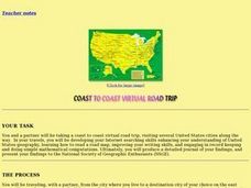
Learners complete a variety of exercises and activities as they plan a coast to coast trip across America. They keep a journal that includes where they went, what they did, what they saw, etc. They compare two cities they visited along...
Curated OER
Exploring the Sky: Reading Maria's Comet
Discover the science behind astronomy. After reading the book Maria's Comet, which is about a young woman who breaks new ground by becoming a female astronomer, young learners practice reading comprehension with worksheet questions about...
Defining US
Integration of Education and American Society
How did the struggle for Civil Rights during the 1950s transform American society and politics? Why are American schools integrated today? Class members explore these essential questions by examining a series of primary and secondary...
Cornell University
Too Much of a Good Thing?
Continuing their study of beneficial insects, young entomologists discover where in the world some of these bugs are. By labeling, coloring, and using the scale on a map, pupils explore the territories and arrival of the Asian lady...
Curated OER
Where to Look for the USA?
Fifth graders, in groups, explore the the type of reference sources are needed to answer a question. Each group identifies where the material was located, and the teacher records the guess.
Curated OER
State of Arkansas Travel Brochure
Eighth graders design a travel brochure to persuade others to visit Arkansas. They depict particular points of interest they decide are the best in the state.
Curated OER
Where Is Rome?
Third graders discover Ancient Rome through maps and worksheets. In this world history lesson, 3rd graders locate Rome on a world map and identify the scope of the Roman Empire. Students label an entire map of Italy after printing one...
Curated OER
Play Doh Map of Your State
Students create a state map using Playdoh. In this hands-on state geography lesson, students work in groups to form a three-dimensional map of their state using Playdoh made at home following a (given) recipe. Students use four colors...
Curated OER
Reservoir Activity
Students research the economic importance of the major reservoirs in Illinois. In groups, they manage a budget for one of the lakes to promote tourism in the area. They also work together to create advertisements.
Curated OER
Lesson #3: Internet Map Activity
Students label assembly centers and relocation camps on a given map of the United States in order to create a better understanding of the relocation experience of Japanese-American citizens and the distance that families had to move and...
Curated OER
Reference Source Four Square
Fourth graders play a four-square game on the playground while reviewing four main references -- dictionary, atlas, thesaurus, and encyclopedia. Students must throw the playground ball in the correct "square" identifying the correct...
Curated OER
CHARTING THE COURSE
Students uses atlases, maps, and Web resources to determine the distance, driving time, and amount of money they need to make the trip (estimates should include hotel/motel stays, meals, and souvenirs).
Curated OER
Introduction to Climatology
Young scholars are introduced to the topic of climatology. In groups, they use the Digital Atlas of Idaho to identify the layers of the atmosphere and review concepts of weather. To end the lesson, they examine different photographs...
Curated OER
Geographical Features of the West
Students practice using latitude and longitude appropriately. In this geography skills lesson, students participate in a classroom activity where they identify latitude and longitude.
Curated OER
Glacier Basics
Students are introduced to the powerful nature of glaciers. Using an atlas, they read the section on glaciers and examine pictures of before and after the glacier moved through an area. In groups, they complete a worksheet on the role...
Curated OER
Basin & Range Faulting
Students identify that the crust of the earth is constantly moving and that with the exception of faults accompanied by earthquakes, this rate of movement is far too slow to notice. Then they print a copy of cross-section map A and...
Curated OER
Recognizing Reference Sources
Fourth graders investigate five different reference sources in the Media Center: Atlas, Dictionary, Encyclopedia, Card Catalog (Look Up Station), and the Internet. They decide which is the BEST source to use to answer specific questions.
Curated OER
Natural History of Costa Rica
Students use outline maps to become acquainted with Costa Rica. They see how it was formed and how its origin has created very diverse environments. Students then use atlases and compare their physical maps with maps of climate and the...
Curated OER
The Commonwealth - Members and Structure
Students research the member countries that make up the Commonwealth. They develop research skills using atlases. They define the word community. They complete an online geography quiz.
Curated OER
The Great Migration
Students research the Great Migration and answer questions to discover where it took place, when it took place, who were migrating, and why in a 2 page paper. They use a map or atlas to plot out the routes and destinations of those...


