Curated OER
Around the World At 30o North Latitude
Reinforce the use of an atlas and reference materials with writers. They discover how geographic location can make living easier or harder. They draw an assigned journey on a map, categorize survival needs, and prioritize options during...
Curated OER
NATO Geography & Language
The class receives background information on NATO, an atlas, and a blank world map. They color the original 1949 countries in red, the 1952 additions in green, and the 1990 additions in blue. This exercise would be a good starting point...
Curated OER
100 Questions
Gather around to play a game! Middle and high schoolers answer questions (provided here) using various reference materials. Bring encyclopedias and other reference materials to class, as each group has limited Internet access! An answer...
Curated OER
Historical Indian Treaties and Aboriginal Population
Sixth graders navigate an online atlas of Canada and compare the land area of of historical Aboriginal peoples in Manitoba to present-day figures.
Curated OER
3rd Grade Social Studies Core Skills (Reference Books)
In this reference materials worksheet, students complete the 20 multiple choice questions pertaining to the correct book needed to find the answer in each situation. Included are dictionary, atlas, encyclopedias, newspapers and maps.
Curated OER
The Rivers and Lakes of Alberta
Students are introduced to the online Atlas of Canada and they identify the lakes and major rivers of Alberta.
Curated OER
Discovering the Northwest Territories Through the Five Themes of Geography
Students use the Atlas of Canada to find basic geographical information about the Northwest Territories.
Curated OER
Discovering Dinosaurs: Planning your Summer Vacation
Students use the online Atlas of Canada to gather information about places in Canada.
Royal Geographical Society
An Introduction to Maps
First graders are introduced to a variety of maps such as globes, street maps, atlases, and different types of floor plans. The focus of the lesson plan requires individuals to create their own plan of the classroom using the PowerPoint...
Curated OER
REFERENCE AND RESEARCH SKILLS
Students examine useful sources of reference materials and highlight vital research skills.Students, in groups, should be encouraged to read as widely as possible to avoid being over-reliant on a narrow range of resources.
Curated OER
Deportation of the Acadians
Middle schoolers use an online atlas to identify the presence of Acadian culture in the Maritime provinces of Canada and explore the deportation.
Curated OER
Nunavut, Our Communities
Students locate the communities of Nanavut on a territorial map and identify community characteristics. They research the online Atlas of Canada
Curated OER
Put the Mountains on the Map
Students discuss what they know about the regions where snow leopards live. They observe the worksheets to see if they can identify any of the mountain ranges and then use atlases to check and complete the country identification worksheet.
Curated OER
Historical Research on Explorers of Canada
Eighth graders navigate an online Atlas of Canada to research an explorer. They examine the areas that were explored.
Curated OER
Reference and Research Skills
Students investigate reference sources that include knowledge of travel and tourism destinations. They examine specific travel information for UK and wider European travel.
Curated OER
Mountain Range Project
This is an outline for a geography project which requires learners to research, compare, and construct a book about various mountain environments around the world. Even though this is a simple outline, it contains some useful ideas and...
Curated OER
The Conquest of the Aztec Civilization
High schoolers use the classroom atlases, the Internet or textbooks to draw a freehand map. They work in groups using the maps in the book The Broken Spears (Portilla) and The Conquest of New Spain (Diaz) to draw a freehand map...
Curated OER
Climate Characteristics of Canadian Localities
Tenth graders match the climate data to a Canadian city. They justify their choice, referring to factors that affect climate. They use the Atlas of Canada's Advanced Search to locate specific communities.
Curated OER
Canada's Landform Regions
High schoolers use a atlas to identify and describe Canada's Landform region. Using the information they collect, they create a thematic map of the region and describe all of the physiographic regions and the processes that formed them....
PBS
Make a Balloon Globe
"We've got the whole world in our hands," is what your students will be singing after completing this fun geography activity. Using the included templates for the seven continents and a balloon, they create their very own globes.
Core Knowledge Foundation
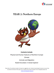
Year 2: Northern Europe
How is life in Northern Europe different from other areas of the world? Historians journey through the various regions of Northern Europe discovering what type of climate, animals, and lifestyles exist in that section of the world. They...
Curated OER
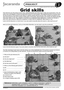
Grid Skills
In this geography instructional activity, students use grid references on a map to locate places in the pictures given. They also identify another advantage of using a grid map, which they have an overhead view of the content to prevent...
Curated OER
Interesting Place Names 1
In this geography worksheet, students analyze 24 names of villages and towns in England, Scotland and Wales. Students use an atlas for reference and mark the ten fake names.


