Curated OER
Landforms All Around
Students create a "Landform Dictionary". They develop an overlay map and participate in hands-on activities to identify the key characteristics of landforms. They discuss the plant and animal life of these areas. Handouts for the lessons...
Curated OER
The End of United States' Occupation of Japan
Ninth graders examine and discuss reasons for end of U.S. occupation of Japan in 1952, locate surrounding Asian countries on map, explore changes to Japan after World War II, and discuss how changes in Japan impacted other countries.
Curated OER
The Music in Us
Students explore the origins of human music. Students watch a video and participate in a variety of activities. They examine evidence, conduct research on he various animals, and create a concept map.
Curated OER
Paws in Jobland
Students explore jobs in different countries . In this lesson about different countries through research. Students are broken into groups and given a country to research. Each group is provided with a worksheet with 14 questions to be...
Curated OER
Migration and Refugees
Learners explore issues relating to refugees. Using the internet, they gather facts about refugees. Students discuss the range of situations which turn citizens of one country into refugees of another.
Curated OER
Warlugulong
Students explore and appreciate variety of ways in which environment can be depicted for range of purposes. They compare different representations of place and environment, and analyze ways information is being communicated.
Curated OER
Continents Lesson
Fourth graders write the correct name of the continent on each land mass. They locate Asia and outline the country of China and label it. They lightly color in the continents.
BBC
Eu, Un, and Commonwealth: Keeping Peace
What are the UN, the EU, and Commonwealth? Have the class brainstorm all they know about these powerful international organizations. Then have them compare and contrast the ways in which different countries or political groups...
Curated OER
Ecosystems Lesson Plan
Students research ecosystems (rainforest, desert, grassland, woodland, and arctic tundra). Students compare the seven continents and the importance of proximaty to the equator.
Curated OER
Create a World
Learners combine imaginative powers with known map-making techniques to create a whole new world.
Curated OER
Let's Visit Hervey Bay
Students explore the concept of saving files on the computer. In this computer technology and science instructional activity, students download pictures, facts, and sounds of whales and save them to a disk. Students then...
Curated OER
The Olympics
Students will research the geography and designa route form Columbia SC to an olympic competition, then follow local news and current events to track team perfomance.
Curated OER
African Safari
Seventh graders examine different countries in Africa to research. They choose one to concentrate their research on using the five themes of geography. They design a multimedia presentation that will make up the African safari.
Curated OER
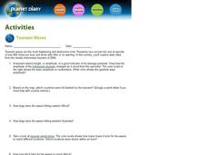
Tsunami Waves
In this tsunami waves worksheet, students explore data from the Indonesian tsunami of 2004 and answer ten questions about the data. They draw conclusions about the devastation and destruction based on the amplitude and speed of the tsunami.
Curated OER
Lesson Plan on Australian Aborigines
Fourth graders investigate the nomadic lifestyle of the Aborigines both before and after the arrival fo the Europeans. They identify the roles of men and women, languages and number of tribes. They act out skits based on the lesson.
Curated OER
How Islands Form
Students how islands form, rising water levels, growth of coral, and volcanoes. They complete Island Investigation worksheets after researching island formation on various Internet websites.
Curated OER
State and National Parks
In this insects worksheet, students 7 questions regarding state and national parks. A print out version of this worksheet is available, but the online version contains links to various webpages with information on the topics, so...
Curated OER
Japan: Images of a People
Students learn the geography of Japan and its location in reference to the United States.
Curated OER
The Commonwealth - Members and Structure
Students research the member countries that make up the Commonwealth. They develop research skills using atlases. They define the word community. They complete an online geography quiz.
Curated OER
NASA's Mars Gamble Pays Off Part 2
Tenth graders explore the planet of Mars. In this Earth Science lesson, 10th graders read articles on the make up of Mars. Students complete a worksheet on their reading.
Curated OER
Sea Connections
Students, after locating different marine habitats on a globe, play a card game about ecosystems, food webs and organisms.
Curated OER
Views of the American West: True or False?
High schoolers explain that a landscape painting may or may not accurately represent a specific place. They identify techniques that create the illusion of three-dimensional space on a flat surface.
Curated OER
The Rocky Shore
Students compare a realistic landscape painting with a photograph of the same place.
Other
National Museum of Australia: Voyaging With a Needle: Embroidered Maps
Hand-embroidered map samplers, the work of women needle workers from the eighteenth and nineteenth centuries, convey what was known of the world at the time and traces the routes of explorers, such as James Cook, who were then active....


