Curated OER
Australia Map
In this blank outline map worksheet, students explore the political boundaries of Australia. This map is labeled and may be used in a variety of classroom activities.
Curated OER
Australia Map: Labeled
In this blank outline map worksheet, students explore the political boundaries of Australia and its provinces and territories. This map is labeled and may be used in a variety of classroom activities.
Institute for Geophysics
Understanding Maps of Earth
Here is your go-to student resource on primary geography concepts, including facts about the surface of the earth and its hemispheres, latitude and longitude, globes, types of maps, and identifying continents and oceans.
TRAIN Educational & Community Services
Multicultural Activities
From catching stars developed by African pygmy tribes to chop stix pick-up or the Hanukkah dreidel, use this list of diverse multicultural activities to help your learners draw connections to unique cultures of the...
Curated OER
Orienteering: Map Skills
Students use a map to locate six specific landmarks on a course using a map. They identify how maps can help us and write a paragraph describing how to get from one landmark to another on the map.
Curriculum Project
Comprehension and Discussion Activities for the Movie Rabbit-Proof Fence
Lead discussion and thoughtful analysis as pupils view Rabbit Proof Fence, a drama based on true story about three aboriginal girls who ran away from Western Australia to return to their Aboriginal families in 1931. Here you'll...
National Geographic
Australia, Antarctica, and Oceana
Go on a traveling adventure throughout Australia, Oceana, and Antarctica! This textbook excerpt offers a full unit of study that can easily be supplemented by extra projects or research materials. Learners study maps, read about...
Devine Educational Consultancy Services
Geography Student Workbook, Australia
Your youngsters will be experts on the geography of Australia after working with these activities and worksheets, which review the continent's weather, major landforms, dimensions, history, and climate.
Curated OER
Latitude/Longitude Activity
Youngsters work in groups to solve clues involving latitude and longitude coordinates in order to decipher mystery animals in this fun learning experience!
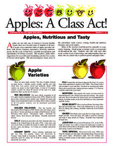
US Apple Association
Apples: A Class Act! (Grades 4–6)
Middle schoolers have a bushel of fun as they engage in activities and research core facts about apples. Packed with suggestions for in-class activities and out-of-class research, the colorful 6-page packet is sure to satisfy hungry...
Curated OER
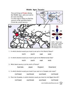
Middle Ages Traveler
In these Middle Ages worksheets, students use the maps to help them find the answers to the questions that help them understand the directions of north, south, east and west. Students also color another map of France according the...
Curated OER
Australia
Students discover information about the Aboriginal people of Australia. In this global studies lesson plan, students listen to mini-lectures regarding the history of Australia and the Aboriginal people. Students compare American Indians...
Curated OER
Cultural Mapping
Young scholars are introduced to the cultural diversity in Australia. Using new vocabulary, they define multiculturalism and explore their own cultural backgrounds. In groups, they complete a series of worksheets to develop a better...
Curated OER
Australia
Students participate in activities in which they discover facts about Australia. They examine its climate and history. They complete a worksheet to end the lesson.
Curriculum Corner
Earth Day Book
This Earth Day, celebrate our beautiful planet with an activity book that challenges scholars to show off their map skills, complete a crossword puzzle, write acrostic poems, alphabetize, and reflect on their personal Earth-friendly habits.
Curated OER
Orienteering: Map Skills
Students discover orienteering. In this orienteering lesson, students search for six specific landmarks. Students brainstorm how maps and landmarks are helpful.
Curated OER
Mapping Australia
In this mapping Australia activity, students locate and label various features and places on a blank map, 10 total. A reference web site is given for additional activities.
Curated OER
Dual place names in Australia
Students discuss landmarks commonly found on maps. They are divided into two groups, and asked to draw a map for a friend who hasn't been to the area. Group A may use street and place names, group B may not. Students discuss the role of...
Curated OER
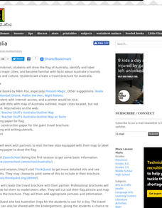
Australia
Young scholars research Australia using the Internet. They draw a flag, identify and label Australia's major cities. They discover facts about Australia's tourists attractions and culture. They design a travel brochure using the facts.
Curated OER
Australian Aboriginal Art And Storytelling
Students explore Aboriginal storytelling traditions through the spoken word and through visual culture. They listen to stories of the Dreamtime told by the Aboriginal people and investigate Aboriginal storytelling in contemporary dot...
Science 4 Inquiry
Edible Plate Tectonics
Many people think they can't observe plate tectonics, but thanks to GPS, we know that Australia moves at a rate of 2.7 inches per year, North America at 1 inches per year, and the Pacific plate at more than 3 inches per year! Scholars...
Curated OER
G'Day Mate
Students understand that Australia is the smallest continent, locate it on a map and sing about the continents. In this Australia lesson, students listen to facts about Australia and complete a book about information they have learned.
World Maps Online
Introduction to the World Map
Students identify the differences between maps and globes. In this map skills instructional activity, students are shown a globe and a map and recognize the differences. Students use post-it notes to locate several locations on the world...


