Curated OER
Map Me a Paragraph
There are so many great reading strategies. In this instructional activity, learners practice decoding. They break down two paragraphs to analyze and determine main ideas and details. They each observes ways to model as they map their...
Curated OER
United States Map- Map Legend/City Symbols
Young scholars investigate the United States map. In this map skills geography lesson, students explore city symbols on the map legend and identify them. Young scholars use post-it notes to mark various symbols.
Curated OER
United States Map
Students describe cities they are familiar with. In this United States Map lesson, students understand how cities are listed on a map. Students become aware of a map legend and the information in it.
Curated OER
United States Map- State Capitals
Students explore map skills. For this state capital lesson, students view a United States Political Map and identify and use post-it notes to label the state capitals.
Curated OER
United States Map- State Capitals
Students explore the state capitals. In this geography lesson, students use a political map to identify the state capitals and place post-it notes on various capitals.
Curated OER
Lesson Design Archaeology- U.S. Map
Students examine the U.S. map and identify cultural areas. In this archaeology lesson, students locate cultural areas on the U.S. map and fill in the proper locations.
Curated OER
"Yarning" About Latitude and Longitude
Students identify various locations using latitude and longitude. In this map skills lesson, students use yarn and labels to create a "human globe." Students identify the Prime Meridian, the Equator, and Northern and Southern Hemisphere.
Curated OER
Mapping Your Watershed
Pupils examine student created maps to locate geographical features such as hills, cliffs, flat meadows, stream beds, etc. They use watershed topo maps to identify landmarks, water flow, and elevation of several features. In addition,...
Curated OER
Let's Play Geography Twister
Students practice geography skills by playing a game based on Twister. Students manipulate their position on a map by placing their arms and legs on the appropriate state or country called out by the teacher.
Curated OER
Watershed
Students study watersheds and use topo maps to help explore where they are located. In this watershed activity students delineate their watershed on their own.
Curated OER
TORNADOES!
Third graders compare the parts of a real tornado with the parts of a tornado created in a demonstration, label "Tornado Alley" on their maps, and label the locations of famous tornado disasters on their maps.
Curated OER
Indiana Travel Guide
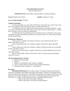
Fourth graders, after exploring and researching the state of Indiana, create a travel guide about the state of Indiana including its capital, major rivers, governors and two famous people from the state. They utilize a variety of art...
Curated OER
Displaying Data
Students create a display map with data from a previous instructional activity. They incorporate graduated marks that identify areas of the school grounds that are good for planting based on density.
Curated OER
Indiana Travel Guide
Fourth graders create a travel guide about the state of Indiana with 100% accuracy. They label the capital within the travel guide with 100% accuracy. Students label one major river in the right location with 100% accuracy. They circle...
Curated OER
Simply Speaking
Emerging orators distinguish between effective and ineffective public speaking strategies. They read a text that fits in with a Native Americans unit and speak about the text with both ineffective and effective volume, tone, phrasing,...
Curated OER
Indiana Travel Guide
Fourth graders share their information about their home state. In this research lesson plan, 4th graders use graphic organizers to make a travel guide about the state of Indiana. This lesson plan could be modified for use with any state,...
Curated OER
Explora-Pond: Surface Area
Students estimate the surface area of a pond using ratios and chance methods of estimation. They gain insight into how well estimations based on chance outcomes match the average of a maximum area estimation and a minimum area estimation.
Curated OER
The Long Walk
Students explore the concept of philanthropy. In this service learning lesson, students read an article that challenges them to consider African-American contributions to social justice.
Curated OER
ExplorA-Pond:4th Grade Surface Area
Fourth graders estimate the surface area of a pond using the chance method and the estimation method. They complete a graph and a short report comparing the results of the two methods.
Curated OER
Animals of the Arctic
Students discover the animals that make the Canadian Arctic their home. In this Arctic animals lesson, students research the animals that live in the region and create posters that feature their findings.
Curated OER
Fun Photosynthesis
Second graders, using large colored poster board, explore photosynthesis and its effect on the food chain and survival of organisms.
Curated OER
Stately Names
In this algebra worksheet, students complete a word puzzle with clues that links the name to that of a State. There are 26 word problems with an answer key.
Curated OER
Revolutionary War
Middle schoolers examine the role of Virginia during the Revolutionary War. Using an inflatable ball, they toss the ball around the room and answer questions related to sayings on the ball. In groups, they play a game to reinforce...


