Curated OER
Saudi Arabia -- Future city
Seventh graders summarize an article on Masdar. For this summarizing lesson students clearly explain three of the four points provided in an outline of the article. The students write an essay and identify six physical features of the...
Curated OER
Geographic Regions of Arkansas
Students examine maps that illustrate the various regions in Arkansas. They label the individual regions on a blank map that is divided into the regions and color each region a different color. Groups research a region and create a...
Happy Housewife
State Notebooking Pages
When learning about US geography, it can hard to remember facts about 50 different states. Help your young scholars organize all of this information with a collection of easy-to-use note-taking guides.
Curated OER
The Early History of Haiti
Seventh graders make list of places Columbus explored on his first journey to Americas, locate island of Hispaniola on map, examine groups of people who have inhabited island, complete blank map and key of Hispaniola, and research early...
Curated OER
Majority Rules
Students color code a map of the United States and label the amount of Electoral votes each state has. In this Electoral College lesson plan, students conduct a vote of their own.
Curated OER
World: Continents
In this blank outline map worksheet, students note the political boundaries of the continents of the world on a Robinson projection map.
Curated OER
Philosophy of Social Studies Education
Learn how to distinguish between curriculum and instruction. Utilize concept mapping strategies to organize a philosophy of elementary social studies education. Your class will be able to explain the process they underwent to organize...
Annenberg Foundation
A Nation Divided
Can a presidential election cause a civil war? Learners research the events surrounding the presidential election of 1860 in a lesson that explores America's history. Using maps, videos, and primary sources, they uncover, brainstorm, and...
Devine Educational Consultancy Services
Geography Student Workbook, Australia
Your youngsters will be experts on the geography of Australia after working with these activities and worksheets, which review the continent's weather, major landforms, dimensions, history, and climate.
Curated OER
Mesopotamia
Here is resource that offers a great, organized approach to your unit on Mesopotamia and early civilizations! As learners study the topics in the unit, such as the Fertile Crescent, ancient Sumeria, the Assyrian and Persian Empires, and...
Global Oneness Project
Bearing Witness
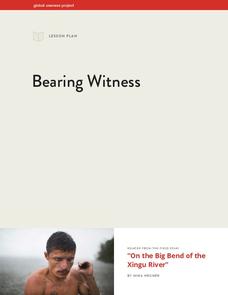
A controversial construction project in South America, the Belo Monte dam, is endangering local cultures, ecosystems, and communities. High schoolers create a concept map based on an online article they read before engaging in...
Curated OER
Move Around the Map
Fourth graders, while working with a partner, label and identify on a tarp map six major cities and five major rivers in Indiana. They traverse along the rivers utilizing a different locomotor skill (hop, skip, walk, run, leap, gallop,...
Curated OER
Zones of Conflict
Students read maps and identify specific countries involved in conflict. They classify countries in cultural realms. They relate maps to what they know about world conflict.
Curated OER
Rivers Run Through It
In this mapping practice worksheet, 5th graders read an informational paragraph and answer 7 questions about the parts of a map along with places shown on a given map.
Curated OER
Where In the World Are You?
Fourth graders fill in blank copies of the United States Map and then the World Map.
Curated OER
Continents and Oceans on the Move
Students create an awareness of the vast percentage of water covering the earth. They relate similarities/differences between topographical maps and other maps of various time periods. Students examine how to use a topographical map.
Curated OER
Let's Play Geography Twister
Pupils practice geography skills by playing a game based on Twister. Students manipulate their position on a map by placing their arms and legs on the appropriate state or country called out by the teacher.
Curated OER
Treasure Hunt!
Learners follow directions on a worksheet to follow directions on a map of the United States and Territories of the United States. In this directions worksheet, students use a compass rose and learn the directions.
Curated OER
Where Should We Put a Store?
Students analyze population data. They convert population data into simple density maps to help make decisions about their world. They select the best location for a school store based on population density. They present their maps...
Curated OER
Populations in the Path of Natural Hazards
Students read "Geographical Mobility: 1995-2000." They examine the maps in the handouts and compare them with maps from an atlas. In the second part of this lesson, students read "In Harm's Way." They receive three more handouts, one a...
Curated OER
Mapping the Middle East
Students examine how the countries of the Middle East were created. They explore the influence of various political and geographic factors in their creation. They list the things they should consider in deciding how to draw new borders...
Curated OER
The ABC's of Apportionment
Students are introduced to the terms of apportionment and redistricting. Using a Census map, they identify the states that had the highest and lowest numbers of change during the past ten years. They examine a map of voting districts and...
Curated OER
Baseball in Korea
Seventh graders explore the origins of baseball. In this Geography lesson, 7th graders compare Korean baseball teams with other countries. Students create a map of all the baseball teams around the world.
Curated OER
The African Slave Trade: From West Africa to South Carolina and Beyond
Eighth graders explore the African slave trade. They identify the principal figures practicing the African slave trades at three locations. Students draw the physical routes of the slave trade on a map and they list the reasons for the...


