Biology Junction
Cell Reproduction Concept Map
For this cell reproduction instructional activity, scholars complete a concept map using different vocabulary words that describe the different phases a cell goes through in the reproduction process.
Curated OER
Story Map
Fill in the graphic organizer including the setting, characters, conflict, and climax of a story. There are 8 blanks intended to assist students in seeing the relationship between the story elements.
Curated OER
California Map
In this California blank outline map worksheet, students examine the political boundaries of the state and then mark the state capital, other cities, and other state attractions on the map.
Curated OER
Wyoming Map
In this blank outline map worksheet, students fill in the state capital, major cities, landforms, and other places of interest on this map of Wyoming.
Freeology
Blank Timeline
Constructing a timeline is a valuable activity for history classrooms, and this graphic organizer is a fast and dependable aid for that endeavor! Blank spaces are available to identify a year and/or event within a particular span of...
Do2Learn
Brainstorming Map Array
Getting ideas down on paper is often the first step when starting a project or new unit of study. Try out this straightforward brainstorming map with your class. Learners write in a topic and use the six bubbles that branch out of the...
Curated OER
Wisconsin Map Activity
In this Wisconsin map worksheet, students fill in the capital, major cities and other state attractions on a blank map of Wisconsin. A reference web site is given for additional activities.
Curated OER
Story Map
In this story elements worksheet, students complete a story map graphic organizer that contains four boxes for students to fill in information. The spaces include characters, setting and problem and solution.
Curated OER
Missouri Map
In this Missouri blank outline map learning exercise, students examine the political boundaries of the state and then mark the state capital, other cities, and other state attractions on the map.
Curated OER
Taxonomy Concept Map
Reinforce learners' knowledge of scientific taxonomy with a helpful concept map instructional activity. Using a word bank, young biologists fill in the blanks to complete the description of organism classification.
Curated OER
Blank US Map
In this blank outline map activity, students study the physical boundaries of the 50 states that make the United States. This outline map may be used for a variety of geographic activities.
Curated OER
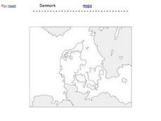
Denmark Outline Map
In this blank outline map learning exercise, students explore the political boundaries of Denmark located in Europe. This map may be used in a variety of classroom activities.
Curated OER
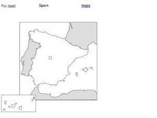
Spain Outline Map
For this blank outline map worksheet, students explore the political boundaries of Spain located in Europe. This map may be used in a variety of classroom activities.
Curated OER
Blank Europe Outline Map
In this blank outline map learning exercise, students explore the political boundaries of the continent of Europe and those of the countries located there. This map may be used in a variety of classroom activities.
Curated OER
Blank Europe Outline Map 2
In this blank outline map worksheet, students explore the political boundaries of the continent of Europe and those of the countries located there. This map may be used in a variety of classroom activities.
Curated OER
Africa Map
In this blank Africa map activity, students investigate the continent of Africa and it's political boundaries. No country borders are denoted.
Curated OER
Canada Outline Map: Labeled
In this blank outline map learning exercise, students study the political boundaries of the North American country of Canada as well as those of the provinces located there. This map is labeled.
Curated OER
Mexico Map
In this blank outline map worksheet, students study the political boundaries of the North American country of Mexico. This map may be used in a variety of classroom activities.
Curated OER
Mexico Outline Map 2
In this outline map worksheet, students discover and investigate the North American country of Mexico. This blank outline map may be used for a variety of classroom activities.
Curated OER
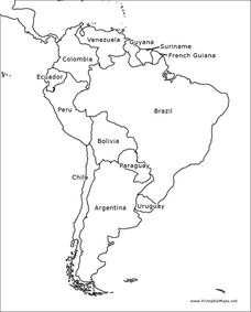
South America Outline Map
In this blank outline map learning exercise, learners explore the political boundaries of South America and the nations there. This map may be used in a variety of classroom activities. The map is labeled with the country names.
Curated OER
South America Outline Map
In this blank outline map worksheet, students explore the political boundaries of South America and the nations there. This map may be used in a variety of classroom activities. The location of the capital cities are denoted with...
Curated OER
Canada Outline Map
In this blank outline map activity, students study the political boundaries of the North American country of Canada as well as those of the provinces located there.
Curated OER
Canada Outline Map
In this blank outline map worksheet, students study the political boundaries of the North American country Canada as well as those of the provinces located there. The capital cities of the provinces are listed.
Curated OER
Canada Outline Map
In this blank outline map instructional activity, students study the political boundaries of the North American country of Canada as well as those of the provinces located there.


